4 Alwyn Close, Luton, LU2 7JX
About 4 Alwyn Close
4 Alwyn Close is a two-bedroom semi-detached house in Luton (LU2 7JX). It has a recorded floor area of 84 m² (around 904 sq ft), construction records dating it to 1930-1949 and council tax band C. The latest certificate (December 2017) shows an E (score 54), well below the UK norm with real room to improve. The recommended improvements would lift it to B (score 84), a 3-band jump.
Across 2018–2024, sale prices on this property compounded at 3.3% per year. On a £-per-square-foot basis, the last sale (£371/sq ft) was about 42.9% above the typical sold price in the postcode. Most recent transfer: April 2024 at £335,000.
What this property has
Inside
- Bedrooms2
- Bathrooms1
- Dining roomYes
- CloakroomYes
Outside
- Private gardenRear
- GarageYes
Building
- Central heatingYes
- RefurbishedYes
Everything you need to know about 4 Alwyn Close
The true value, the hidden risks and the full sale history, in one report.
30-day money-back guarantee

The data behind every report


Energy performance
Recommended upgrades on file would lift this property by multiple EPC bands.
EPC Rating
Planning history
4 Alwyn Close has no planning applications on record.
Notable planning nearby
26applications of note in the surrounding area
We flagged 2 things worth checking at 4 Alwyn Close
Independent checks surfaced things a buyer would want to understand before offering. The report explains each one in full, with the underlying data and what to ask.
- Signs of HMO activity in the area
- Larger development activity nearby
30-day money-back guarantee
Sales history & valuation
4 Alwyn Close valuation sits well clear of the typical sold price in this postcode.
£349,000
Modelled from EPC, postcode comparables and a sale-price growth of 3.3% per year over 6 years.
£335,000
Growth on file: 3.3% per year over 6 years.
Sales timeline
4 April 2024Most recent
£335,000
+21.8%over 6 years16 February 2018
£275,000
Median price across the last 5 sales in LU2 7JX: £396,000 (2024–2020).
Versus other Alwyn Close homes
On price per m², 4 Alwyn Close stands well clear of the street.
Price per m²
£3,988
Street avg £3,334
Floor Area
84 m²
Street avg 89 m²
Habitable Rooms
3 rooms
Street avg 4 rooms
CO₂ Emissions
5.2 t/year
Street avg 5.6 t/year
Everything you need to know about 4 Alwyn Close
The true value, the hidden risks and the full sale history, in one report.
30-day money-back guarantee
The data behind every report
Similar properties nearby
The neighbourhood at a glance
Crime
6/mo
Steady year-on-year across the wider district.
Nearest stop
0.1 km
Wardown Crescent — bus stop.
Closest school
0.6 km
River Bank Primary School. 42 schools nearby.
Go deeper on the local area
The full report breaks down crime, transport links, schools and air quality in depth.
Road noise across the postcode
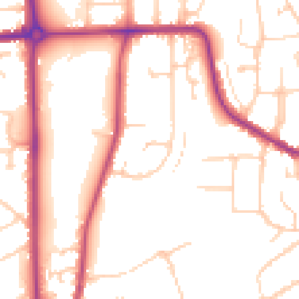
Daytime· 07:00 – 23:00
52.3dB
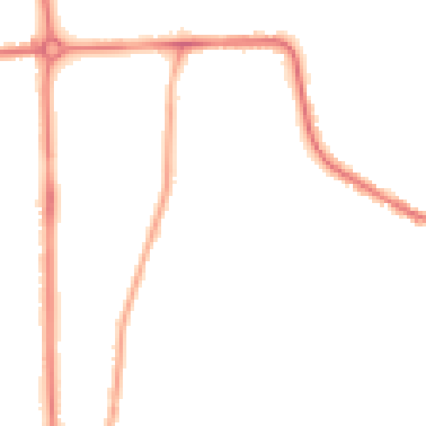
Night-time· 23:00 – 07:00
43.9dB