263 Milligan Road, Leicester, LE2 8FH
About 263 Milligan Road
263 Milligan Road is a three-bedroom semi-detached house in Leicester (LE2 8FH). It has a recorded floor area of 80 m² (around 861 sq ft), construction records dating it to 1930-1949 and council tax band B. The latest certificate (June 2022) shows a D (score 67), on the cusp of jumping into the C band. When first surveyed in November 2008 the rating was E, the property has climbed 1 band since. Between certificates, wall efficiency went from Poor to Average, roof efficiency went from Poor to Good and hot-water efficiency went from Average to Good. The recommended improvements would lift it to B (score 83), a 2-band jump. Our model identifies extension potential, subject to local planning policy. The home occupies a corner plot.
Across 2007–2022, sale prices on this property compounded at 3.9% per year. On a £-per-square-foot basis, the last sale (£290/sq ft) was about 86.4% above the typical sold price in the postcode. Sold October 2022 for £250,000. That sale was during the post-pandemic price surge, when transactions cleared materially above pre-2020 trend. One historical planning record sits against the property in 2007.
What this property has
Inside
- Bedrooms3
- Bathrooms1
- Open-plan layoutYes
- Dining roomYes
- Utility roomYes
Outside
- Private gardenSide and rear
- GarageYes
- Corner plotYes
Building
- Central heatingYes
- Extension potentialPossible
Everything you need to know about 263 Milligan Road
The true value, the hidden risks and the full sale history, in one report.
Pick your report · from £14.99
One time fee only - money back guarantee

The data behind every report







Energy performance
Recommended upgrades on file would lift this property by multiple EPC bands.
EPC Rating
Certificate validity
Valid until 19 June 2032
Property Improvements
Changes detected from historical EPC data
Hot water system upgraded
Cavity wall insulation installed
Loft insulation upgraded to recommended levels
More low energy lighting installed

Get a survey for this property
Level 2 HomeBuyer Report
We've checked 10 risk factors against the available data for this property and believe a Level 2 HomeBuyer Report could be a suitable option for you.
From £545 · Includes VAT
Planning history
Council records show a subdivision application — the property's legal arrangement has been altered.
1 application on record at 263 Milligan Road, Leicester, LE2 8FH
- Aug 2007SubdivisionAmendmentOutcome in report
Extension: Two storey · Side of property
CHANGE OF USE FROM SINGLE DWELLING TO FOUR SELF CONTAINED FLATS (4 X 1BED) (CLASS C3); TWO STOREY SIDE EXTENSION
Extension- Documents
- 3 docs on file
- Reference
- 20071219
Unlock 263 Milligan Road, Leicester, LE2 8FH's full planning history
You're seeing the shape of it. The report has the substance.
- Every decision — granted, refused or withdrawn (1 on record)
- All 1 application on this property in full, plus 15 notable nearby
- The 3 documents, officer reports & conditions
- What the pattern means for extending or converting here
One time fee only - money back guarantee
Sales history & valuation
Latest sale on 263 Milligan Road was the highest on Land Registry record across the postcode.
£261,000
Modelled from EPC, postcode comparables and a sale-price growth of 3.9% per year over 15 years.
£250,000
Growth on file: 3.9% per year over 15 years.
Sales timeline
26 October 2022Most recent
£250,000
+80.5%over 15 years17 June 2007
£138,500
Median price across the last 5 sales in LE2 8FH: £227,500 (2025–2021).
Nearby sales in LE2 8FH
Versus other Milligan Road homes
On years held, 263 Milligan Road runs well behind the street norm.
Price per m²
£3,125
Street avg £2,047
Floor Area
80 m²
Street avg 78 m²
Habitable Rooms
4 rooms
Street avg 5 rooms
CO₂ Emissions
3.3 t/year
Street avg 4.0 t/year
Everything you need to know about 263 Milligan Road
The true value, the hidden risks and the full sale history, in one report.
Pick your report · from £14.99
One time fee only - money back guarantee
The data behind every report
Similar properties nearby
The neighbourhood at a glance
Crime
910/mo
Falling year-on-year across the wider district.
Nearest stop
0.1 km
Burgess Road — bus stop.
Closest school
0.4 km
Montrose School. 33 schools nearby.
Go deeper on the local area
A Local Area report breaks down crime, transport links, schools and air quality in depth.
Road noise across the postcode
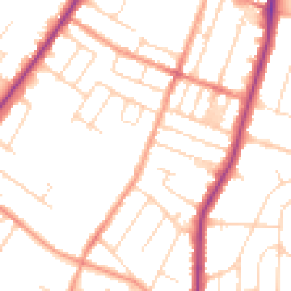
Daytime· 07:00 – 23:00
50.2dB

Night-time· 23:00 – 07:00
40.6dB