13 Amos Avenue, Liverpool, L21 7QH
About 13 Amos Avenue
13 Amos Avenue is a two-bedroom end-of-terrace house in Liverpool (L21 7QH). It has a recorded floor area of 99 m² (around 1068 sq ft), construction records dating it to 1930-1949 and council tax band A. The latest certificate (June 2010) shows a D (score 57), a step below the typical UK home. The latest certificate is from June 2010, so improvements made since then won't be reflected. Records show the property has been extended at some point in its history.
At 99 m² the property is well over the postcode median (73 m² across 16 EPCs), placing it in the larger end of the local stock. Today's modelled estimate of £153,000 is 45.7% above the 2016 sale price. On a £-per-square-foot basis, the last sale (£98/sq ft) was about 15.9% below the postcode norm. On the market in September 2016 and unlisted since — roughly 10 years.
What this property has
Inside
- Bedrooms2
- Bathrooms1
- Dining roomYes
Outside
- Private gardenRear
Building
- Central heatingYes
- Previously extendedYes
Everything you need to know about 13 Amos Avenue
The true value, the hidden risks and the full sale history, in one report.
30-day money-back guarantee

The data behind every report


Energy performance
13 Amos Avenue's EPC is over a decade old — improvements since won't be reflected.
EPC Expired
This certificate is over 10 years old and is no longer valid.Expired 29 Jun 2020
EPC Rating
Planning history
13 Amos Avenue has no planning applications on record.
The full report still covers planning activity across the surrounding area.
Sales history & valuation
13 Amos Avenue valuation sits well clear of the typical sold price in this postcode.
£153,000
Modelled from EPC, postcode comparables.
£105,000
Recorded with HM Land Registry.
Sales timeline
25 September 2016Most recent
£105,000
Median price across the last 5 sales in L21 7QH: £135,000 (2025–2020).
Versus other Amos Avenue homes
On floor area, 13 Amos Avenue stands well clear of the street.
Price per m²
£1,058
Street avg £1,448
Floor Area
99 m²
Street avg 73 m²
Habitable Rooms
3 rooms
Street avg 5 rooms
CO₂ Emissions
5.0 t/year
Street avg 4.0 t/year
Everything you need to know about 13 Amos Avenue
The true value, the hidden risks and the full sale history, in one report.
30-day money-back guarantee
The data behind every report
Similar properties nearby
1 Kent Avenue, Litherland
L21 7QJ
1 Amos Avenue
L21 7QH
1 Gale Road, Litherland
L21 7QR
1 Ruby Close, Litherland
L21 7RH
1 Amethyst Close, Litherland
L21 7RD
1 Boundary Road, Litherland
L21 7LA
1 Alexandra Mount
L21 7PN
1 Sefton Moss Villas
L21 7QX
The neighbourhood at a glance
Reported crime in the wider district is trending notably upward year-on-year.
Crime
4/mo
Rising year-on-year across the wider district.
Nearest stop
0.2 km
Orrell Road — bus stop.
Closest school
0.1 km
English Martyrs' Catholic Primary School. 39 schools nearby.
Go deeper on the local area
The full report breaks down crime, transport links, schools and air quality in depth.
Road noise across the postcode
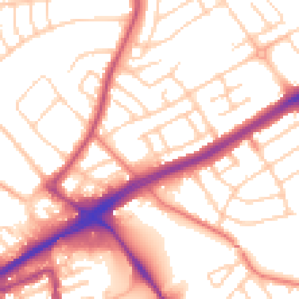
Daytime· 07:00 – 23:00
54.3dB

Night-time· 23:00 – 07:00
44.3dB