18 Arnside, Liverpool, L21 5JH
About 18 Arnside
18 Arnside is a three-bedroom semi-detached house in Liverpool (L21 5JH). It has a recorded floor area of 84 m² (around 904 sq ft), construction records dating it to 1930-1949 and council tax band B. The latest certificate (July 2025) shows a C (score 70). The rating has held steady at C across 2 certificates since November 2010. Between certificates, wall efficiency went from Poor to Good and lighting went from Very Poor to Very Good; while window efficiency dropped from Good to Poor and hot-water efficiency dropped from Very Good to Good.
A recent sale: £212,000 in September 2025. At 84 m² it's 16.7% larger than the typical home in the postcode (72 m² median across 17 EPCs). Across 1996–2025, sale prices on this property compounded at 5% per year. On a £-per-square-foot basis, the last sale (£234/sq ft) was about 39.8% above the typical sold price in the postcode.
What this property has
Inside
- Bedrooms3
- Bathrooms1
Everything you need to know about 18 Arnside
The true value, the hidden risks and the full sale history, in one report.
30-day money-back guarantee

The data behind every report


Energy performance
EPC Rating
Property Improvements
Changes detected from historical EPC data
Heating controls changed
Hot water efficiency decreased
Cavity wall insulation installed
More low energy lighting installed
Planning history
18 Arnside has no planning applications on record.
The full report still covers planning activity across the surrounding area.
Sales history & valuation
Price for 18 Arnside has grown more than fourfold since the 1996 starting point.
£218,000
Modelled from EPC, postcode comparables and a sale-price growth of 5.0% per year over 29 years.
£212,000
Growth on file: 5.0% per year over 29 years.
Sales timeline
18 September 2025Most recent
£212,000
+256.3%over 24 years3 April 2001
£59,500
5 May 1998
£59,500
+14.4%over 1 year15 November 1996
£52,000
Median price across the last 5 sales in L21 5JH: £175,000 (2023–2019).
Versus other Arnside homes
Years Held for 18 Arnside lags the street by a wide margin.
Price per m²
£2,524
Street avg £2,078
Floor Area
84 m²
Street avg 86 m²
Habitable Rooms
5 rooms
Street avg 4 rooms
CO₂ Emissions
2.3 t/year
Street avg 6.6 t/year
Everything you need to know about 18 Arnside
The true value, the hidden risks and the full sale history, in one report.
30-day money-back guarantee
The data behind every report
Similar properties nearby
10 Arnside
L21 5JH
10 St Matthews Avenue
L21 5JS
1 Silverdale Drive
L21 5HT
1 Hawkshead Drive
L21 5JE
11 Ennerdale Drive
L21 5HX
1 Ennerdale Drive
L21 5HX
10 Keswick Drive
L21 5JQ
1 Netherton Park Road
L21 5JD
The neighbourhood at a glance
Reported crime in the wider district is trending notably upward year-on-year.
Crime
4/mo
Rising year-on-year across the wider district.
Nearest stop
0.2 km
Boundary Road — bus stop.
Closest school
0.4 km
The Salesian Academy of St John Bosco. 41 schools nearby.
Go deeper on the local area
The full report breaks down crime, transport links, schools and air quality in depth.
Road noise across the postcode
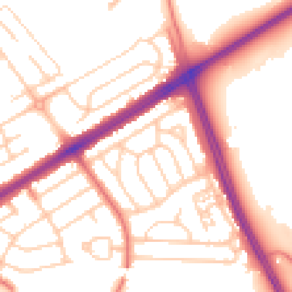
Daytime· 07:00 – 23:00
53.8dB

Night-time· 23:00 – 07:00
44.1dB