21 Ecclesall Avenue, Liverpool, L21 5HG
About 21 Ecclesall Avenue
21 Ecclesall Avenue is a three-bedroom semi-detached house in Liverpool (L21 5HG). It has a recorded floor area of 86 m² (around 926 sq ft), construction records dating it to 1930-1949 and council tax band C. The latest certificate (November 2017) shows a D (score 62), on the cusp of jumping into the C band. The recommended improvements would lift it to B (score 82), a 2-band jump.
Across 2018–2019, sale prices on this property compounded at 16.3% per year. Today's modelled estimate of £243,000 is 45.8% above the 2019 sale price. On a £-per-square-foot basis, the last sale (£180/sq ft) was about 28.7% above the typical sold price in the postcode. Most recent transfer: June 2019 at £166,700.
What this property has
Inside
- Bedrooms3
- Bathrooms2
Everything you need to know about 21 Ecclesall Avenue
The true value, the hidden risks and the full sale history, in one report.
30-day money-back guarantee

The data behind every report


Energy performance
Recommended upgrades on file would lift this property by multiple EPC bands.
EPC Rating
Planning history
21 Ecclesall Avenue has no planning applications on record.
The full report still covers planning activity across the surrounding area.
We flagged 1 thing worth checking at 21 Ecclesall Avenue
Independent checks surfaced things a buyer would want to understand before offering. The report explains each one in full, with the underlying data and what to ask.
- Recent ownership pattern worth a look
30-day money-back guarantee
Sales history & valuation
21 Ecclesall Avenue changed hands twice within eighteen months — unusual for the area.
£243,000
Modelled from EPC, postcode comparables and a sale-price growth of 16.3% per year over 1 year.
£166,700
Growth on file: 16.3% per year over 1 year.
Sales timeline
27 June 2019Most recent
£166,700
+23.5%over 1 year1 February 2018
£135,000
Median price across the last 5 sales in L21 5HG: £148,000 (2022–2014).
Nearby sales in L21 5HG
Versus other Ecclesall Avenue homes
Price per m²
£1,938
Street avg £1,747
Floor Area
86 m²
Street avg 89 m²
Habitable Rooms
5 rooms
Street avg 5 rooms
CO₂ Emissions
4.1 t/year
Street avg 4.2 t/year
Everything you need to know about 21 Ecclesall Avenue
The true value, the hidden risks and the full sale history, in one report.
30-day money-back guarantee
The data behind every report
Similar properties nearby
1 Ennerdale Drive
L21 5HX
11 Ennerdale Drive
L21 5HX
1 Hawkshead Drive
L21 5JE
10 Arnside
L21 5JH
10 St Matthews Avenue
L21 5JS
1 Netherton Park Road
L21 5JD
1 Silverdale Drive
L21 5HT
10 Silverdale Drive
L21 5HU
The neighbourhood at a glance
Reported crime in the wider district is trending notably upward year-on-year.
Crime
4/mo
Rising year-on-year across the wider district.
Nearest stop
0.1 km
Kirkstone Road South — bus stop.
Closest school
0.4 km
St Philip's Church of England Controlled Primary School. 42 schools nearby.
Go deeper on the local area
The full report breaks down crime, transport links, schools and air quality in depth.
Road noise across the postcode
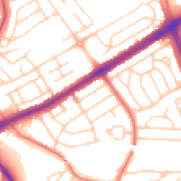
Daytime· 07:00 – 23:00
53.3dB

Night-time· 23:00 – 07:00
42.4dB