12 Norville Road, Liverpool, L14 3LY
About 12 Norville Road
12 Norville Road is a semi-detached house in Liverpool (L14 3LY). It has a recorded floor area of 98 m² (around 1055 sq ft), construction records dating it to 1930-1949 and council tax band B. The latest certificate (August 2017) shows an E (score 48), well below the UK norm with real room to improve. The recommended improvements would lift it to B (score 85), a 3-band jump.
Across 2018–2019, sale prices on this property compounded at 3.3% per year. Today's modelled estimate of £240,000 sits 84.6% above the 2019 sale of £130,000. On a £-per-square-foot basis, the last sale (£123/sq ft) was about 29% below the postcode norm. Most recent transfer: March 2019 at £130,000.
Everything you need to know about 12 Norville Road
The true value, the hidden risks and the full sale history, in one report.
Pick your report · every report is £14.99
One time fee only - money back guarantee

The data behind every report


Energy performance
12 Norville Road's carbon output runs well above what efficient homes in the postcode produce.
EPC Rating
Get a survey for this property
Level 3 Building Survey
Because the property has solid (non-cavity) walls, we believe a Level 3 building survey should be considered.
From £885 · Includes VAT
Planning history
12 Norville Road has no planning applications on record.
A planning report still maps activity across the surrounding area and reads this property's extension & conversion potential.
Sales history & valuation
12 Norville Road changed hands twice within eighteen months — unusual for the area.
£240,000
Modelled from EPC, postcode comparables and a sale-price growth of 3.3% per year over 1 year.
£130,000
Growth on file: 3.3% per year over 1 year.
Sales timeline
15 March 2019Most recent
£130,000
+4.0%over 1 year2 January 2018
£125,000
Median price across the last 5 sales in L14 3LY: £210,000 (2025–2020).
Nearby sales in L14 3LY
Versus other Norville Road homes
12 Norville Road is notably below the street on price per m².
Price per m²
£1,327
Street avg £1,987
Floor Area
98 m²
Street avg 92 m²
Habitable Rooms
5 rooms
Street avg 5 rooms
CO₂ Emissions
6.6 t/year
Street avg 4.8 t/year
Everything you need to know about 12 Norville Road
The true value, the hidden risks and the full sale history, in one report.
Pick your report · every report is £14.99
One time fee only - money back guarantee
The data behind every report
Similar properties nearby
The neighbourhood at a glance
Rail-style transport is unusually close for this postcode.
Crime
6/mo
Rising year-on-year across the wider district.
Nearest stop
0.2 km
Queens Drive — bus stop.
Closest school
0.5 km
Dixons Broadgreen Academy. 51 schools nearby.
Go deeper on the local area
A Local Area report breaks down crime, transport links, schools and air quality in depth.
Road noise across the postcode
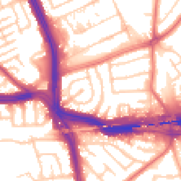
Daytime· 07:00 – 23:00
56.9dB
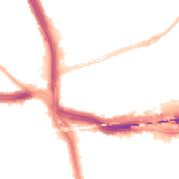
Night-time· 23:00 – 07:00
47.7dB