16 Daymerslea Ridge, Leatherhead, KT22 8TF
About 16 Daymerslea Ridge
16 Daymerslea Ridge is a four-bedroom detached house in Leatherhead (KT22 8TF). It has a recorded floor area of 146 m² (around 1572 sq ft), construction records dating it to 1967-1975 and council tax band F. Tenure is freehold. The latest certificate (April 2016) shows a D (score 59), a step below the typical UK home. The recommended improvements would push it to C (score 74). The latest certificate is from April 2016, so improvements made since then won't be reflected. Records show the property has been extended at some point in its history.
Held since December 2003 — that's 22 years off the open market, well above the local norm. At 146 m² the property is well over the postcode median (111 m² across 14 EPCs), placing it in the larger end of the local stock. Today's modelled estimate of £761,000 sits 148.7% above the 2003 sale of £306,000. On a £-per-square-foot basis, the last sale (£195/sq ft) was about 31.5% below the postcode norm. 2 planning records sit against the property, 2 approved, 0 refused. Past consents include an extension, partial demolition, a porch and a conservatory, meaningful when judging how the property has evolved.
Know exactly what you're buying at 16 Daymerslea Ridge
Before you offer, see what the listing won't tell you, the true value, the red flags and the full history.
Already flagged here
Valuation
against the asking price
Risks
planning & flood
Sold prices
similar homes nearby
Trends
the local market
What this property has
Inside
- Bedrooms4
- Bathrooms2
- Dining roomYes
- CloakroomYes
- StudyYes
Outside
- Private gardenSouth-west-facing
- GarageSingle
Building
- TenureFreehold
- Central heatingYes
- Previously extendedYes
- RefurbishedYes
Energy performance
16 Daymerslea Ridge's carbon output runs well above what efficient homes in the postcode produce.
EPC Expired
This certificate is over 10 years old and is no longer valid.Expired 13 Apr 2026
EPC Rating
Planning history
Planning history includes recorded demolition works, indicating a major rebuild phase at this address.
- Nov 2020DemolitionFullIn report
Extension: Single storey · Rear of property
Erection of single storey rear extension following demolition of existing conservatory.
Extension- Documents
- 2 docs on file
- Reference
- MO/2020/1489
- Jun 2006PorchFullIn report
Extension: Single storey
First floor side extension, rear conservatory and front porch. Construction of pitched roof over existing front bay window.
ExtensionConservatory- Documents
- 10 docs on file
- Reference
- MO/2006/0675
We flagged 1 thing worth checking at 16 Daymerslea Ridge
Independent checks surfaced things a buyer would want to understand before offering. The report explains each one in full, with the underlying data and what to ask.
- Larger development activity nearby
30-day money-back guarantee
Sales history & valuation
16 Daymerslea Ridge valuation sits well clear of the typical sold price in this postcode.
£761,000
Modelled from EPC, postcode comparables.
£306,000
Recorded with HM Land Registry.
Sales timeline
12 December 2003Most recent
£306,000
Median price across the last 5 sales in KT22 8TF: £618,000 (2024–2017).
Nearby sales in KT22 8TF
17 Daymerslea Ridge, Leatherhead, KT22 8TF
Sold Nov 2024
£750,0007 Daymerslea Ridge, Leatherhead, KT22 8TF
Sold May 2021
£618,00011 Daymerslea Ridge, Leatherhead, KT22 8TF
Sold Oct 2018
£600,0005 Daymerslea Ridge, Leatherhead, KT22 8TF
Sold Nov 2017
£522,50021 Daymerslea Ridge, Leatherhead, KT22 8TF
Sold Sept 2017
£686,000
Everything we know about 16 Daymerslea Ridge, in one report
What it's really worth, what could be wrong, and the planning, sales and area data in full.
What we flagged
- Larger development activity nearby

Versus other Daymerslea Ridge homes
Price per m² for 16 Daymerslea Ridge lags the street by a wide margin.
Price per m²
£2,096
Street avg £4,913
Floor Area
146 m²
Street avg 114 m²
Habitable Rooms
8 rooms
Street avg 5 rooms
CO₂ Emissions
6.7 t/year
Street avg 6.0 t/year
Similar properties nearby
The neighbourhood at a glance
Crime
3/mo
Steady year-on-year across the wider district.
Nearest stop
0.1 km
Melvinshaw — bus stop.
Closest school
0.6 km
St Andrew's Catholic School. 11 schools nearby.
Go deeper on the local area
The full report breaks down crime, transport links, schools and air quality in depth.
Road noise across the postcode
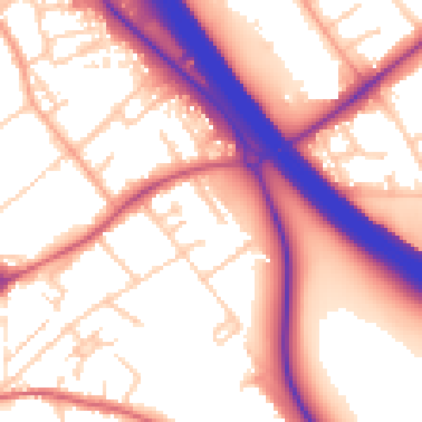
Daytime· 07:00 – 23:00
57.4dB

Night-time· 23:00 – 07:00
50.1dB