9 Pyrles Lane, Loughton, IG10 2NW
About 9 Pyrles Lane
9 Pyrles Lane is a property in Loughton (IG10 2NW). It has council tax band D.
Held since December 2002 — that's 23 years off the open market, well above the local norm. 3 planning records sit against the property, 2 approved, 1 refused. Past consents include an extension, a loft conversion and a porch, meaningful when judging how the property has evolved. Across 1996–2002, sale prices on this property compounded at 12.6% per year.
Everything you need to know about 9 Pyrles Lane
The true value, the hidden risks and the full sale history, in one report.
30-day money-back guarantee

The data behind every report


Energy performance
No EPC on record
This property doesn't have an Energy Performance Certificate yet. An EPC is required to sell or let — and unlocks our automated valuation.
Planning history
- May 2017Loft ConversionFullIn report
Extension: Single storey · Side of property
First floor side extension & loft conversion (Revised application to EPF/1762/16)
Extension- Documents
- 12 docs on file
- Reference
- EPF/0592/17
- Sept 2016Loft ConversionFullIn report
Extension: Single storey · Side of property
Proposed first floor side extension with a gable end roof, loft extension with rear dormer and 5 roof lights to the front elevation
Extension- Documents
- 20 docs on file
- Reference
- EPF/1762/16
We flagged 1 thing worth checking at 9 Pyrles Lane
Independent checks surfaced things a buyer would want to understand before offering. The report explains each one in full, with the underlying data and what to ask.
- Larger development activity nearby
30-day money-back guarantee
Sales history & valuation
Sale price has at least doubled since 1996.
£195,000
Growth on file: 12.6% per year over 7 years.
Sales timeline
13 December 2002Most recent
£195,000
+116.8%over 6 years30 May 1996
£89,950
Median price across the last 5 sales in IG10 2NW: £602,000 (2025–2023).
Everything you need to know about 9 Pyrles Lane
The true value, the hidden risks and the full sale history, in one report.
30-day money-back guarantee
The data behind every report
Similar properties nearby
1 Doubleday Road
IG10 2AT
1 Coteford Close
IG10 2NT
1 Beech Close
IG10 2PH
1 Coles Green
IG10 2QS
1 Colebrook Path
IG10 2HW
1 Appleton Road
IG10 2HH
1 Cedar Drive
IG10 2PA
1 Brookfield Terrace, Pyrles Lane
IG10 2NR
The neighbourhood at a glance
Crime
4/mo
Steady year-on-year across the wider district.
Nearest stop
0.1 km
Pyrles Lane — bus stop.
Closest school
0.7 km
Hereward Primary School. 11 schools nearby.
Go deeper on the local area
The full report breaks down crime, transport links, schools and air quality in depth.
Road noise across the postcode
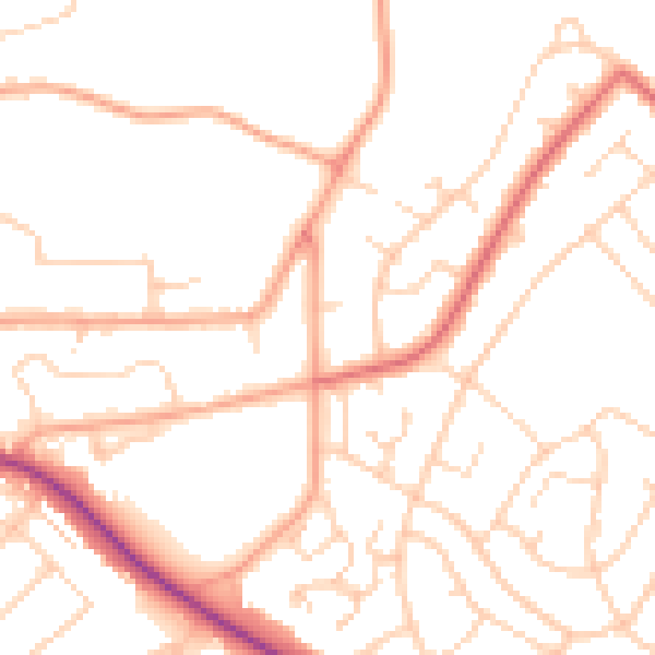
Daytime· 07:00 – 23:00
50.4dB

Night-time· 23:00 – 07:00
40.2dB