63 Raglan Road, Knaphill, Woking, GU21 2AR
About 63 Raglan Road
63 Raglan Road is a mid-terrace house in Knaphill, Woking, Woking (GU21 2AR). It has a recorded floor area of 26 m² (around 280 sq ft), construction records dating it to before 1900 and council tax band B. The latest certificate (February 2020) shows a D (score 60), on the cusp of jumping into the C band. When first surveyed in October 2008 the rating was E, the property has climbed 1 band since. Between certificates, window efficiency went from Very Poor to Average and hot-water efficiency went from Very Poor to Poor; while wall efficiency dropped from Good to Very Poor. The recommended improvements would push it to C (score 80). Main heating runs on electricity. At 26 m² this is the 7th smallest of 34 units on EPC record in the building, where floor areas span 19–96 m². The building's EPC ratings span E to C across 34 units on file.
Held since December 2005 — that's 21 years off the open market, well above the local norm. Across 2002–2005, sale prices on this property compounded at 6.9% per year. Today's modelled estimate of £135,000 is 24.4% above the 2005 sale price. On a £-per-square-foot basis, the last sale (£388/sq ft) was about 25.6% above the typical sold price in the postcode. At 26 m² it's 23.5% smaller than the typical home in the postcode (34 m² median across 33 EPCs).
Everything you need to know about 63 Raglan Road
The true value, the hidden risks and the full sale history, in one report.
Pick your report · from £14.99
One time fee only - money back guarantee

The data behind every report







Energy performance
EPC Rating
Certificate validity
Valid until 4 February 2030
Property Improvements
Changes detected from historical EPC data
Hot water system upgraded
Single glazing replaced with double or better glazing
More low energy lighting installed

Get a survey for this property
Level 3 Building Survey
Because the property was built before 1919, has no mains gas supply, and has solid (non-cavity) walls, we believe a Level 3 building survey should be considered.
From £820 · Includes VAT
Planning history
63 Raglan Road has no planning applications on record.
A planning report still maps activity across the surrounding area and reads this property's extension & conversion potential.
Sales history & valuation
63 Raglan Road saw 3 transfers in just over a decade — high turnover for the postcode.
£135,000
Modelled from EPC, postcode comparables and a sale-price growth of 6.9% per year over 4 years.
£108,500
Growth on file: 6.9% per year over 4 years.
Sales timeline
21 December 2005Most recent
£108,500
+8.6%over 2 years10 March 2003
£99,950
+17.6%over 11 months17 April 2002
£85,000
Median price across the last 5 sales in GU21 2AR: £417,500 (2026–2024).
Nearby sales in GU21 2AR
37 Raglan Road, Knaphill, Woking, GU21 2AR
Sold Mar 2026
£515,00041 Raglan Road, Knaphill, Woking, GU21 2AR
Sold Jul 2025
£417,500105 Raglan Road, Knaphill, Woking, GU21 2AR
Sold Feb 2025
£446,00047 Raglan Road, Knaphill, Woking, GU21 2AR
Sold Sept 2024
£140,00085 Raglan Road, Knaphill, Woking, GU21 2AR
Sold Jul 2024
£155,000
Versus other Raglan Road homes
CO₂ Emissions for 63 Raglan Road runs comfortably ahead of the street norm.
Price per m²
£4,173
Street avg £4,733
Floor Area
26 m²
Street avg 27 m²
Habitable Rooms
1 rooms
Street avg 1 rooms
CO₂ Emissions
2.2 t/year
Street avg 2.8 t/year
Everything you need to know about 63 Raglan Road
The true value, the hidden risks and the full sale history, in one report.
Pick your report · from £14.99
One time fee only - money back guarantee
The data behind every report
Similar properties nearby
1 Creswell, Anchor Hill, Knaphill
GU21 2JG
1 Boleyn Court, Tudor Way, Knaphill
GU21 2UA
1 Cranley Place, Queens Road, Knaphill
GU21 2HJ
1 Cranmer Court, Hampton Close, Knaphill
GU21 2UW
1 Creston Avenue, Knaphill
GU21 2NE
1 Choir Green, Knaphill
GU21 2NQ
1 Council Cottages, Anchor Hill, Knaphill
GU21 2JH
1 Beechwood Road, Knaphill
GU21 2DJ
The neighbourhood at a glance
Crime
336/mo
Falling year-on-year across the wider district.
Nearest stop
0.2 km
Inkerman Way — bus stop.
Closest school
0.2 km
St John's Primary School. 17 schools nearby.
Go deeper on the local area
A Local Area report breaks down crime, transport links, schools and air quality in depth.
Road noise across the postcode
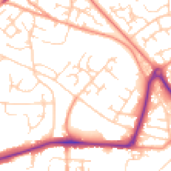
Daytime· 07:00 – 23:00
52.6dB
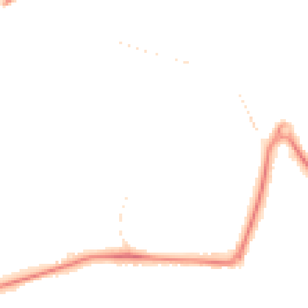
Night-time· 23:00 – 07:00
41.9dB