12 The Loning, Enfield, EN3 5RE
About 12 The Loning
12 The Loning is a mid-terrace house in Enfield (EN3 5RE). It has a recorded floor area of 83 m² (around 893 sq ft), construction records dating it to 1930-1949 and council tax band C. The latest certificate (November 2019) shows a D (score 66), on the cusp of jumping into the C band. The recommended improvements would lift it to B (score 82), a 2-band jump.
Held since May 2002 — that's 24 years off the open market, well above the local norm. Today's modelled estimate of £410,000 sits 188.7% above the 2002 sale of £142,000. On a £-per-square-foot basis, the last sale (£159/sq ft) was about 28.1% below the postcode norm. 2 planning records sit against the property, 0 approved, 1 refused.
Everything you need to know about 12 The Loning
The true value, the hidden risks and the full sale history, in one report.
30-day money-back guarantee

The data behind every report


Energy performance
Recommended upgrades on file would lift this property by multiple EPC bands.
EPC Rating
Planning history
12 The Loning has 2 separate extension applications on the council record.
- Jun 2016ExtensionOutlineIn report
Extension: Single storey · Rear of property
Single storey rear extension 4m deep x 4m high (2.5m high to eaves)
- Documents
- 6 docs on file
- Reference
- 16/02130/PRH
- May 2016ExtensionOutlineIn report
Extension: Single storey · Rear of property
Single storey rear extension 4m deep x 4m high (2.5m high to eaves)
- Documents
- 6 docs on file
- Reference
- 16/01503/PRH
We flagged 2 things worth checking at 12 The Loning
Independent checks surfaced things a buyer would want to understand before offering. The report explains each one in full, with the underlying data and what to ask.
- Signs of HMO activity in the area
- Larger development activity nearby
30-day money-back guarantee
Sales history & valuation
12 The Loning valuation sits well clear of the typical sold price in this postcode.
£410,000
Modelled from EPC, postcode comparables.
£142,000
Recorded with HM Land Registry.
Sales timeline
8 May 2002Most recent
£142,000
Median price across the last 5 sales in EN3 5RE: £425,000 (2022–2018).
Versus other The Loning homes
EPC Rating for 12 The Loning runs comfortably ahead of the street norm.
Price per m²
£1,711
Street avg £3,725
Floor Area
83 m²
Street avg 80 m²
Habitable Rooms
5 rooms
Street avg 5 rooms
CO₂ Emissions
3.2 t/year
Street avg 4.2 t/year
Everything you need to know about 12 The Loning
The true value, the hidden risks and the full sale history, in one report.
30-day money-back guarantee
The data behind every report
Similar properties nearby
The neighbourhood at a glance
Rail-style transport is unusually close for this postcode.
Crime
8/mo
Rising year-on-year across the wider district.
Nearest stop
0.3 km
Albany Leisure Centre — bus stop.
Closest school
0.5 km
Enfield Heights Academy. 42 schools nearby.
Go deeper on the local area
The full report breaks down crime, transport links, schools and air quality in depth.
Road noise across the postcode
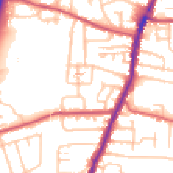
Daytime· 07:00 – 23:00
53.2dB

Night-time· 23:00 – 07:00
43.4dB