Skip to content

12a, Portelet Road, Tower Hamlets, London, E1 4ER

Estimated value

£396,000

  • Since the 2016 sale (£420,000)-6%
  • Against E1 4ER's recent median (£493,500)-20%

Newest record on this page: January 2026. Land Registry and EPC registers update monthly, so this page can trail them by 2–3 months.

Learn about this valuation
Property type
Mid terrace
Floor 00
Habitable rooms
5
From EPC
Floor area
76 m²
818 sq ft
Energy rating
C
Score 75
Council tax
Band C
Tenure
Private Rental
Get directions (opens in a new tab)
Valuation

About this valuation

How the figure is worked out and what it's based on. If you know this home, you can tell other visitors what you think it's worth.

Our estimate

£396,000

  • Against its 2016 sale (£420,000)-6%
  • Against E1 4ER's recent median (£493,500)-20%

Your note and figure are shown publicly on this page.

How the estimate is made

The estimate for 12a is modelled from its 76 m² EPC floor area, its 1 recorded sale and recent sales of comparable homes in E1 4ER. It is an automated estimate, not a survey or mortgage valuation: condition, layout and improvements that aren't on record can move the real figure either way.

What it's based on

  • Floor area

    76 m² from the EPC lodged in September 2025

  • Sales of this home

    1 sale recorded, the latest in 2016

  • Recent sales in E1 4ER

    5 sales, median £493,500 (2026–2021)

This page or the full report?

DataThis pageFull report
SalesLatest sale shown: January 2026Latest available records, read when you order
ValuationEstimate from the last refreshAnalysed against comparable sales
PlanningNone on this homeFull history, plus nearby schemes
Flood riskNot shownIncluded
Price

Sales history & valuation

Every recorded sale of this home, how its price has moved, and what neighbouring properties have sold for.
Risks

What this page doesn't show

2 potential issues have already been flagged for 12a, Portelet Road, Tower Hamlets, London, E1 4ER. The detail, evidence and what to ask about it are in the Risks Report.
  • Signs of HMO activity in the areaIn report
  • Larger development activity nearbyIn report
  • Flood risk from rivers, sea and surface waterIn report
  • Subsidence and ground-stability signalsIn report
  • Refusals, enforcement and big schemes nearbyIn report

One time fee only - money back guarantee
Overview

About 12a

A plain-English summary derived from public records, EPC certificates, sold prices and local data.

12a is a mid-terrace house in Tower Hamlets, London, London (E1 4ER). It has a recorded floor area of 76 m² (around 818 sq ft), construction records dating it to 1967-1975 and council tax band C. The latest certificate (September 2025) shows a C (score 75), near the top of the C band. When first surveyed in September 2015 the rating was D, the property has climbed 1 band since. Between certificates, wall efficiency went from Very Poor to Poor, hot-water efficiency went from Average to Good and lighting went from Poor to Very Good; while window efficiency dropped from Average to Poor.

On a £-per-square-foot basis, the last sale (£513/sq ft) was about 93.7% above the typical sold price in the postcode. On the market in January 2016 and unlisted since — roughly 11 years.

Before you decide

Everything you need to know about 12a

The true value, the hidden risks and the full sale history, in one report.

Signs of HMO activity in the areaLarger development activity nearby

Pick your report · from £14.99

One time fee only - money back guarantee

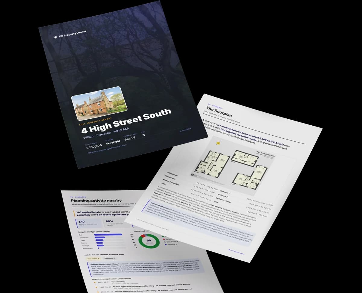
Preview of the full property report

The data behind every report

  • HM Land Registry, source of sold price history
  • Department for Education, source of schools data
  • Police.uk, source of crime statistics
  • Department for Transport, source of stations and transport links
  • Environment Agency, source of flood risk data
  • Department for Environment, Food & Rural Affairs, source of road noise data
  • PlanIt, source of planning application records
Energy

Energy performance

Every EPC certificate filed against this property — current rating, recorded improvements, and where there's headroom to reach a higher band.
Current Certificate(1 of 2)
Sept 2025

EPC Rating

A
B
C
C75
D
E
F
G
Main Heating
Gas
Main Fuel
Gas
Hot Water
Good
Windows
Poor
CO2 Emissions
1.8 t/year
Occupancy
Rented

Certificate validity

Valid until 10 September 2035

8 years remaining

Property Improvements

Changes detected from historical EPC data

Sept 2025from Sept 2015
EPC improved fromD60toC75
Heating System
Storage HeatersGas Boiler

Replaced storage heaters with gas boiler

Main Fuel
ElectricGas

Connected to mains gas supply

Heating Controls
ManualFull

Heating controls upgraded for better temperature management

Hot Water
Immersion (Off-Peak)Main System

Hot water system upgraded

Windows
Partial DoubleFull Double

Windows upgraded, improving insulation

Walls
Very PoorPoor

Wall insulation improved

Low Energy Lighting
11%100%

More low energy lighting installed

Planning

Planning history

Applications and permits filed against 12a, Portelet Road, Tower Hamlets, London, E1 4ER, sourced from the PlanIt planning register.

12a has no planning applications on record.

13

But the area is active

13 notable applications nearby — larger schemes and conversions that could reshape the street. The report maps them all.

On the street

Versus other Portelet Road homes

Four headline reads against 26 similar flats on this street, drawn from the latest EPC and Land Registry data.

12a outperforms the street on co₂ emissions by a wide margin.

Price per m²

£5,526

Street avg £3,891

Above

Floor Area

76 m²

Street avg 80 m²

Below

Habitable Rooms

5 rooms

Street avg 5 rooms

Above

CO₂ Emissions

1.8 t/year

Street avg 2.6 t/year

Strongly above
Area

The neighbourhood at a glance

A condensed read of the local area. Each tile links through to the full breakdown on the London district page.

Rail-style transport is unusually close for this postcode.

Crime

949/mo

Falling year-on-year across the wider district.

Nearest stop

0.2 km

Colebert Avenue — bus stop.

Closest school

0.1 km

Morpeth School. 116 schools nearby.

Nearest schools

  • Morpeth SchoolSecondary139m
  • Bangabandhu Primary SchoolPrimary367m
  • Bonner Primary SchoolPrimary494m
  • Globe Primary SchoolPrimary510m

Nearest stops

  • Colebert AvenueBus stop170m
  • Portman PlaceBus stop295m
  • Stepney Green StationBus stop316m
  • Morpeth StreetBus stop376m

Most reported crime locally

  • Violence & Sexual Offences4,314 reports24%
  • Anti-social Behaviour3,926 reports22%
  • Other Theft1,664 reports9%
  • Theft from Person1,458 reports8%

Go deeper on the local area

A Local Area report breaks down crime, transport links, schools and air quality in depth.
Noise

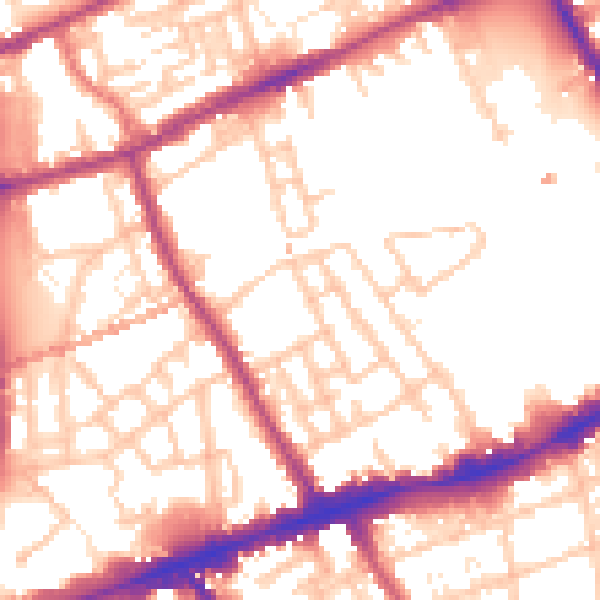
Road noise across the postcode

Modelled day and night-time noise levels around E1 4ER from Defra's strategic mapping. The pin marks this postcode's centroid.
Daytime road noise heatmap for E1 4ER

Daytime· 07:00 – 23:00

54.5dB

Low
Night-time road noise heatmap for E1 4ER

Night-time· 23:00 – 07:00

44.4dB

Low
55 dB
60 dB
65 dB
70 dB
75 dB
80 dB
Defra Road Noise Strategic Mapping, Round 4
SDL Surveying

Get a survey for this property

Level 2 HomeBuyer Report

Late 20th centuryGround Floor MaisonetteEPC C

We've checked 10 risk factors against the available data for this property and believe a Level 2 HomeBuyer Report could be a suitable option for you.

From £595 · Includes VAT

Property research, connected

Get up to date data on unlimited properties per month

Explore sale histories, valuations, energy ratings and local areas. Ask the assistant to connect the details and take your research further.

Start your research
Method

How to read this page

Where every figure above comes from, how current it is and what it can't tell you.
How the estimate is made
The estimate for 12a is modelled from its 76 m² EPC floor area, its 1 recorded sale and recent sales of comparable homes in E1 4ER. It is an automated estimate, not a survey or mortgage valuation: condition, layout and improvements that aren't on record can move the real figure either way.
Where sold prices come from
Sold prices are HM Land Registry Price Paid Data, which covers residential sales in England and Wales since 1995. 1 sale is recorded for 12a. Sales normally appear two to three months after completion, so the most recent ones take time to show up anywhere.
Reading the EPC
Energy Performance Certificates rate homes from A (most efficient) to G and last 10 years. The latest one for 12a was lodged in September 2025 at band C and is valid until September 2035. 2 certificates are on record, which shows how the home has changed.
Planning records
Planning applications are collected from local authority registers through PlanIt. None is matched to 12a. Councils sometimes file applications under a different address format, and applications on neighbouring land aren't listed here; the report covers both.
Area figures
Crime is police-recorded street-level data over the last 19 months, which places each incident at an approximate point. The 116 schools and 30 stops listed are measured in a straight line from E1 4ER, not by walking route. Road noise is Defra's strategic noise modelling, averaged across the postcode.
Council tax band
12a is in council tax band C. Bands are set by the Valuation Office Agency from historic values (1 April 1991 in England, 1 April 2003 in Wales), not today's price; the amount you pay depends on the council's rate for the band.
FAQ

Common questions

The questions buyers, sellers and homeowners most often ask about 12a, Portelet Road, Tower Hamlets, London, E1 4ER. Each answer is also embedded as structured data for search engines.

Know this home? Think our valuation is wrong?

Leave a note for other visitors about work done or anything the records miss, and say what you think it's worth. It takes about two minutes.