9 Church Lane, Keelby, Grimsby, DN41 8ED
About 9 Church Lane
9 Church Lane is a semi-detached house in Keelby, Grimsby, Grimsby (DN41 8ED). It has a recorded floor area of 140 m² (around 1507 sq ft), construction records dating it to before 1900 and council tax band E. The latest certificate (September 2017) shows an F (score 34), near the bottom of the EPC scale. The recommended improvements would lift it to C (score 80), a 3-band jump. Main heating runs on oil.
On energy efficiency it sits in the bottom 10% of properties in this postcode — significant headroom for improvement. 2 planning records sit against the property, 1 approved, 0 refused. The record references listed-building consent, which constrain future alterations. Across 2001–2018, sale prices on this property compounded at 7.9% per year. Today's modelled estimate of £271,000 is 15.3% above the 2018 sale price. Sold September 2018 for £235,000.
Everything you need to know about 9 Church Lane
The true value, the hidden risks and the full sale history, in one report.
Pick your report · from £14.99
One time fee only - money back guarantee

The data behind every report







Energy performance
9 Church Lane sits at the bottom of the postcode for energy efficiency — meaningful headroom to improve.
EPC Rating
Certificate validity
Valid until 25 September 2027

Get a survey for this property
Level 3 Building Survey
Because the property was built before 1919, has no mains gas supply, and has solid (non-cavity) walls, we believe a Level 3 building survey should be considered.
From £885 · Includes VAT
Planning history
9 Church Lane has multiple listed-building consents on file — alterations need formal heritage approval.
2 applications on record at 9 Church Lane, Keelby, Grimsby, DN41 8ED
- Apr 2019RenovationHeritageOutcome in report
Listed building consent for replacement of failed clay pantile roof coverings with new hand-made natural clay pantiles, including minor repairs to structural timbers. Conservation repairs and replacement of weather-spalled chalk ashlars to west gable upper levels.
Listed- Documents
- 16 docs on file
- Reference
- 139130
- More recent applications — locked
- ConditionsOct 2020Decision
Unlock 9 Church Lane, Keelby, Grimsby, DN41 8ED's full planning history
You're seeing the shape of it. The report has the substance.
- Every decision — granted, refused or withdrawn (2 on record)
- All 2 applications on this property in full, plus 2 notable nearby
- The 28 documents, officer reports & conditions
- What the pattern means for extending or converting here
One time fee only - money back guarantee
Sales history & valuation
Sale price has grown by over 3x since 2001.
£271,000
Modelled from EPC, postcode comparables and a sale-price growth of 7.9% per year over 17 years.
£235,000
Growth on file: 7.9% per year over 17 years.
Sales timeline
30 September 2018Most recent
£235,000
+261.5%over 16 years10 October 2001
£65,000
Median price across the last 5 sales in DN41 8ED: £410,000 (2026–2021).
Nearby sales in DN41 8ED
Summerfield House, Church Lane, Keelby, Grimsby, DN41 8ED
Sold Jan 2026
£500,00018 Church Lane, Keelby, Grimsby, DN41 8ED
Sold Nov 2024
£410,0008 Church Lane, Keelby, Grimsby, DN41 8ED
Sold Jan 2024
£129,0007a, Church Lane, Keelby, Grimsby, DN41 8ED
Sold Jan 2023
£282,000South Place, Church Lane, Keelby, Grimsby, DN41 8ED
Sold Aug 2016
£250,000
Versus other Church Lane homes
On epc rating, 9 Church Lane runs well behind the street norm.
Price per m²
£1,679
Street avg £1,575
Floor Area
140 m²
Street avg 187 m²
Habitable Rooms
5 rooms
Street avg 6 rooms
CO₂ Emissions
13.0 t/year
Street avg 5.1 t/year
Everything you need to know about 9 Church Lane
The true value, the hidden risks and the full sale history, in one report.
Pick your report · from £14.99
One time fee only - money back guarantee
The data behind every report
Similar properties nearby
1 Cotham Gardens, Keelby
DN41 8RB
1 Brocklesby Road, Keelby
DN41 8HR
1 Holly Close, Stallingborough
DN41 8TG
1 Buttercross Close, Stallingborough
DN41 8TB
1 Healing Road, Stallingborough
DN41 8AD
1 Grange Farm Cottages, Riby Road, Stallingborough
DN41 8BU
1 Karen Avenue, Keelby
DN41 8EU
1 Cissplatt Lane, Keelby
DN41 8HU
The neighbourhood at a glance
Daytime road noise here sits well below conversation level — a quiet pocket of the postcode.
Crime
25/mo
Falling year-on-year across the wider district.
Nearest stop
0.2 km
Post Office — bus stop.
Closest school
0.3 km
Keelby Primary Academy. 1 school nearby.
Go deeper on the local area
A Local Area report breaks down crime, transport links, schools and air quality in depth.
Road noise across the postcode
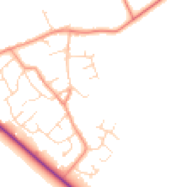
Daytime· 07:00 – 23:00
47.2dB

Night-time· 23:00 – 07:00
39.4dB