11 Abbots Road, Scunthorpe, DN17 1JF
About 11 Abbots Road
11 Abbots Road is a three-bedroom semi-detached house in Scunthorpe (DN17 1JF). It has a recorded floor area of 79 m² (around 850 sq ft), construction records dating it to 1930-1949 and council tax band A. The latest certificate (February 2013) shows a D (score 60), on the cusp of jumping into the C band. The recommended improvements would lift it to B (score 82), a 2-band jump. The latest certificate is from February 2013, so improvements made since then won't be reflected.
Across 2006–2016, sale prices on this property compounded at 2.2% per year. Today's modelled estimate of £141,000 is 34.3% above the 2016 sale price. On a £-per-square-foot basis, the last sale (£123/sq ft) was about 22.2% above the typical sold price in the postcode. Last sold in June 2016, so it's been off the market for around 10 years.
Know exactly what you're buying at 11 Abbots Road
Before you offer, see what the listing won't tell you, the true value, the red flags and the full history.
Valuation
against the asking price
Risks
planning & flood
Sold prices
similar homes nearby
Trends
the local market
What this property has
Inside
- Bedrooms3
- Dining roomYes
Outside
- Private gardenRear
- GarageYes
Building
- Central heatingYes
- RefurbishedYes
Energy performance
Recommended upgrades on file would lift this property by multiple EPC bands.
EPC Expired
This certificate is over 10 years old and is no longer valid.Expired 09 Feb 2023
EPC Rating
Planning history
11 Abbots Road has no planning applications on record.
The full report still covers planning activity across the surrounding area.
Sales history & valuation
11 Abbots Road valuation sits well clear of the typical sold price in this postcode.
£141,000
Modelled from EPC, postcode comparables and a sale-price growth of 2.2% per year over 10 years.
£105,000
Growth on file: 2.2% per year over 10 years.
Sales timeline
2 June 2016Most recent
£105,000
+23.5%over 9 years20 July 2006
£85,000
Median price across the last 5 sales in DN17 1JF: £145,000 (2023–2022).
Nearby sales in DN17 1JF
Everything we know about 11 Abbots Road, in one report
What it's really worth, what could be wrong, and the planning, sales and area data in full.
- Am I paying too much?
- Is something wrong with it?
- Is the agent's story true?
- Will it hold its value?

Versus other Abbots Road homes
Habitable Rooms for 11 Abbots Road lags the street by a wide margin.
Price per m²
£1,329
Street avg £1,295
Floor Area
79 m²
Street avg 81 m²
Habitable Rooms
4 rooms
Street avg 5 rooms
CO₂ Emissions
4.0 t/year
Street avg 4.3 t/year
Similar properties nearby
1 Blake Avenue
DN17 1LU
1 Brumby Grove Cottages, Scotter Road
DN17 1ST
1 Bridport Walk
DN17 1UB
1 Byron Close
DN17 1LX
1 Chelwood Road
DN17 1HB
1 Bodmin Close
DN17 1TW
1 Brumby Hall Gardens
DN17 1BP
1 Cathedral Court
DN17 1HZ
The neighbourhood at a glance
Daytime road noise here sits well below conversation level — a quiet pocket of the postcode.
Crime
5/mo
Steady year-on-year across the wider district.
Nearest stop
0.1 km
Monks Road — bus stop.
Closest school
0.5 km
Priory Lane Community School. 26 schools nearby.
Go deeper on the local area
The full report breaks down crime, transport links, schools and air quality in depth.
Road noise across the postcode
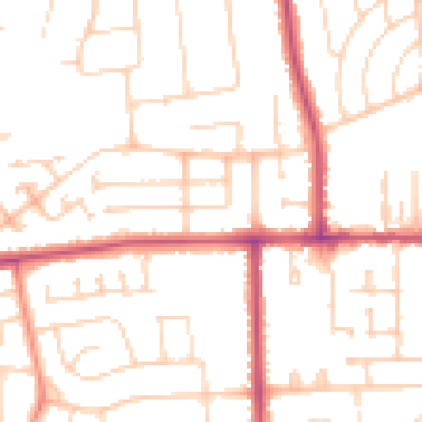
Daytime· 07:00 – 23:00
49.8dB
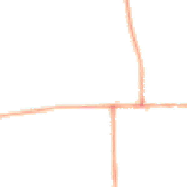
Night-time· 23:00 – 07:00
39.8dB