17 Corunna Drive, Colchester, CO2 9HF
About 17 Corunna Drive
17 Corunna Drive is a three-bedroom semi-detached house in Colchester (CO2 9HF). It has a recorded floor area of 79 m² (around 850 sq ft) and council tax band D. The latest certificate (August 2012) shows a C (score 76), near the top of the C band. The latest certificate is from August 2012, so improvements made since then won't be reflected.
Across 2012–2014, sale prices on this property compounded at 6.9% per year. Today's modelled estimate of £322,000 sits 53.3% above the 2014 sale of £210,000. One planning record on file: a loft conversion approved in 2017. Past consents include a loft conversion, meaningful when judging how the property has evolved. Last sold in December 2014, so it's been off the market for around 11 years.
What this property has
Inside
- Bedrooms3
- Bathrooms1
Outside
- Private gardenRear
- ParkingOff road
Everything you need to know about 17 Corunna Drive
The true value, the hidden risks and the full sale history, in one report.
Pick your report · every report is £14.99
One time fee only - money back guarantee

The data behind every report


Energy performance
17 Corunna Drive's EPC is over a decade old — improvements since won't be reflected.
EPC Expired
This certificate is over 10 years old and is no longer valid.Expired 01 Aug 2022
EPC Rating
Get a survey for this property
Level 2 HomeBuyer Report
We've checked 10 risk factors against the available data for this property and believe a Level 2 HomeBuyer Report could be a suitable option for you.
From £595 · Includes VAT
Planning history
1 application on record at 17 Corunna Drive, Colchester, CO2 9HF
- Nov 2017Loft ConversionFullOutcome in report
Loft conversion to create additional bedroom and ensuite.
- Documents
- 5 docs on file
- Reference
- 172561
Unlock 17 Corunna Drive, Colchester, CO2 9HF's full planning history
You're seeing the shape of it. The report has the substance.
- Every decision — granted, refused or withdrawn (1 on record)
- All 1 application on this property in full, plus 1 notable nearby
- The 5 documents, officer reports & conditions
- What the pattern means for extending or converting here
One time fee only - money back guarantee
Sales history & valuation
17 Corunna Drive valuation sits well clear of the typical sold price in this postcode.
£322,000
Modelled from EPC, postcode comparables and a sale-price growth of 6.9% per year over 2 years.
£210,000
Growth on file: 6.9% per year over 2 years.
Sales timeline
5 December 2014Most recent
£210,000
+14.8%over 2 years16 November 2012
£183,000
Median price across the last 5 sales in CO2 9HF: £285,000 (2022–2020).
Nearby sales in CO2 9HF
Versus other Corunna Drive homes
17 Corunna Drive is notably below the street on floor area.
Price per m²
£2,658
Street avg £2,605
Floor Area
79 m²
Street avg 98 m²
CO₂ Emissions
2.1 t/year
Street avg 2.5 t/year
Years Held
11 years
Street avg 10 years
Everything you need to know about 17 Corunna Drive
The true value, the hidden risks and the full sale history, in one report.
Pick your report · every report is £14.99
One time fee only - money back guarantee
The data behind every report
Similar properties nearby
The neighbourhood at a glance
Reported crime in the wider district is trending notably upward year-on-year.
Crime
5/mo
Rising year-on-year across the wider district.
Nearest stop
0.1 km
Lordswood Road — bus stop.
Closest school
0.4 km
Montgomery Primary School, Colchester. 26 schools nearby.
Go deeper on the local area
A Local Area report breaks down crime, transport links, schools and air quality in depth.
Road noise across the postcode
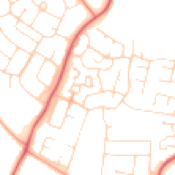
Daytime· 07:00 – 23:00
49.5dB

Night-time· 23:00 – 07:00
38.9dB