60 High Road, Layer De La Haye, Colchester, CO2 0DT
About 60 High Road
60 High Road is a five-bedroom property in Layer-De-La-Haye, Colchester, Colchester (CO2 0DT). It has council tax band D. Period features are noted in the property record.
It hasn't traded since September 2004, a hold of 22 years that's notably long for the area. Across 1996–2004, sale prices on this property compounded at 17.2% per year. 5 bedrooms is on the larger side for this postcode, where 4 is the typical count.
What this property has
Inside
- Bedrooms5
- Dining roomYes
- EnsuiteYes
Outside
- ParkingOff road
Building
- Period featuresYes
Everything you need to know about 60 High Road
The true value, the hidden risks and the full sale history, in one report.
Pick your report · from £14.99
One time fee only - money back guarantee

The data behind every report







Energy performance
No EPC on record
This property doesn't have an Energy Performance Certificate yet. An EPC is required to sell or let — and unlocks our automated valuation.

Get a survey for this property
Level 2 HomeBuyer Report
We've checked 10 risk factors against the available data for this property and believe a Level 2 HomeBuyer Report could be a suitable option for you.
Planning history
60 High Road has no planning applications on record.
But the area is active
1 notable application nearby — larger schemes and conversions that could reshape the street. The report maps them all.
Sales history & valuation
Sale price has grown by over 3x since 1996.
£295,000
Growth on file: 17.2% per year over 8 years.
Sales timeline
2 September 2004Most recent
£295,000
+202.6%over 6 years30 April 1998
£97,500
+14.7%over 1 year1 November 1996
£85,000
Median price across the last 5 sales in CO2 0DT: £575,000 (2026–2018).
Nearby sales in CO2 0DT
73 High Road, Layer De La Haye, Colchester, CO2 0DT
Sold Apr 2026
£450,00077 High Road, Layer De La Haye, Colchester, CO2 0DT
Sold Jan 2025
£475,00069 High Road, Layer De La Haye, Colchester, CO2 0DT
Sold Jun 2022
£575,00084a, High Road, Layer De La Haye, Colchester, CO2 0DT
Sold Dec 2020
£922,50086 High Road, Layer De La Haye, Colchester, CO2 0DT
Sold Nov 2018
£700,000
Everything you need to know about 60 High Road
The true value, the hidden risks and the full sale history, in one report.
Pick your report · from £14.99
One time fee only - money back guarantee
The data behind every report
Similar properties nearby
1 Hillfield Cottages, Layer Breton
CO2 0PS
1 Eldred Cottages, Olivers Lane
CO2 0HJ
1 Greate House Farm Road, Layer De La Haye
CO2 0LP
1 Birch Road, Layer De La Haye
CO2 0EL
1 Chancery Grove, Mersea Road, Blackheath
CO2 0BQ
1 Ash Grove
CO2 0AH
1 Chestnut Avenue
CO2 0AL
1 Blenheim Drive
CO2 0AR
The neighbourhood at a glance
Daytime road noise here sits well below conversation level — a quiet pocket of the postcode.
Crime
311/mo
Steady year-on-year across the wider district.
Nearest stop
0.1 km
New Cut — bus stop.
Closest school
0.3 km
Layer-de-la-Haye Church of England Voluntary Controlled Primary School. 6 schools nearby.
Go deeper on the local area
A Local Area report breaks down crime, transport links, schools and air quality in depth.
Road noise across the postcode
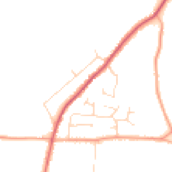
Daytime· 07:00 – 23:00
45.3dB

Night-time· 23:00 – 07:00
37.6dB