54 High Road, Layer De La Haye, Colchester, CO2 0DT
About 54 High Road
54 High Road is a four-bedroom detached house in Layer-De-La-Haye, Colchester, Colchester (CO2 0DT). It has a recorded floor area of 134 m² (around 1442 sq ft), construction records dating it to 1967-1975 and council tax band E. The latest certificate (December 2016) shows a D (score 55), a step below the typical UK home. Earlier certificates rated it C (October 2010); the latest reading is one band lower. Between certificates, window efficiency went from Average to Good and lighting went from Average to Good; while wall efficiency dropped from Good to Poor and roof efficiency dropped from Good to Average. The recommended improvements would lift it to A (score 95), a 3-band jump.
Across 2001–2013, sale prices on this property compounded at 4.1% per year. Today's modelled estimate of £524,000 sits 60% above the 2013 sale of £327,500. 5 planning records sit against the property, 4 approved, 0 refused. Past consents include an extension, meaningful when judging how the property has evolved. Last sold in July 2013, so it's been off the market for around 13 years.
What this property has
Inside
- Bedrooms4
- Bathrooms2
Everything you need to know about 54 High Road
The true value, the hidden risks and the full sale history, in one report.
Pick your report · from £14.99
One time fee only - money back guarantee

The data behind every report







Energy performance
54 High Road's carbon output runs well above what efficient homes in the postcode produce.
EPC Rating
Certificate validity
Valid until 7 December 2026
Property Improvements
Changes detected from historical EPC data
Hot water efficiency decreased
Window efficiency improved
More low energy lighting installed

Get a survey for this property
Level 2 HomeBuyer Report
We've checked 10 risk factors against the available data for this property and believe a Level 2 HomeBuyer Report could be a suitable option for you.
From £795 · Includes VAT
Planning history
54 High Road has been extended on multiple sides of the property across separate planning applications.
5 applications on record at 54 High Road, Layer De La Haye, Colchester, CO2 0DT
- Aug 2017ExtensionFullOutcome in report
Extension: Side and rear of property
Two storey side, front and rear extension to replace existing single storey garage. Apply render and cladding to existing and proposed external elevations.
- Documents
- 42 docs on file
- Reference
- 171473
- More recent applications — locked
- ExtensionMar 2024Decision
- OutbuildingMay 2019Decision
+ 2 more applications in the report
Unlock 54 High Road, Layer De La Haye, Colchester, CO2 0DT's full planning history
You're seeing the shape of it. The report has the substance.
- Every decision — granted, refused or withdrawn (4 on record)
- All 5 applications on this property in full, plus 1 notable nearby
- The 86 documents, officer reports & conditions
- What the pattern means for extending or converting here
One time fee only - money back guarantee
Sales history & valuation
54 High Road valuation sits well clear of the typical sold price in this postcode.
£524,000
Modelled from EPC, postcode comparables and a sale-price growth of 4.1% per year over 12 years.
£327,500
Growth on file: 4.1% per year over 12 years.
Sales timeline
11 July 2013Most recent
£327,500
+63.8%over 12 years17 May 2001
£199,950
Median price across the last 5 sales in CO2 0DT: £575,000 (2026–2018).
Nearby sales in CO2 0DT
73 High Road, Layer De La Haye, Colchester, CO2 0DT
Sold Apr 2026
£450,00077 High Road, Layer De La Haye, Colchester, CO2 0DT
Sold Jan 2025
£475,00069 High Road, Layer De La Haye, Colchester, CO2 0DT
Sold Jun 2022
£575,00084a, High Road, Layer De La Haye, Colchester, CO2 0DT
Sold Dec 2020
£922,50086 High Road, Layer De La Haye, Colchester, CO2 0DT
Sold Nov 2018
£700,000
Versus other High Road homes
On co₂ emissions, 54 High Road runs well behind the street norm.
Price per m²
£2,444
Street avg £3,392
Floor Area
134 m²
Street avg 147 m²
Habitable Rooms
6 rooms
Street avg 6 rooms
CO₂ Emissions
6.9 t/year
Street avg 4.9 t/year
Everything you need to know about 54 High Road
The true value, the hidden risks and the full sale history, in one report.
Pick your report · from £14.99
One time fee only - money back guarantee
The data behind every report
Similar properties nearby
1 Hillfield Cottages, Layer Breton
CO2 0PS
1 Eldred Cottages, Olivers Lane
CO2 0HJ
1 Birch Road, Layer De La Haye
CO2 0EL
1 Greate House Farm Road, Layer De La Haye
CO2 0LP
1 Chancery Grove, Mersea Road, Blackheath
CO2 0BQ
1 Ash Grove
CO2 0AH
1 Chestnut Avenue
CO2 0AL
1 Blenheim Drive
CO2 0AR
The neighbourhood at a glance
Daytime road noise here sits well below conversation level — a quiet pocket of the postcode.
Crime
311/mo
Steady year-on-year across the wider district.
Nearest stop
0.1 km
New Cut — bus stop.
Closest school
0.3 km
Layer-de-la-Haye Church of England Voluntary Controlled Primary School. 6 schools nearby.
Go deeper on the local area
A Local Area report breaks down crime, transport links, schools and air quality in depth.
Road noise across the postcode
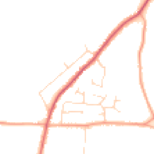
Daytime· 07:00 – 23:00
45.3dB

Night-time· 23:00 – 07:00
37.6dB