Jays Cottage, The Heath, Hatfield Heath, Bishop's Stortford, CM22 7EB
About Jays Cottage
Jays Cottage is an end-of-terrace house in Bishop's Stortford (CM22 7EB). It has a recorded floor area of 70 m² (around 753 sq ft), construction records dating it to before 1900 and council tax band D. The latest certificate (July 2020) shows a D (score 65), on the cusp of jumping into the C band. Earlier certificates rated it C (August 2010); the latest reading is one band lower. Between certificates, roof efficiency went from Good to Very Good; while wall efficiency dropped from Very Good to Very Poor and hot-water efficiency dropped from Very Good to Good. The recommended improvements would push it to C (score 80).
Untraded for 15 years, with the last transfer in June 2011. Today's modelled estimate of £376,000 sits 60.7% above the 2011 sale of £234,000. On a £-per-square-foot basis, the last sale (£311/sq ft) was about 23.3% above the typical sold price in the postcode.
Know exactly what you're buying at Jays Cottage
Before you offer, see what the listing won't tell you, the true value, the red flags and the full history.
Already flagged here
Valuation
against the asking price
Risks
planning & flood
Sold prices
similar homes nearby
Trends
the local market
Energy performance
EPC Rating
Property Improvements
Changes detected from historical EPC data
Hot water efficiency decreased
Roof insulation improved
Planning history
Jays Cottage has no planning applications on record.
Notable planning nearby
3applications of note in the surrounding area
We flagged 1 thing worth checking at Jays Cottage
Independent checks surfaced things a buyer would want to understand before offering. The report explains each one in full, with the underlying data and what to ask.
- Larger development activity nearby
30-day money-back guarantee
Sales history & valuation
Jays Cottage valuation sits well clear of the typical sold price in this postcode.
£376,000
Modelled from EPC, postcode comparables.
£234,000
Recorded with HM Land Registry.
Sales timeline
2 June 2011Most recent
£234,000
Median price across the last 5 sales in CM22 7EB: £287,000 (2022–2016).
Nearby sales in CM22 7EB
The Chestnuts, The Heath, Hatfield Heath, Bishop's Stortford, CM22 7EB
Sold Nov 2022
£500,000Primley, The Heath, Hatfield Heath, Bishop's Stortford, CM22 7EB
Sold Aug 2019
£287,000Stonedash, The Heath, Hatfield Heath, Bishop's Stortford, CM22 7EB
Sold Jul 2018
£553,000Highview, Flat 1, The Heath, Hatfield Heath, Bishop's Stortford, CM22 7EB
Sold Nov 2016
£232,000Highview, Flat 2, The Heath, Hatfield Heath, Bishop's Stortford, CM22 7EB
Sold Mar 2016
£199,995
Everything we know about Jays Cottage, in one report
What it's really worth, what could be wrong, and the planning, sales and area data in full.
What we flagged
- Larger development activity nearby

Similar properties nearby
1 Bennington Cottages, Crabbs Green, Hatfield Broad Oak
CM22 7JU
1 Barnfield, Hatfield Broad Oak
CM22 7JR
1 Broad Street Green, Hatfield Broad Oak
CM22 7JA
1 Barrington Hall Cottages, Hatfield Broad Oak
CM22 7LA
1 Cannons Lane, Hatfield Broad Oak
CM22 7HX
1 Browns Cottages, The Heath, Hatfield Heath
CM22 7DZ
1 Blackbird Cottages, Stortford Road, Hatfield Heath
CM22 7DU
1 Ardley Crescent, Hatfield Heath
CM22 7AH
The neighbourhood at a glance
Daytime road noise here sits well below conversation level — a quiet pocket of the postcode.
Crime
2/mo
Steady year-on-year across the wider district.
Nearest stop
0.0 km
The White Horse — bus stop.
Closest school
0.2 km
Hatfield Heath Primary School. 3 schools nearby.
Go deeper on the local area
The full report breaks down crime, transport links, schools and air quality in depth.
Road noise across the postcode
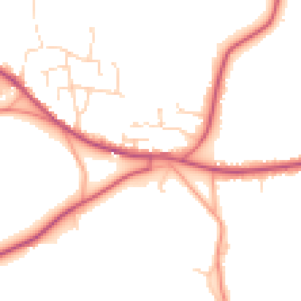
Daytime· 07:00 – 23:00
48.3dB

Night-time· 23:00 – 07:00
40.7dB