19 Water Street, Wirral, CH62 5HB
About 19 Water Street
19 Water Street is a three-bedroom end-of-terrace house in Wirral (CH62 5HB). It has a recorded floor area of 76 m² (around 820 sq ft), construction records dating it to 2007 onwards and council tax band C. It is a listed building, which means external alterations are tightly controlled but it may qualify for heritage tax reliefs. Other recorded features include a basement and a loft. At 76 m² this is the 7th smallest of 13 units on EPC record in the building, where floor areas span 49–116 m². The building's EPC ratings span E to B across 13 units on file. The latest certificate (September 2009) shows a C (score 69), just inside the C band. Main heating runs on electricity. The latest certificate is from September 2009, so improvements made since then won't be reflected.
4 planning records sit against the property, 4 approved, 0 refused. Past consents include new windows, meaningful when judging how the property has evolved. Across 2006–2020, sale prices on this property compounded at 2.7% per year. On a £-per-square-foot basis, the last sale (£305/sq ft) was about 97.4% above the typical sold price in the postcode. Last sale on file: £249,995 in September 2020.
Know exactly what you're buying at 19 Water Street
Before you offer, see what the listing won't tell you, the true value, the red flags and the full history.
Launch offer · save £5
Valuation
against the asking price
Risks
planning & flood
Sold prices
similar homes nearby
Trends
the local market
What this property has
Inside
- Bedrooms3
- Bathrooms1
- Open-plan layoutYes
- Dining roomYes
- Utility roomYes
- LoftYes
- BasementYes
Outside
- Private gardenYes
Building
- Listed buildingYes
Energy performance
19 Water Street's EPC is over a decade old — improvements since won't be reflected.
EPC Expired
This certificate is over 10 years old and is no longer valid.Expired 30 Sept 2019
EPC Rating
Planning history
19 Water Street has been through 4 approved planning applications — a well-evolved property.
- Mar 2019RenovationHeritageIn report
Retrospective Permission Ground floor opening kitchen and dining room. Ground floor opening dining room and living room
Retrospective- Documents
- 9 docs on file
- Reference
- LBC/19/00154
- Jun 2011RenovationHeritageIn report
Installation of 1 No. rooflight
- Agent
- S M Design Services Ltd
- Documents
- 5 docs on file
- Reference
- LBC/11/00220
What's in 19 Water Street, Wirral, CH62 5HB's planning history?
2 more on this property, plus refusals, disputes and full decisions nearby, in the report.
Sales history & valuation
The latest sale landed in the post-pandemic price surge — useful context when reading the figure.
£260,000
Modelled from EPC, postcode comparables and a sale-price growth of 2.7% per year over 14 years.
£249,995
Growth on file: 2.7% per year over 14 years.
Sales timeline
24 September 2020Most recent
£249,995
+47.1%over 14 years6 July 2006
£170,000
Median price across the last 5 sales in CH62 5HB: £220,000 (2025–2012).
Everything we know about 19 Water Street, in one report
What it's really worth, what could be wrong, and the planning, sales and area data in full.
- Am I paying too much?
- Is something wrong with it?
- Is the agent's story true?
- Will it hold its value?

Versus other Water Street homes
Price per m² for 19 Water Street runs comfortably ahead of the street norm.
Price per m²
£3,281
Street avg £2,108
Floor Area
76 m²
Street avg 66 m²
Habitable Rooms
3 rooms
Street avg 3 rooms
CO₂ Emissions
2.8 t/year
Street avg 2.3 t/year
Similar properties nearby
The neighbourhood at a glance
Rail-style transport is unusually close for this postcode.
Crime
3/mo
Steady year-on-year across the wider district.
Nearest stop
0.1 km
Shore Drive — bus stop.
Closest school
0.3 km
Church Drive Primary School. 20 schools nearby.
Go deeper on the local area
The full report breaks down crime, transport links, schools and air quality in depth.
Road noise across the postcode
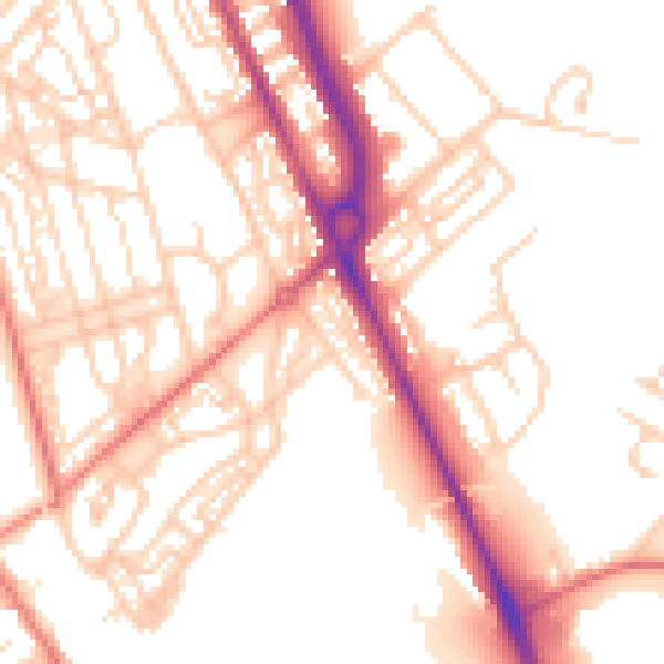
Daytime· 07:00 – 23:00
53.5dB

Night-time· 23:00 – 07:00
43.0dB