58 Barnsdale Avenue, Wirral, CH61 1BQ
About 58 Barnsdale Avenue
58 Barnsdale Avenue is a semi-detached house in Wirral (CH61 1BQ). It has a recorded floor area of 84 m² (around 904 sq ft), construction records dating it to 1930-1949 and council tax band C. The latest certificate (November 2019) shows an E (score 54), well below the UK norm with real room to improve. The recommended improvements would lift it to B (score 83), a 3-band jump.
One planning record on file: an extension approved in 2020. Past consents include an extension and partial demolition, meaningful when judging how the property has evolved. It lags the bulk of the postcode on energy efficiency (less efficient than 83% of similar EPCs). Across 2020–2021, sale prices on this property compounded at 78.4% per year. On a £-per-square-foot basis, the last sale (£525/sq ft) was about 182.7% above the typical sold price in the postcode. Last sale on file: £475,000 in November 2021. That sale was during the post-pandemic price surge, when transactions cleared materially above pre-2020 trend.
Everything you need to know about 58 Barnsdale Avenue
The true value, the hidden risks and the full sale history, in one report.
30-day money-back guarantee

The data behind every report


Energy performance
Recommended upgrades on file would lift this property by multiple EPC bands.
EPC Rating
Planning history
Planning history includes recorded demolition works, indicating a major rebuild phase at this address.
- May 2020DemolitionFullIn report
Extension: Part single, part two storey · Side and rear of property
Erection of two-storey side and single-storey rear extensions following demolition of existing single storey rear extension.
- Agent
- BDM Ltd.
Extension- Documents
- 6 docs on file
- Reference
- APP/20/00422
What's in 58 Barnsdale Avenue, Wirral, CH61 1BQ's planning history?
Refusals, disputes and full decisions on this property and nearby, in the report.
Sales history & valuation
Latest sale on 58 Barnsdale Avenue was the highest on Land Registry record across the postcode.
£485,000
Modelled from EPC, postcode comparables and a sale-price growth of 78.4% per year over 2 years.
£475,000
Growth on file: 78.4% per year over 2 years.
Sales timeline
5 November 2021Most recent
£475,000
+171.4%over 1 year14 February 2020
£175,000
Median price across the last 5 sales in CH61 1BQ: £265,000 (2025–2022).
Nearby sales in CH61 1BQ
Versus other Barnsdale Avenue homes
58 Barnsdale Avenue outperforms the street on price per m² by a wide margin.
Price per m²
£5,655
Street avg £2,634
Floor Area
84 m²
Street avg 95 m²
Habitable Rooms
5 rooms
Street avg 5 rooms
CO₂ Emissions
4.7 t/year
Street avg 4.1 t/year
Everything you need to know about 58 Barnsdale Avenue
The true value, the hidden risks and the full sale history, in one report.
30-day money-back guarantee
The data behind every report
Similar properties nearby
10 Holmwood Avenue
CH61 1AX
1 Holmwood Avenue
CH61 1AX
10 Holmwood Drive, Heswall
CH61 1AU
1 Lower Thingwall Lane
CH61 1AZ
10 Woodlands Drive
CH61 1AL
1 Woodlands Drive
CH61 1AP
1 The Leas
CH61 1BA
1 Barnsdale Avenue
CH61 1BD
The neighbourhood at a glance
Crime
2/mo
Steady year-on-year across the wider district.
Nearest stop
0.3 km
Sparks Lane — bus stop.
Closest school
0.5 km
Thingwall Primary School. 13 schools nearby.
Go deeper on the local area
The full report breaks down crime, transport links, schools and air quality in depth.
Road noise across the postcode
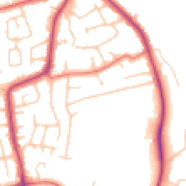
Daytime· 07:00 – 23:00
50.7dB

Night-time· 23:00 – 07:00
41.3dB