Spring House, Flat 3, 551 Filton Avenue, Horfield, Bristol, BS7 0QH
About Spring House
Spring House is a two-bedroom end-of-terrace house in Horfield, Bristol, Bristol (BS7 0QH). It has a recorded floor area of 61 m² (around 657 sq ft), construction records dating it to 1950-1966 and council tax band B. Tenure is freehold. At 61 m² this is the 3rd smallest of 5 units on EPC record in Spring House, where floor areas span 31–107 m². The latest certificate (July 2021) shows a C (score 70).
It hasn't traded since December 2007, a hold of 19 years that's notably long for the area. That sale landed at the peak of the pre-credit-crunch market, which is a useful reference point when interpreting the price. Across 2004–2007, sale prices on this property compounded at 8.4% per year. Today's modelled estimate of £223,000 sits 51.2% above the 2007 sale of £147,500. On a £-per-square-foot basis, the last sale (£225/sq ft) was about 71.1% above the typical sold price in the postcode. At 61 m² it sits well below the postcode median (88 m² across 26 EPCs), making it one of the more compact homes locally. 2 planning records sit against the property, 2 approved, 0 refused. Past consents include change of use to residential and an extension, meaningful when judging how the property has evolved.
What this property has
Inside
- Bedrooms2
- EnsuiteYes
Outside
- GarageYes
Building
- TenureFreehold
- Heating systemGas
- RefurbishedYes
Everything you need to know about Spring House
The true value, the hidden risks and the full sale history, in one report.
Pick your report · from £14.99
One time fee only - money back guarantee

The data behind every report





Energy performance
EPC Rating
Certificate validity
Valid until 25 July 2031

Get a survey for this property
Level 2 HomeBuyer Report
We've checked 10 risk factors against the available data for this property and believe a Level 2 HomeBuyer Report could be a suitable option for you.
From £545 · Includes VAT
Planning history
2 applications on record at Spring House, Flat 3, 551 Filton Avenue, Horfield, Bristol, BS7 0QH
- Oct 2002ExtensionFullOutcome in report
Extension: Two storey · Side and rear of property
Erection of two storey side and rear extension to facilitate extension to existing residential unit and two additional units; retention of shop.
- Documents
- 7 docs on file
- Reference
- PT02/2472/F
- More recent applications — locked
- Change of UseOct 2003Decision
Unlock Spring House, Flat 3, 551 Filton Avenue, Horfield, Bristol, BS7 0QH's full planning history
You're seeing the shape of it. The report has the substance.
- Every decision — granted, refused or withdrawn (2 on record)
- All 2 applications on this property in full, plus 159 notable nearby
- The 21 documents, officer reports & conditions
- What the pattern means for extending or converting here
One time fee only - money back guarantee
Sales history & valuation
The latest sale landed at the peak of the pre-credit-crunch market — a high-water reference point.
£223,000
Modelled from EPC, postcode comparables and a sale-price growth of 8.4% per year over 3 years.
£147,500
Growth on file: 8.4% per year over 3 years.
Sales timeline
19 December 2007Most recent
£147,500
+27.4%over 3 years16 December 2004
£115,750
Median price across the last 5 sales in BS7 0QH: £255,000 (2026–2019).
Nearby sales in BS7 0QH
581 Filton Avenue, Horfield, Bristol, BS7 0QH
Sold Feb 2026
£255,000607 Filton Avenue, Horfield, Bristol, BS7 0QH
Sold Sept 2025
£190,000583 Filton Avenue, Horfield, Bristol, BS7 0QH
Sold Feb 2021
£293,000609 Filton Avenue, Horfield, Bristol, BS7 0QH
Sold Feb 2020
£795577 Filton Avenue, Horfield, Bristol, BS7 0QH
Sold Nov 2019
£260,000
Versus other Filton Avenue homes
Habitable Rooms for Spring House runs comfortably ahead of the street norm.
EPC Rating
70 (C)
Street avg 65 (D)
Floor Area
61 m²
Street avg 46 m²
CO₂ Emissions
2.2 t/year
Street avg 1.8 t/year
Habitable Rooms
4 rooms
Street avg 2 rooms
Everything you need to know about Spring House
The true value, the hidden risks and the full sale history, in one report.
Pick your report · from £14.99
One time fee only - money back guarantee
The data behind every report
Similar properties nearby
Ash Lea Court, Flat 21, Lyddington Road
BS7 0FD
Ash Lea Court, Flat 24, Lyddington Road
BS7 0FD
74a, Flat 3, Toronto Road
BS7 0JT
557a, First Floor Flat, Filton Avenue, Horfield
BS7 0QH
74a, Flat 1, Toronto Road
BS7 0JT
2a, Flat, Filton Road, Horfield
BS7 0PA
Ash Lea Court, Flat 26, Lyddington Road
BS7 0FD
85a, Flat A, Beverley Road
BS7 0JW
The neighbourhood at a glance
Rail-style transport is unusually close for this postcode.
Crime
297/mo
Steady year-on-year across the wider district.
Nearest stop
0.1 km
The Bulldog — bus stop.
Closest school
0.3 km
Shield Road Primary School. 21 schools nearby.
Go deeper on the local area
A Local Area report breaks down crime, transport links, schools and air quality in depth.
Road noise across the postcode
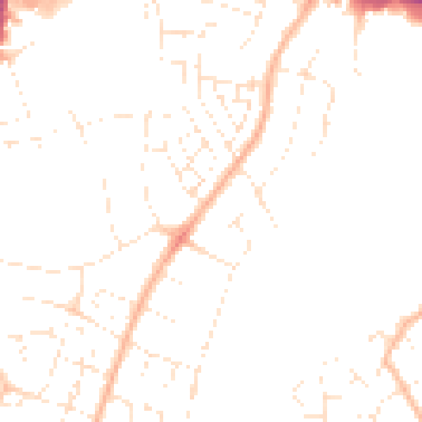
Daytime· 07:00 – 23:00
46.6dB

Night-time· 23:00 – 07:00
36.9dB