575 Filton Avenue, Horfield, Bristol, BS7 0QH
About 575 Filton Avenue
575 Filton Avenue is a four-bedroom end-of-terrace house in Horfield, Bristol, Bristol (BS7 0QH). It has a recorded floor area of 94 m² (around 1012 sq ft), construction records dating it to 1930-1949 and council tax band B. The latest certificate (December 2025) shows a D (score 64), on the cusp of jumping into the C band. The recommended improvements would push it to C (score 79). This certificate was lodged in the last six months, so the rating reflects current condition.
Held since July 2005 — that's 21 years off the open market, well above the local norm. Across 1999–2005, sale prices on this property compounded at 15.9% per year. Today's modelled estimate of £383,000 sits 121.4% above the 2005 sale of £173,000. On a £-per-square-foot basis, the last sale (£171/sq ft) was about 34.7% above the typical sold price in the postcode. 2 planning records sit against the property, 0 approved, 0 refused.
What this property has
Inside
- Bedrooms4
- Bathrooms1
Everything you need to know about 575 Filton Avenue
The true value, the hidden risks and the full sale history, in one report.
Pick your report · every report is £14.99
One time fee only - money back guarantee

The data behind every report


Energy performance
The EPC has just been inspected, so the rating reflects current condition.
EPC Rating
Get a survey for this property
Level 3 Building Survey
Because the property has solid (non-cavity) walls, we believe a Level 3 building survey should be considered.
From £955 · Includes VAT
Planning history
Council records show a subdivision application — the property's legal arrangement has been altered.
2 applications on record at 575 Filton Avenue, Horfield, Bristol, BS7 0QH
- Jul 2015SubdivisionFullOutcome in report
Extension: Two storey · Side of property
Demolition of existing attached garage. Erection of two storey side extension to facilitate the subdivision of existing dwelling into 4no. self-contained flats with associated works.
Extension- Documents
- 33 docs on file
- Reference
- PT15/2070/F
- More recent applications — locked
- SubdivisionOct 2016Decision
Unlock 575 Filton Avenue, Horfield, Bristol, BS7 0QH's full planning history
You're seeing the shape of it. The report has the substance.
- Every decision — granted, refused or withdrawn (2 on record)
- All 2 applications on this property in full, plus 162 notable nearby
- The 57 documents, officer reports & conditions
- What the pattern means for extending or converting here
One time fee only - money back guarantee
Sales history & valuation
575 Filton Avenue has more than doubled in price since the earliest registered sale in 1999.
£383,000
Modelled from EPC, postcode comparables and a sale-price growth of 15.9% per year over 6 years.
£173,000
Growth on file: 15.9% per year over 6 years.
Sales timeline
12 July 2005Most recent
£173,000
+140.3%over 5 years5 August 1999
£72,000
Median price across the last 5 sales in BS7 0QH: £205,000 (2022–2015).
Nearby sales in BS7 0QH
557b, Filton Avenue, Horfield, Bristol, BS7 0QH
Sold Jun 2022
£190,000583 Filton Avenue, Horfield, Bristol, BS7 0QH
Sold Feb 2021
£293,000609 Filton Avenue, Horfield, Bristol, BS7 0QH
Sold Feb 2020
£795577 Filton Avenue, Horfield, Bristol, BS7 0QH
Sold Nov 2019
£260,000601 Filton Avenue, Horfield, Bristol, BS7 0QH
Sold May 2015
£226,000
Versus other Filton Avenue homes
575 Filton Avenue outperforms the street on years held by a wide margin.
Price per m²
£1,840
Street avg £2,134
Floor Area
94 m²
Street avg 99 m²
Habitable Rooms
5 rooms
Street avg 5 rooms
CO₂ Emissions
3.8 t/year
Street avg 4.1 t/year
Everything you need to know about 575 Filton Avenue
The true value, the hidden risks and the full sale history, in one report.
Pick your report · every report is £14.99
One time fee only - money back guarantee
The data behind every report
Similar properties nearby
1 Dorchester Road
BS7 0LA
1 Beechcroft Walk
BS7 0NH
1 Cropthorne Road South
BS7 0PS
1 Blakeney Road
BS7 0DL
1 Conrad Court, Shakespeare Avenue
BS7 0PN
1 Buxton Walk
BS7 0LG
1 Bayswater Road
BS7 0BN
1 Bythesea Avenue
BS7 0FN
The neighbourhood at a glance
Rail-style transport is unusually close for this postcode.
Crime
6/mo
Rising year-on-year across the wider district.
Nearest stop
0.1 km
The Bulldog — bus stop.
Closest school
0.3 km
Shield Road Primary School. 21 schools nearby.
Go deeper on the local area
A Local Area report breaks down crime, transport links, schools and air quality in depth.
Road noise across the postcode
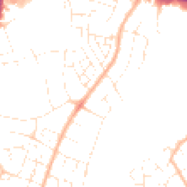
Daytime· 07:00 – 23:00
46.6dB

Night-time· 23:00 – 07:00
36.9dB