30 Filton Avenue, Horfield, Bristol, BS7 0AG
About 30 Filton Avenue
30 Filton Avenue is a four-bedroom mid-terrace house in Horfield, Bristol, Bristol (BS7 0AG). It has a recorded floor area of 129 m² (around 1389 sq ft), construction records dating it to 1900-1929 and council tax band C. The latest certificate (February 2015) shows an E (score 53), well below the UK norm with real room to improve. The rating has held steady at E across 3 certificates since April 2009. Between certificates, wall efficiency went from Very Poor to Poor and lighting went from Average to Good. The recommended improvements would lift it to C (score 78), a 2-band jump. The latest certificate is from February 2015, so improvements made since then won't be reflected. Period features are noted in the property record.
Across 1999–2012, sale prices on this property compounded at 6.7% per year. Today's modelled estimate of £495,000 sits 73.7% above the 2012 sale of £284,950. On a £-per-square-foot basis, the last sale (£205/sq ft) was about 79% above the typical sold price in the postcode. It lags the bulk of the postcode on energy efficiency (less efficient than 75% of similar EPCs). Last changed hands 14 years ago, in June 2012.
What this property has
Inside
- Bedrooms4
- Open-plan layoutYes
- Dining roomYes
Building
- Heating systemGas
- Period featuresYes
- RefurbishedYes
Everything you need to know about 30 Filton Avenue
The true value, the hidden risks and the full sale history, in one report.
Pick your report · every report is £14.99
One time fee only - money back guarantee

The data behind every report


Energy performance
30 Filton Avenue's carbon output runs well above what efficient homes in the postcode produce.
EPC Expired
This certificate is over 10 years old and is no longer valid.Expired 13 Feb 2025
EPC Rating
Property Improvements
Changes detected from historical EPC data
Windows upgraded, improving insulation
Low energy lighting percentage decreased
Windows upgraded, improving insulation
Wall insulation improved
Roof insulation improved
More low energy lighting installed
Get a survey for this property
Level 3 Building Survey
Because the property was built before 1919, has been extended more than once, and has solid (non-cavity) walls, we believe a Level 3 building survey should be considered.
From £1,020 · Includes VAT
Planning history
30 Filton Avenue has no planning applications on record.
But the area is active
162 notable applications nearby — larger schemes and conversions that could reshape the street. The report maps them all.
Sales history & valuation
Sale price has at least doubled since 1999.
£495,000
Modelled from EPC, postcode comparables and a sale-price growth of 6.7% per year over 13 years.
£284,950
Growth on file: 6.7% per year over 13 years.
Sales timeline
21 June 2012Most recent
£284,950
+7.5%over 2 years10 September 2009
£265,000
+110.3%over 9 years19 October 1999
£126,000
Median price across the last 5 sales in BS7 0AG: £440,000 (2025–2017).
Nearby sales in BS7 0AG
52 Filton Avenue, Horfield, Bristol, BS7 0AG
Sold Aug 2025
£490,00016 Filton Avenue, Horfield, Bristol, BS7 0AG
Sold Jan 2023
£582,50054 Filton Avenue, Horfield, Bristol, BS7 0AG
Sold Oct 2022
£249,00020 Filton Avenue, Horfield, Bristol, BS7 0AG
Sold Jan 2019
£440,00032 Filton Avenue, Horfield, Bristol, BS7 0AG
Sold Apr 2017
£400,000
Versus other Filton Avenue homes
On floor area, 30 Filton Avenue runs well behind the street norm.
Price per m²
£2,209
Street avg £1,816
Floor Area
129 m²
Street avg 151 m²
Habitable Rooms
7 rooms
Street avg 7 rooms
CO₂ Emissions
6.8 t/year
Street avg 6.2 t/year
Everything you need to know about 30 Filton Avenue
The true value, the hidden risks and the full sale history, in one report.
Pick your report · every report is £14.99
One time fee only - money back guarantee
The data behind every report
Similar properties nearby
1 Dorchester Road
BS7 0LA
1 Bayswater Road
BS7 0BN
1 Beechcroft Walk
BS7 0NH
1 Cropthorne Road South
BS7 0PS
1 Blakeney Road
BS7 0DL
1 Conrad Court, Shakespeare Avenue
BS7 0PN
1 Buxton Walk
BS7 0LG
1 Bythesea Avenue
BS7 0FN
The neighbourhood at a glance
Reported crime in the wider district is trending notably upward year-on-year.
Crime
6/mo
Rising year-on-year across the wider district.
Nearest stop
0.1 km
Memorial Stadium — bus stop.
Closest school
0.5 km
Ashley Down Primary School. 39 schools nearby.
Go deeper on the local area
A Local Area report breaks down crime, transport links, schools and air quality in depth.
Road noise across the postcode
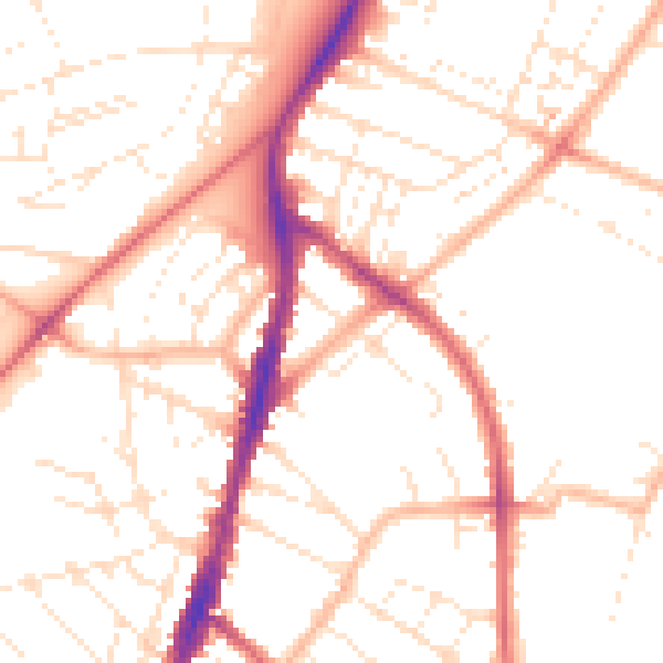
Daytime· 07:00 – 23:00
50.9dB

Night-time· 23:00 – 07:00
40.6dB