2 Smithcourt Drive, Little Stoke, Bristol, BS34 8LZ
About 2 Smithcourt Drive
2 Smithcourt Drive is a property in Little Stoke, Bristol, Bristol (BS34 8LZ). It has council tax band C.
It hasn't traded since November 2001, a hold of 25 years that's notably long for the area. One planning record on file: an extension approved in 2011. Past consents include an extension, meaningful when judging how the property has evolved. Across 1996–2001, sale prices on this property compounded at 14.6% per year.
Everything you need to know about 2 Smithcourt Drive
The true value, the hidden risks and the full sale history, in one report.
Pick your report · every report is £14.99
One time fee only - money back guarantee

The data behind every report


Energy performance
No EPC on record
This property doesn't have an Energy Performance Certificate yet. An EPC is required to sell or let — and unlocks our automated valuation.
Get a survey for this property
Level 2 HomeBuyer Report
We've checked 10 risk factors against the available data for this property and believe a Level 2 HomeBuyer Report could be a suitable option for you.
Planning history
Council records include a two-storey side extension at 2 Smithcourt Drive.
1 application on record at 2 Smithcourt Drive, Little Stoke, Bristol, BS34 8LZ
- Dec 2011ExtensionFullOutcome in report
Extension: Two storey · Side of property
Erection of two storey side extension to form additional living accommodation.
- Documents
- 9 docs on file
- Reference
- PT11/3385/F
Unlock 2 Smithcourt Drive, Little Stoke, Bristol, BS34 8LZ's full planning history
You're seeing the shape of it. The report has the substance.
- Every decision — granted, refused or withdrawn (1 on record)
- All 1 application on this property in full, plus 9 notable nearby
- The 9 documents, officer reports & conditions
- What the pattern means for extending or converting here
One time fee only - money back guarantee
Sales history & valuation
2 Smithcourt Drive has more than doubled in price since the earliest registered sale in 1996.
£118,950
Growth on file: 14.6% per year over 5 years.
Sales timeline
2 November 2001Most recent
£118,950
+109.6%over 5 years28 May 1996
£56,750
Median price across the last 5 sales in BS34 8LZ: £405,000 (2022–2013).
Nearby sales in BS34 8LZ
15 Smithcourt Drive, Little Stoke, Bristol, BS34 8LZ
Sold Oct 2022
£425,00011 Smithcourt Drive, Little Stoke, Bristol, BS34 8LZ
Sold Sept 2021
£405,0005 Smithcourt Drive, Little Stoke, Bristol, BS34 8LZ
Sold Sept 2020
£410,0004 Smithcourt Drive, Little Stoke, Bristol, BS34 8LZ
Sold Dec 2017
£292,5009 Smithcourt Drive, Little Stoke, Bristol, BS34 8LZ
Sold Dec 2013
£190,000
Everything you need to know about 2 Smithcourt Drive
The true value, the hidden risks and the full sale history, in one report.
Pick your report · every report is £14.99
One time fee only - money back guarantee
The data behind every report
Similar properties nearby
1 Constantine Avenue, Stoke Gifford
BS34 8UG
1 Buckingham Drive, Stoke Gifford
BS34 8NS
1 Albany Gate, Stoke Gifford
BS34 8UJ
1 Charbon Gate, Stoke Gifford
BS34 8XF
1 Chevening Close, Stoke Gifford
BS34 8NJ
1 Bush Avenue, Little Stoke
BS34 8LY
1 Balmoral Close, Stoke Gifford
BS34 8NL
1 Cerimon Gate, Stoke Gifford
BS34 8UN
The neighbourhood at a glance
Rail-style transport is unusually close for this postcode.
Crime
6/mo
Steady year-on-year across the wider district.
Nearest stop
0.2 km
Kingsway Roundabout — bus stop.
Closest school
0.5 km
Little Stoke Primary School. 24 schools nearby.
Go deeper on the local area
A Local Area report breaks down crime, transport links, schools and air quality in depth.
Road noise across the postcode
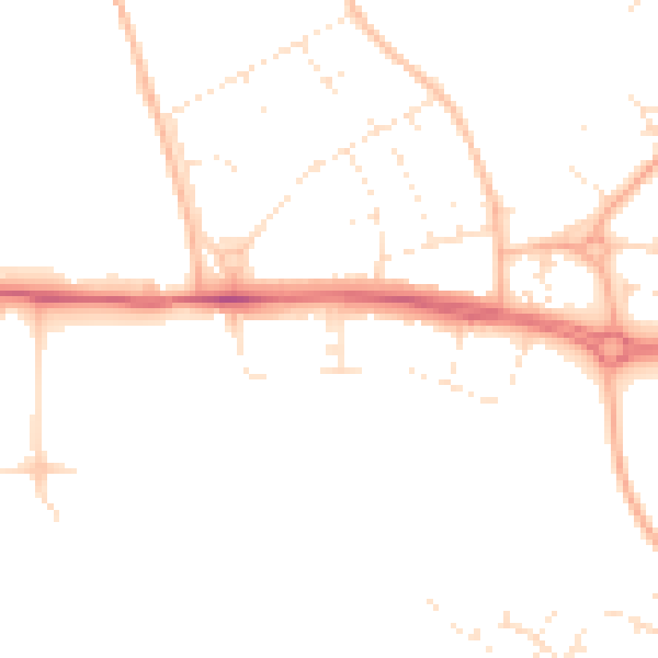
Daytime· 07:00 – 23:00
47.4dB

Night-time· 23:00 – 07:00
38.4dB