23 Mortimer Road, Filton, Bristol, BS34 7LE
About 23 Mortimer Road
23 Mortimer Road is a two-bedroom mid-terrace house in Filton, Bristol, Bristol (BS34 7LE). It has a recorded floor area of 71 m² (around 767 sq ft), construction records dating it to 1930-1949 and council tax band B. The latest certificate (July 2011) shows a D (score 57), a step below the typical UK home. The latest certificate is from July 2011, so improvements made since then won't be reflected.
Sold January 2019 for £238,000. Across the public record there are 4 sales, relatively high churn for a single property. Across 2000–2019, sale prices on this property compounded at 6.6% per year. Today's modelled estimate of £299,000 is 25.6% above the 2019 sale price. On a £-per-square-foot basis, the last sale (£310/sq ft) was about 73.9% above the typical sold price in the postcode. At 71 m² it's 16.1% smaller than the typical home in the postcode (85 m² median across 13 EPCs).
What this property has
Inside
- Bedrooms2
- Bathrooms1
- Dining roomYes
Outside
- Private gardenRear
- GarageDouble
Everything you need to know about 23 Mortimer Road
The true value, the hidden risks and the full sale history, in one report.
Pick your report · every report is £14.99
One time fee only - money back guarantee

The data behind every report


Energy performance
23 Mortimer Road's EPC is over a decade old — improvements since won't be reflected.
EPC Expired
This certificate is over 10 years old and is no longer valid.Expired 20 Jul 2021
EPC Rating
Get a survey for this property
Level 3 Building Survey
Because the property has solid (non-cavity) walls, we believe a Level 3 building survey should be considered.
From £885 · Includes VAT
Planning history
23 Mortimer Road has no planning applications on record.
But the area is active
130 notable applications nearby — larger schemes and conversions that could reshape the street. The report maps them all.
Sales history & valuation
Sale price has grown by over 3x since 2000.
£299,000
Modelled from EPC, postcode comparables and a sale-price growth of 6.6% per year over 19 years.
£238,000
Growth on file: 6.6% per year over 19 years.
Sales timeline
4 January 2019Most recent
£238,000
+72.5%over 6 years23 March 2012
£138,000
-16.3%over 4 years18 April 2007
£164,950
+129.1%over 7 years17 March 2000
£72,000
Median price across the last 5 sales in BS34 7LE: £311,500 (2025–2020).
Nearby sales in BS34 7LE
9 Mortimer Road, Filton, Bristol, BS34 7LE
Sold Jul 2025
£311,5003 Mortimer Road, Filton, Bristol, BS34 7LE
Sold Jul 2024
£410,00043 Mortimer Road, Filton, Bristol, BS34 7LE
Sold Aug 2023
£315,00031 Mortimer Road, Filton, Bristol, BS34 7LE
Sold May 2022
£285,00019 Mortimer Road, Filton, Bristol, BS34 7LE
Sold Dec 2020
£292,000
Versus other Mortimer Road homes
23 Mortimer Road is notably below the street on epc rating.
Price per m²
£3,338
Street avg £2,750
Floor Area
71 m²
Street avg 86 m²
Habitable Rooms
4 rooms
Street avg 5 rooms
CO₂ Emissions
4.0 t/year
Street avg 3.5 t/year
Everything you need to know about 23 Mortimer Road
The true value, the hidden risks and the full sale history, in one report.
Pick your report · every report is £14.99
One time fee only - money back guarantee
The data behind every report
Similar properties nearby
1 Elm Park, Filton
BS34 7PR
1 Canberra Grove, Filton
BS34 7DH
1 Blenheim Drive, Filton
BS34 7AX
1 Concorde House, Bevan Court, Filton
BS34 7QN
1 Glebelands Road, Filton
BS34 7AD
1 Charlton Avenue
BS34 7QX
1 Meadowsweet Avenue, Filton
BS34 7AN
1 Clyde Grove, Filton
BS34 7RL
The neighbourhood at a glance
Rail-style transport is unusually close for this postcode.
Crime
6/mo
Steady year-on-year across the wider district.
Nearest stop
0.1 km
Wallscourt Road — bus stop.
Closest school
0.4 km
Shield Road Primary School. 20 schools nearby.
Go deeper on the local area
A Local Area report breaks down crime, transport links, schools and air quality in depth.
Road noise across the postcode
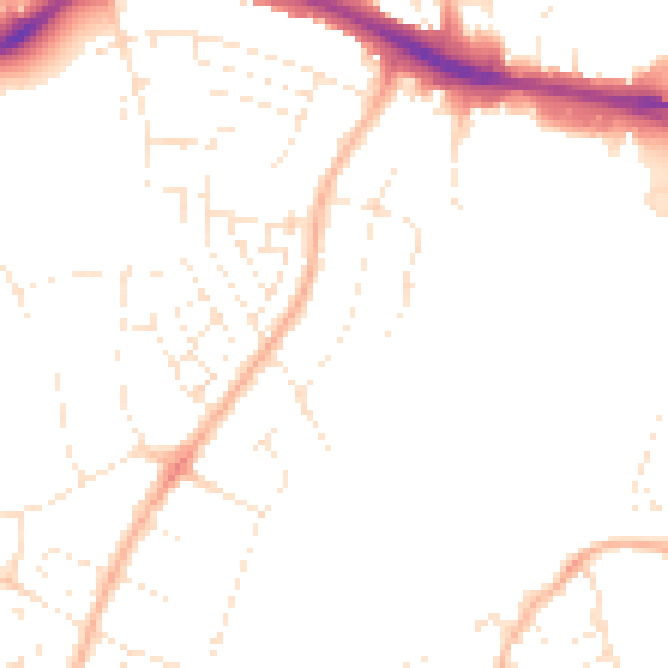
Daytime· 07:00 – 23:00
48.0dB

Night-time· 23:00 – 07:00
38.4dB