18 Ormsley Close, Little Stoke, Bristol, BS34 6EN
About 18 Ormsley Close
18 Ormsley Close is a three-bedroom mid-terrace house in Little Stoke, Bristol, Bristol (BS34 6EN). It has a recorded floor area of 64 m² (around 689 sq ft), construction records dating it to 1950-1966 and council tax band B. The latest certificate (July 2020) shows a C (score 72). When first surveyed in November 2008 the rating was D, the property has climbed 1 band since. Between certificates, lighting went from Very Poor to Good. The recommended improvements would push it to B (score 89).
Held since December 2007 — that's 18 years off the open market, well above the local norm. That sale landed at the peak of the pre-credit-crunch market, which is a useful reference point when interpreting the price. Across 1999–2007, sale prices on this property compounded at 13.7% per year. Today's modelled estimate of £290,000 sits 71.6% above the 2007 sale of £169,000. On a £-per-square-foot basis, the last sale (£245/sq ft) was about 18% below the postcode norm.
What this property has
Inside
- Bedrooms3
- Bathrooms1
Everything you need to know about 18 Ormsley Close
The true value, the hidden risks and the full sale history, in one report.
Pick your report · every report is £14.99
One time fee only - money back guarantee

The data behind every report


Energy performance
EPC Rating
Property Improvements
Changes detected from historical EPC data
More low energy lighting installed
Get a survey for this property
Level 2 HomeBuyer Report
We've checked 10 risk factors against the available data for this property and believe a Level 2 HomeBuyer Report could be a suitable option for you.
From £545 · Includes VAT
Planning history
18 Ormsley Close has no planning applications on record.
But the area is active
5 notable applications nearby — larger schemes and conversions that could reshape the street. The report maps them all.
Sales history & valuation
Sale price has at least doubled since 1999.
£290,000
Modelled from EPC, postcode comparables and a sale-price growth of 13.7% per year over 8 years.
£169,000
Growth on file: 13.7% per year over 8 years.
Sales timeline
14 December 2007Most recent
£169,000
+45.7%over 4 years31 October 2003
£116,000
+96.6%over 4 years29 September 1999
£59,000
Median price across the last 5 sales in BS34 6EN: £287,750 (2025–2021).
Nearby sales in BS34 6EN
21 Ormsley Close, Little Stoke, Bristol, BS34 6EN
Sold Jul 2025
£295,00020 Ormsley Close, Little Stoke, Bristol, BS34 6EN
Sold Mar 2025
£280,00010 Ormsley Close, Little Stoke, Bristol, BS34 6EN
Sold Aug 2024
£287,75036 Ormsley Close, Little Stoke, Bristol, BS34 6EN
Sold Jul 2024
£294,00022 Ormsley Close, Little Stoke, Bristol, BS34 6EN
Sold Sept 2021
£350,000
Versus other Ormsley Close homes
18 Ormsley Close outperforms the street on years held by a wide margin.
Price per m²
£2,641
Street avg £3,359
Floor Area
64 m²
Street avg 70 m²
Habitable Rooms
4 rooms
Street avg 5 rooms
CO₂ Emissions
2.1 t/year
Street avg 3.0 t/year
Everything you need to know about 18 Ormsley Close
The true value, the hidden risks and the full sale history, in one report.
Pick your report · every report is £14.99
One time fee only - money back guarantee
The data behind every report
Similar properties nearby
1 Farley Close, Little Stoke
BS34 6HB
1 Filby Drive, Little Stoke
BS34 6EL
1 Collins Avenue, Little Stoke
BS34 6JZ
1 Brockley Close, Little Stoke
BS34 6EZ
1 Bourton Avenue, Patchway
BS34 6EB
1 Bibury Avenue, Patchway
BS34 6DE
1 Cranham Drive, Patchway
BS34 6AQ
1 Gallivan Close, Little Stoke
BS34 6RW
The neighbourhood at a glance
Rail-style transport is unusually close for this postcode.
Crime
6/mo
Steady year-on-year across the wider district.
Nearest stop
0.1 km
Wroxham Drive — bus stop.
Closest school
0.3 km
Stoke Lodge Primary School. 20 schools nearby.
Go deeper on the local area
A Local Area report breaks down crime, transport links, schools and air quality in depth.
Road noise across the postcode
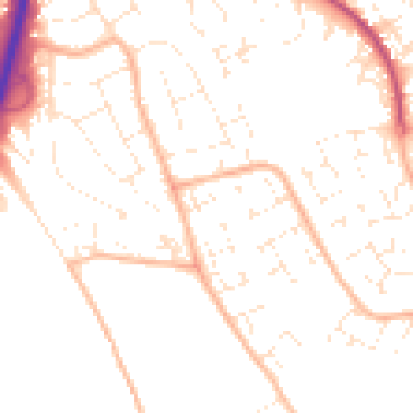
Daytime· 07:00 – 23:00
50.1dB

Night-time· 23:00 – 07:00
39.6dB