226 St Johns Lane, Bristol, BS3 5AU
About 226 St Johns Lane
226 St Johns Lane is a one-bedroom mid-terrace house in Bristol (BS3 5AU). It has a recorded floor area of 63 m² (around 678 sq ft) and construction records dating it to 1900-1929. Tenure is freehold. The latest certificate (February 2015) shows a D (score 58), a step below the typical UK home. Earlier certificates rated it C (June 2013); the latest reading is one band lower. The latest certificate is from February 2015, so improvements made since then won't be reflected.
Held since December 2006 — that's 20 years off the open market, well above the local norm. Across 1995–2006, sale prices on this property compounded at 8.7% per year. Today's modelled estimate of £217,000 sits 73.6% above the 2006 sale of £125,000. 2 planning records sit against the property, 1 approved, 1 refused. Past consents include an extension and subdivision, meaningful when judging how the property has evolved.
What this property has
Inside
- Bedrooms1
- Bathrooms1
Outside
- Private gardenYes
Building
- TenureFreehold
- Heating systemGas
Everything you need to know about 226 St Johns Lane
The true value, the hidden risks and the full sale history, in one report.
Pick your report · from £14.99
One time fee only - money back guarantee

The data behind every report







Energy performance
226 St Johns Lane's EPC is over a decade old — improvements since won't be reflected.
EPC Expired
This certificate is over 10 years old and is no longer valid.Expired 05 Feb 2025
EPC Rating
Certificate validity
Expired on 5 February 2025

Get a survey for this property
Level 3 Building Survey
Because the property was built before 1919 and has solid (non-cavity) walls, we believe a Level 3 building survey should be considered.
From £885 · Includes VAT
Planning history
Council records show a subdivision application — the property's legal arrangement has been altered.
2 applications on record at 226 St Johns Lane, Bristol, BS3 5AU
- Mar 2007Change of UseFullOutcome in report
Change of use of existing ground floor retail unit to a one-bed self-contained flat, including associated alterations to front elevation and conversion of loft space to provide additional bedroom for upper floor maisonette.
- Documents
- 12 docs on file
- Reference
- 06/05323/F
- More recent applications — locked
- SubdivisionOct 2008Decision
Unlock 226 St Johns Lane, Bristol, BS3 5AU's full planning history
You're seeing the shape of it. The report has the substance.
- Every decision — granted, refused or withdrawn (2 on record)
- All 2 applications on this property in full, plus 8 notable nearby
- The 24 documents, officer reports & conditions
- What the pattern means for extending or converting here
One time fee only - money back guarantee
Sales history & valuation
Sale price has at least doubled since 1995.
£217,000
Modelled from EPC, postcode comparables and a sale-price growth of 8.7% per year over 11 years.
£125,000
Growth on file: 8.7% per year over 11 years.
Sales timeline
15 December 2006Most recent
£125,000
+150.0%over 11 years5 December 1995
£50,000
Median price across the last 5 sales in BS3 5AU: £200,000 (2025–2023).
Nearby sales in BS3 5AU
244 St Johns Lane, Bristol, BS3 5AU
Sold Oct 2025
£266,500238a, St Johns Lane, Bristol, BS3 5AU
Sold Sept 2024
£173,999238 St Johns Lane, Bristol, BS3 5AU
Sold Sept 2024
£200,000First Floor Flat, 218 St Johns Lane, Bristol, BS3 5AU
Sold Oct 2023
£191,250256 St Johns Lane, Bristol, BS3 5AU
Sold Oct 2023
£300,000
Versus other St Johns Lane homes
Habitable Rooms for 226 St Johns Lane runs comfortably ahead of the street norm.
Price per m²
£1,984
Street avg £3,304
Floor Area
63 m²
Street avg 50 m²
Habitable Rooms
4 rooms
Street avg 3 rooms
CO₂ Emissions
3.5 t/year
Street avg 2.4 t/year
Everything you need to know about 226 St Johns Lane
The true value, the hidden risks and the full sale history, in one report.
Pick your report · from £14.99
One time fee only - money back guarantee
The data behind every report
Similar properties nearby
1 Lock Mill House, Novers Hill, Bedminster
BS3 5DP
1 Bristol South End
BS3 5BH
1 Dickinsons Fields
BS3 5BG
1 Highbury Road, Bedminster
BS3 5NS
1 Dawlish Road
BS3 5LB
1 Clinton Road
BS3 5PB
1 Avondown Court, Bedminster Road
BS3 5NF
1 Ketch Road
BS3 5DQ
The neighbourhood at a glance
Rail-style transport is unusually close for this postcode.
Crime
310/mo
Steady year-on-year across the wider district.
Nearest stop
0.1 km
Dunford Road — bus stop.
Closest school
0.3 km
Victoria Park Primary School. 41 schools nearby.
Go deeper on the local area
A Local Area report breaks down crime, transport links, schools and air quality in depth.
Road noise across the postcode
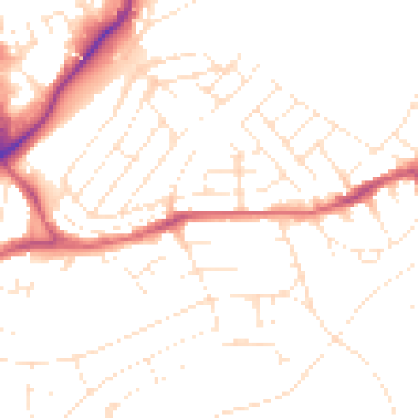
Daytime· 07:00 – 23:00
49.5dB

Night-time· 23:00 – 07:00
39.5dB