151a, West Street, Bedminster, Bristol, BS3 3PN
About 151a
151a is a mid-terrace house in Bedminster, Bristol, Bristol (BS3 3PN). It has a recorded floor area of 60 m² (around 646 sq ft), construction records dating it to before 1900 and council tax band A. At 60 m² this is the 8th smallest of 13 units on EPC record in the building, where floor areas span 29–68 m². The building's EPC ratings span D to B, with this unit at the bottom. The latest certificate (October 2023) shows a D (score 62), on the cusp of jumping into the C band. The rating has held steady at D across 2 certificates since October 2013. Between certificates, roof efficiency dropped from Good to Very Poor.
Across 2017–2018, sale prices on this property compounded at -88.7% per year. Today's modelled estimate of £233,000 sits 23200% above the 2018 sale of £1,000. On a £-per-square-foot basis, the last sale (£2/sq ft) was about 99% below the postcode norm. Last changed hands 8 years ago, in May 2018.
Everything you need to know about 151a
The true value, the hidden risks and the full sale history, in one report.
Pick your report · every report is £14.99
One time fee only - money back guarantee

The data behind every report


Energy performance
EPC Rating
Get a survey for this property
Level 3 Building Survey
Because the property was built before 1919 and has solid (non-cavity) walls, we believe a Level 3 building survey should be considered.
From £885 · Includes VAT
Planning history
151a has no planning applications on record.
But the area is active
9 notable applications nearby — larger schemes and conversions that could reshape the street. The report maps them all.
Sales history & valuation
Latest sale on 151a was the lowest on Land Registry record across the postcode.
£233,000
Modelled from EPC, postcode comparables and a sale-price growth of -88.7% per year over 1 year.
£1,000
Growth on file: -88.7% per year over 1 year.
Sales timeline
15 May 2018Most recent
£1,000
-90.0%over 1 year25 April 2017
£10,000
Median price across the last 5 sales in BS3 3PN: £99,995 (2018–2001).
Nearby sales in BS3 3PN
151 West Street, Bedminster, Bristol, BS3 3PN
Sold Apr 2018
£130,000153b, West Street, Bedminster, Bristol, BS3 3PN
Sold Feb 2018
£150,000153 West Street, Bedminster, Bristol, BS3 3PN
Sold Jun 2006
£99,995155 West Street, Bedminster, Bristol, BS3 3PN
Sold Apr 2001
£36,000147 West Street, Bedminster, Bristol, BS3 3PN
Sold Jan 2001
£45,000
Versus other West Street homes
On price per m², 151a runs well behind the street norm.
Price per m²
£17
Street avg £2,053
Floor Area
60 m²
Street avg 55 m²
Habitable Rooms
3 rooms
Street avg 3 rooms
CO₂ Emissions
3.0 t/year
Street avg 2.2 t/year
Everything you need to know about 151a
The true value, the hidden risks and the full sale history, in one report.
Pick your report · every report is £14.99
One time fee only - money back guarantee
The data behind every report
Similar properties nearby
1 Chessel Mews, West Street, Bedminster
BS3 3LT
1 Cripps Road
BS3 3LE
1 Chapel Barton, West Street, Bedminster
BS3 3PQ
1 Aubrey Road
BS3 3EY
1 Ashgrove Road, Bedminster
BS3 3JP
1 Brighton Terrace, Bedminster
BS3 3PS
1 Dunstan Mews
BS3 3AS
1 Chessel Heights, West Street, Bedminster
BS3 3NB
The neighbourhood at a glance
Rail-style transport is unusually close for this postcode.
Crime
4/mo
Rising year-on-year across the wider district.
Nearest stop
0.0 km
Chessel Street — bus stop.
Closest school
0.2 km
Compass Point Primary School. 33 schools nearby.
Go deeper on the local area
A Local Area report breaks down crime, transport links, schools and air quality in depth.
Road noise across the postcode
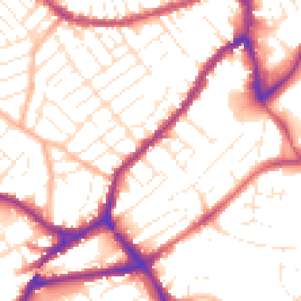
Daytime· 07:00 – 23:00
53.9dB

Night-time· 23:00 – 07:00
44.2dB