12 Benfield Close, Portslade, Brighton, BN41 2DD
About 12 Benfield Close
12 Benfield Close is a semi-detached house in Portslade, Brighton, Brighton (BN41 2DD). It has a recorded floor area of 117 m² (around 1259 sq ft), construction records dating it to 1967-1975 and council tax band D. The latest certificate (November 2018) shows a D (score 65), on the cusp of jumping into the C band. When first surveyed in March 2009 the rating was F, the property has climbed 2 bands since. Between certificates, wall efficiency went from Poor to Average, roof efficiency went from Very Poor to Average and window efficiency went from Average to Good. The recommended improvements would lift it to B (score 85), a 2-band jump.
It hasn't traded since July 2003, a hold of 23 years that's notably long for the area. At 117 m² the property is well over the postcode median (86 m² across 6 EPCs), placing it in the larger end of the local stock. Across 2003–2003, sale prices on this property compounded at 32.3% per year. Today's modelled estimate of £440,000 sits 104.7% above the 2003 sale of £215,000. On a £-per-square-foot basis, the last sale (£171/sq ft) was about 36.2% below the postcode norm.
Know exactly what you're buying at 12 Benfield Close
Before you offer, see what the listing won't tell you, the true value, the red flags and the full history.
Already flagged here
Valuation
against the asking price
Risks
planning & flood
Sold prices
similar homes nearby
Trends
the local market
Energy performance
Recommended upgrades on file would lift this property by multiple EPC bands.
EPC Rating
Property Improvements
Changes detected from historical EPC data
Heating controls upgraded for better temperature management
Window efficiency improved
Cavity wall insulation installed
Loft insulation installed or upgraded to 250mm+
More low energy lighting installed
Planning history
12 Benfield Close has no planning applications on record.
Notable planning nearby
2applications of note in the surrounding area
We flagged 2 things worth checking at 12 Benfield Close
Independent checks surfaced things a buyer would want to understand before offering. The report explains each one in full, with the underlying data and what to ask.
- Larger development activity nearby
- Recent ownership pattern worth a look
30-day money-back guarantee
Sales history & valuation
12 Benfield Close changed hands twice within eighteen months — unusual for the area.
£440,000
Modelled from EPC, postcode comparables and a sale-price growth of 32.3% per year over 1 year.
£215,000
Growth on file: 32.3% per year over 1 year.
Sales timeline
24 July 2003Most recent
£215,000
+32.3%28 May 2003
£162,500
Median price across the last 5 sales in BN41 2DD: £360,000 (2020–2012).
Nearby sales in BN41 2DD
2 Benfield Close, Portslade, Brighton, BN41 2DD
Sold Oct 2020
£465,0001 Benfield Close, Portslade, Brighton, BN41 2DD
Sold May 2018
£360,0003 Benfield Close, Portslade, Brighton, BN41 2DD
Sold May 2017
£365,43610 Benfield Close, Portslade, Brighton, BN41 2DD
Sold Aug 2013
£250,0005 Benfield Close, Portslade, Brighton, BN41 2DD
Sold Aug 2012
£340,000
Everything we know about 12 Benfield Close, in one report
What it's really worth, what could be wrong, and the planning, sales and area data in full.
What we flagged
- Larger development activity nearby
- Recent ownership pattern worth a look

Versus other Benfield Close homes
Price per m² for 12 Benfield Close lags the street by a wide margin.
Price per m²
£1,838
Street avg £3,557
Floor Area
117 m²
Street avg 94 m²
Habitable Rooms
6 rooms
Street avg 4 rooms
CO₂ Emissions
4.6 t/year
Street avg 3.6 t/year
Similar properties nearby
1 Beech Close, Portslade
BN41 2WR
1 Easthill Drive, Portslade
BN41 2FD
1 Brackenbury Close, Portslade
BN41 2ES
1 Anvil Close, Portslade
BN41 2HT
1 Benfield Close, Portslade
BN41 2DD
1 Burlington Gardens, Portslade
BN41 2DS
1 Deacons Drive, Portslade
BN41 2FJ
1 Bush Cottage Close, Portslade
BN41 2GU
The neighbourhood at a glance
Rail-style transport is unusually close for this postcode.
Crime
4/mo
Steady year-on-year across the wider district.
Nearest stop
0.1 km
Highlands Road — bus stop.
Closest school
0.2 km
Benfield Primary School. 22 schools nearby.
Go deeper on the local area
The full report breaks down crime, transport links, schools and air quality in depth.
Road noise across the postcode
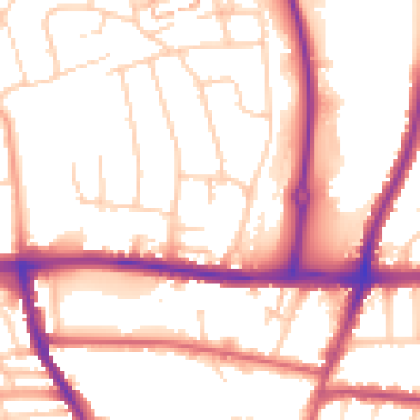
Daytime· 07:00 – 23:00
54.1dB

Night-time· 23:00 – 07:00
45.0dB