2 Benfield Close, Portslade, Brighton, BN41 2DD
About 2 Benfield Close
2 Benfield Close is a three-bedroom semi-detached house in Portslade, Brighton, Brighton (BN41 2DD). It has a recorded floor area of 127 m² (around 1367 sq ft), construction records dating it to 1930-1949 and council tax band C. The latest certificate (July 2020) shows a D (score 62), on the cusp of jumping into the C band. The recommended improvements would lift it to B (score 83), a 2-band jump. Records show the property has been extended at some point in its history. The home occupies a cul-de-sac position.
At 127 m² the property is well over the postcode median (86 m² across 6 EPCs), placing it in the larger end of the local stock. One planning record on file: an extension approved in 2001. Past consents include an extension, meaningful when judging how the property has evolved. Across 1995–2020, sale prices on this property compounded at 9.1% per year. Today's modelled estimate of £539,000 is 15.9% above the 2020 sale price. On a £-per-square-foot basis, the last sale (£340/sq ft) was about 28% above the typical sold price in the postcode. Last sale on file: £465,000 in October 2020.
Know exactly what you're buying at 2 Benfield Close
Before you offer, see what the listing won't tell you, the true value, the red flags and the full history.
Already flagged here
Valuation
against the asking price
Risks
planning & flood
Sold prices
similar homes nearby
Trends
the local market
What this property has
Inside
- Bedrooms3
- Bathrooms2
- Open-plan layoutYes
- Dining roomYes
Outside
- Private gardenRear
- ParkingOff road
- Cul-de-sacYes
Building
- Previously extendedYes
Energy performance
Recommended upgrades on file would lift this property by multiple EPC bands.
EPC Rating
Planning history
- Apr 2001ExtensionFullIn report
Extension: Single storey · Rear of property
Proposed ground floor single storey rear extension and room in roof with side dormer.
- Reference
- BH2000/03220/FP
We flagged 1 thing worth checking at 2 Benfield Close
Independent checks surfaced things a buyer would want to understand before offering. The report explains each one in full, with the underlying data and what to ask.
- Larger development activity nearby
30-day money-back guarantee
Sales history & valuation
Latest sale on 2 Benfield Close was the highest on Land Registry record across the postcode.
£539,000
Modelled from EPC, postcode comparables and a sale-price growth of 9.1% per year over 26 years.
£465,000
Growth on file: 9.1% per year over 26 years.
Sales timeline
22 October 2020Most recent
£465,000
+376.9%over 20 years26 November 1999
£97,500
+96.0%over 4 years16 March 1995
£49,750
Median price across the last 5 sales in BN41 2DD: £340,000 (2018–2012).
Nearby sales in BN41 2DD
1 Benfield Close, Portslade, Brighton, BN41 2DD
Sold May 2018
£360,0003 Benfield Close, Portslade, Brighton, BN41 2DD
Sold May 2017
£365,43610 Benfield Close, Portslade, Brighton, BN41 2DD
Sold Aug 2013
£250,0005 Benfield Close, Portslade, Brighton, BN41 2DD
Sold Aug 2012
£340,0006 Benfield Close, Portslade, Brighton, BN41 2DD
Sold Oct 2008
£195,000
Everything we know about 2 Benfield Close, in one report
What it's really worth, what could be wrong, and the planning, sales and area data in full.
What we flagged
- Larger development activity nearby

Versus other Benfield Close homes
2 Benfield Close is notably below the street on years held.
Price per m²
£3,661
Street avg £3,253
Floor Area
127 m²
Street avg 92 m²
Habitable Rooms
4 rooms
Street avg 5 rooms
CO₂ Emissions
5.6 t/year
Street avg 3.5 t/year
Similar properties nearby
1 Crest Way, Portslade
BN41 2EY
1 Benfield Close, Portslade
BN41 2DD
1 Easthill Drive, Portslade
BN41 2FD
1 Bush Cottage Close, Portslade
BN41 2GU
1 Avery Close, Portslade
BN41 2WP
1 Chalky Road, Portslade
BN41 2WF
1 Brasslands Drive, Portslade
BN41 2PN
1 Burlington Gardens, Portslade
BN41 2DS
The neighbourhood at a glance
Rail-style transport is unusually close for this postcode.
Crime
4/mo
Steady year-on-year across the wider district.
Nearest stop
0.1 km
Highlands Road — bus stop.
Closest school
0.2 km
Benfield Primary School. 22 schools nearby.
Go deeper on the local area
The full report breaks down crime, transport links, schools and air quality in depth.
Road noise across the postcode
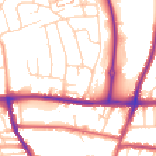
Daytime· 07:00 – 23:00
54.1dB

Night-time· 23:00 – 07:00
45.0dB