5 Amelia Crescent, Worthing, BN11 4EB
About 5 Amelia Crescent
5 Amelia Crescent is a three-bedroom mid-terrace house in Worthing (BN11 4EB). It has a recorded floor area of 116 m² (around 1249 sq ft), construction records dating it to 1996-2002 and council tax band D. Period features are noted in the property record. The latest certificate (November 2017) shows a C (score 70). The recommended improvements would push it to B (score 84).
Across 2004–2018, sale prices on this property compounded at 3% per year. Today's modelled estimate of £408,000 is 20% above the 2018 sale price. On a £-per-square-foot basis, the last sale (£272/sq ft) was about 51.3% above the typical sold price in the postcode. Last changed hands 8 years ago, in February 2018.
What this property has
Inside
- Bedrooms3
- Bathrooms2
- Dining roomYes
Outside
- Private gardenRear
- GarageYes
Building
- Period featuresYes
Everything you need to know about 5 Amelia Crescent
The true value, the hidden risks and the full sale history, in one report.
Pick your report · every report is £14.99
One time fee only - money back guarantee

The data behind every report


Energy performance
EPC Rating
Get a survey for this property
Level 3 Building Survey
Because the property has been extended more than once, we believe a Level 3 building survey should be considered.
From £1,020 · Includes VAT
Planning history
5 Amelia Crescent has no planning applications on record.
But the area is active
8 notable applications nearby — larger schemes and conversions that could reshape the street. The report maps them all.
Sales history & valuation
5 Amelia Crescent valuation sits well clear of the typical sold price in this postcode.
£408,000
Modelled from EPC, postcode comparables and a sale-price growth of 3.0% per year over 14 years.
£340,000
Growth on file: 3.0% per year over 14 years.
Sales timeline
28 February 2018Most recent
£340,000
+38.8%over 12 years19 April 2005
£245,000
+8.9%over 1 year12 March 2004
£225,000
Median price across the last 5 sales in BN11 4EB: £380,000 (2024–2009).
Nearby sales in BN11 4EB
Versus other Amelia Crescent homes
5 Amelia Crescent outperforms the street on habitable rooms by a wide margin.
Price per m²
£2,931
Street avg £2,261
Floor Area
116 m²
Street avg 126 m²
Habitable Rooms
5 rooms
Street avg 4 rooms
CO₂ Emissions
3.6 t/year
Street avg 3.6 t/year
Everything you need to know about 5 Amelia Crescent
The true value, the hidden risks and the full sale history, in one report.
Pick your report · every report is £14.99
One time fee only - money back guarantee
The data behind every report
Similar properties nearby
1 Amelia Crescent
BN11 4EB
1 Little Pembrokes, Downview Road
BN11 4NL
1 Elizabeth Road
BN11 4EF
1 Acre Gardens, Boundary Road
BN11 4LN
1 Longfellow Road
BN11 4NU
1 Coach House Mews, Gratwicke Road
BN11 4DQ
1 Chappell Croft, Manor Road
BN11 4SF
1 Mill House Gardens
BN11 4NE
The neighbourhood at a glance
Rail-style transport is unusually close for this postcode.
Crime
5/mo
Steady year-on-year across the wider district.
Nearest stop
0.2 km
Amelia Park — bus stop.
Closest school
0.0 km
St Mary's Catholic Primary School. 23 schools nearby.
Go deeper on the local area
A Local Area report breaks down crime, transport links, schools and air quality in depth.
Road noise across the postcode
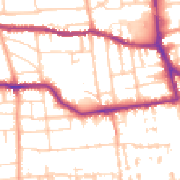
Daytime· 07:00 – 23:00
53.1dB
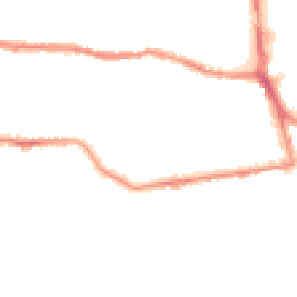
Night-time· 23:00 – 07:00
42.3dB