Model valuation£417,0008 Busby Close
Local market context
1 Larkfield Way is a three-bedroom semi-detached house in Brighton (BN1 8EG). It has a recorded floor area of 112 m² (around 1206 sq ft), construction records dating it to 1930-1949 and council tax band E. The latest certificate (October 2016) shows a D (score 62), on the cusp of jumping into the C band. The recommended improvements would lift it to B (score 84), a 2-band jump. Other recorded features include a conservatory. Period features are noted in the property record. Our model identifies extension potential, subject to local planning policy.
One planning record on file: an extension approved in 2017. Past consents include an extension, meaningful when judging how the property has evolved. Today's modelled estimate of £721,000 is 24.1% above the 2017 sale price. On a £-per-square-foot basis, the last sale (£482/sq ft) was about 64.1% above the typical sold price in the postcode. 9 years since the last transfer (March 2017).
The true value, the hidden risks and the full sale history, in one report.
Pick your report · from £14.99
One time fee only - money back guarantee
The data behind every report


Recommended upgrades on file would lift this property by multiple EPC bands.
Certificate validity
Valid until 10 October 2026

Get a survey for this property
We've checked 10 risk factors against the available data for this property and believe a Level 2 HomeBuyer Report could be a suitable option for you.
From £995 · Includes VAT
Council records include a two-storey side extension at 1 Larkfield Way.
1 application on record at 1 Larkfield Way, Brighton, BN1 8EG
Extension: Two storey · Side of property
Erection of two storey side extension incorporating enlargement of existing garage and associated roof alterations.
You're seeing the shape of it. The report has the substance.
One time fee only - money back guarantee
1 Larkfield Way valuation sits well clear of the typical sold price in this postcode.
£721,000
Modelled from EPC, postcode comparables.
£580,950
Recorded with HM Land Registry.
6 March 2017Most recent
£580,950
Median price across the last 5 sales in BN1 8EG: £700,000 (2025–2021).
Price per m²
£5,187
Street avg £4,409
Floor Area
112 m²
Street avg 119 m²
Habitable Rooms
5 rooms
Street avg 5 rooms
CO₂ Emissions
5.3 t/year
Street avg 4.5 t/year
Property research, connected
Explore sale histories, valuations, energy ratings and local areas. Ask the assistant to connect the details and take your research further.
Start your researchBN1 8EP
BN1 8RF
BN1 8QD
BN1 8XP
BN1 8RL
BN1 8AA
BN1 8AL
BN1 8YT
Daytime road noise here sits well below conversation level — a quiet pocket of the postcode.
Crime
1110/mo
Falling year-on-year across the wider district.
Nearest stop
0.2 km
Surrenden Road East End — bus stop.
Closest school
0.5 km
Varndean School. 26 schools nearby.
Go deeper on the local area
A Local Area report breaks down crime, transport links, schools and air quality in depth.
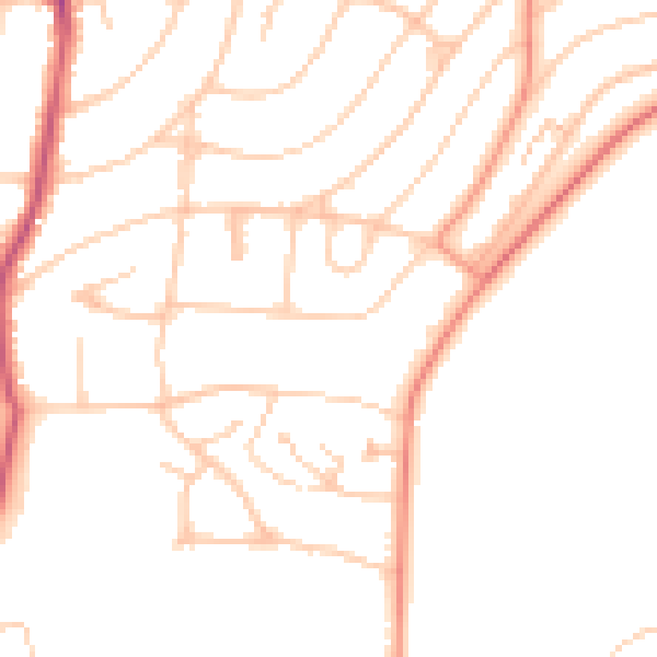
Daytime· 07:00 – 23:00
47.8dB

Night-time· 23:00 – 07:00
38.2dB