12 Fairlie Gardens, Brighton, BN1 6PY
About 12 Fairlie Gardens
12 Fairlie Gardens is a three-bedroom detached house in Brighton (BN1 6PY). It has a recorded floor area of 116 m² (around 1249 sq ft), construction records dating it to 1967-1975 and council tax band E. The latest certificate (May 2024) shows a D (score 61), on the cusp of jumping into the C band. The rating has held steady at D across 2 certificates since September 2014. Between certificates, roof efficiency went from Average to Good and lighting went from Very Poor to Very Good; while wall efficiency dropped from Average to Poor. The recommended improvements would push it to C (score 78). Records show the property has been extended at some point in its history. The home occupies a cul-de-sac position.
A recent sale: £725,000 in October 2025. 3 planning records sit against the property, 3 approved, 0 refused. Past consents include tree works, meaningful when judging how the property has evolved. Across 2002–2025, sale prices on this property compounded at 4.6% per year.
What this property has
Inside
- Bedrooms3
- Bathrooms2
- Utility roomYes
- CloakroomYes
- EnsuiteYes
Outside
- Private gardenWest-facing
- GarageYes
- Cul-de-sacYes
Building
- Previously extendedYes
Everything you need to know about 12 Fairlie Gardens
The true value, the hidden risks and the full sale history, in one report.
Pick your report · from £14.99
One time fee only - money back guarantee

The data behind every report







Energy performance
EPC Rating
Certificate validity
Valid until 30 May 2034
Property Improvements
Changes detected from historical EPC data
Windows upgraded, improving insulation
Roof insulation improved
More low energy lighting installed

Get a survey for this property
Level 2 HomeBuyer Report
We've checked 10 risk factors against the available data for this property and believe a Level 2 HomeBuyer Report could be a suitable option for you.
From £995 · Includes VAT
Planning history
Planning history at 12 Fairlie Gardens is exclusively tree-management applications — typical for a property with mature trees on or near the plot.
3 applications on record at 12 Fairlie Gardens, Brighton, BN1 6PY
- Mar 2015Tree WorksTreesOutcome in report
1no Sycamore in rear garden - crown reduce by approx. 30% (4-5m on the top and 3-4m on the side growth or lateral branches).
- Reference
- BH2015/01011
- More recent applications — locked
- Tree WorksMar 2025Decision
- Tree WorksJun 2019Decision
Unlock 12 Fairlie Gardens, Brighton, BN1 6PY's full planning history
You're seeing the shape of it. The report has the substance.
- Every decision — granted, refused or withdrawn (3 on record)
- All 3 applications on this property in full, plus 9 notable nearby
- The 7 documents, officer reports & conditions
- What the pattern means for extending or converting here
One time fee only - money back guarantee
Sales history & valuation
Sale price has at least doubled since 2002.
£761,000
Modelled from EPC, postcode comparables and a sale-price growth of 4.6% per year over 23 years.
£725,000
Growth on file: 4.6% per year over 23 years.
Sales timeline
13 October 2025Most recent
£725,000
+182.1%over 23 years15 August 2002
£257,000
Median price across the last 5 sales in BN1 6PY: £730,000 (2026–2021).
Nearby sales in BN1 6PY
Versus other Fairlie Gardens homes
12 Fairlie Gardens is notably below the street on years held.
Price per m²
£6,250
Street avg £6,350
Floor Area
116 m²
Street avg 101 m²
Habitable Rooms
6 rooms
Street avg 5 rooms
CO₂ Emissions
4.9 t/year
Street avg 4.4 t/year
Everything you need to know about 12 Fairlie Gardens
The true value, the hidden risks and the full sale history, in one report.
Pick your report · from £14.99
One time fee only - money back guarantee
The data behind every report
Similar properties nearby
1 Bates Road
BN1 6PF
1 Cumberland Lodge, Cumberland Road
BN1 6ST
1 Cleveland Road
BN1 6FF
1 Fircroft Close
BN1 6RY
1 Chester Terrace
BN1 6GB
1 Fairlie Gardens
BN1 6PY
1 Friar Road
BN1 6NG
1 Elms Lea Avenue
BN1 6UG
The neighbourhood at a glance
Rail-style transport is unusually close for this postcode.
Crime
1110/mo
Falling year-on-year across the wider district.
Nearest stop
0.1 km
Surrenden Holt — bus stop.
Closest school
0.3 km
Dorothy Stringer School. 32 schools nearby.
Go deeper on the local area
A Local Area report breaks down crime, transport links, schools and air quality in depth.
Road noise across the postcode
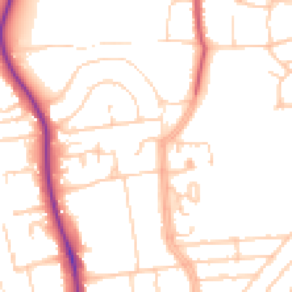
Daytime· 07:00 – 23:00
49.9dB

Night-time· 23:00 – 07:00
41.1dB