8 Dearncamme Close, Bolton, BL2 3FT
About 8 Dearncamme Close
8 Dearncamme Close is a four-bedroom detached house in Bolton (BL2 3FT). It has a recorded floor area of 119 m² (around 1281 sq ft), construction records dating it to 1976-1982 and council tax band D. The latest certificate (June 2019) shows a D (score 68), on the cusp of jumping into the C band. The recommended improvements would lift it to B (score 82), a 2-band jump. Other recorded features include a conservatory. Records show the property has been extended at some point in its history. The home occupies a cul-de-sac position.
One planning record on file: an extension approved in 2005. Past consents include an extension, a garage conversion and a conservatory, meaningful when judging how the property has evolved. Across 1998–2020, sale prices on this property compounded at 5.7% per year. Today's modelled estimate of £392,000 is 42.5% above the 2020 sale price. Last sale on file: £275,000 in February 2020.
What this property has
Inside
- Bedrooms4
- Bathrooms3
- Open-plan layoutYes
- Dining roomYes
- Utility roomYes
- CloakroomYes
- EnsuiteYes
- ConservatoryYes
Outside
- Private gardenYes
- ParkingOff road
- Cul-de-sacYes
Building
- Previously extendedYes
Everything you need to know about 8 Dearncamme Close
The true value, the hidden risks and the full sale history, in one report.
Pick your report · every report is £14.99
One time fee only - money back guarantee

The data behind every report


Energy performance
Recommended upgrades on file would lift this property by multiple EPC bands.
EPC Rating
Get a survey for this property
Level 2 HomeBuyer Report
We've checked 10 risk factors against the available data for this property and believe a Level 2 HomeBuyer Report could be a suitable option for you.
From £595 · Includes VAT
Planning history
1 application on record at 8 Dearncamme Close, Bolton, BL2 3FT
- Apr 2005Garage ConversionFullOutcome in report
Extension: Rear of property
CONVERSION OF EXISTING GARAGE TO FORM HABITABLE ROOM TOGETHER WITH TWO STOREY EXTENSION TO REAR OF GARAGE AND A FIRST FLOOR OVER GARAGE TOGETHER WITH ERECTION OF CONSERVATORY AT REAR.
ExtensionConservatory- Documents
- 1 doc on file
- Reference
- 70567/05
Unlock 8 Dearncamme Close, Bolton, BL2 3FT's full planning history
You're seeing the shape of it. The report has the substance.
- Every decision — granted, refused or withdrawn (1 on record)
- All 1 application on this property in full
- The 1 documents, officer reports & conditions
- What the pattern means for extending or converting here
One time fee only - money back guarantee
Sales history & valuation
Sale price has grown by over 3x since 1998.
£392,000
Modelled from EPC, postcode comparables and a sale-price growth of 5.7% per year over 21 years.
£275,000
Growth on file: 5.7% per year over 21 years.
Sales timeline
28 February 2020Most recent
£275,000
+227.4%over 21 years4 December 1998
£84,000
Median price across the last 5 sales in BL2 3FT: £268,000 (2022–2015).
Nearby sales in BL2 3FT
Versus other Dearncamme Close homes
On habitable rooms, 8 Dearncamme Close stands well clear of the street.
Price per m²
£2,311
Street avg £2,419
Floor Area
119 m²
Street avg 112 m²
Habitable Rooms
7 rooms
Street avg 6 rooms
CO₂ Emissions
4.7 t/year
Street avg 4.3 t/year
Everything you need to know about 8 Dearncamme Close
The true value, the hidden risks and the full sale history, in one report.
Pick your report · every report is £14.99
One time fee only - money back guarantee
The data behind every report
Similar properties nearby
1 Cherry Tree Way
BL2 3BS
1 Aire Drive
BL2 3FX
1 Dearncamme Close
BL2 3FT
1 Christchurch Lane
BL2 3QF
1 Bluebell Close
BL2 3PF
1 Acre Field
BL2 3LQ
1 Brook House Close
BL2 3QS
1 Colmore Grove
BL2 3AW
The neighbourhood at a glance
Rail-style transport is unusually close for this postcode.
Crime
1/mo
Steady year-on-year across the wider district.
Nearest stop
0.1 km
Aire Drive — bus stop.
Closest school
0.6 km
Canon Slade School. 30 schools nearby.
Go deeper on the local area
A Local Area report breaks down crime, transport links, schools and air quality in depth.
Road noise across the postcode
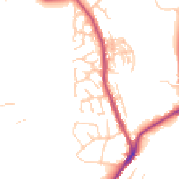
Daytime· 07:00 – 23:00
47.4dB

Night-time· 23:00 – 07:00
39.8dB