84a, Ground Floor Flat, Alma Road, Bournemouth, BH9 1AN
About 84a
84a is a two-bedroom semi-detached house in Bournemouth (BH9 1AN). It has a recorded floor area of 43 m² (around 463 sq ft), construction records dating it to 1950-1966 and council tax band A. The latest certificate (November 2017) shows a D (score 62), on the cusp of jumping into the C band. The recommended improvements would push it to C (score 76). Period features are noted in the property record.
Held since September 2006 — that's 20 years off the open market, well above the local norm. At 43 m² it sits well below the postcode median (68 m² across 43 EPCs), making it one of the more compact homes locally. Today's modelled estimate of £160,000 is 45.5% above the 2006 sale price. On a £-per-square-foot basis, the last sale (£238/sq ft) was about 33.2% above the typical sold price in the postcode.
What this property has
Inside
- Bedrooms2
- Bathrooms1
- Dining roomYes
Outside
- Private gardenYes
- ParkingAllocated
Building
- Central heatingYes
- Period featuresYes
Everything you need to know about 84a
The true value, the hidden risks and the full sale history, in one report.
Pick your report · every report is £14.99
One time fee only - money back guarantee

The data behind every report


Energy performance
EPC Rating
Get a survey for this property
Level 2 HomeBuyer Report
We've checked 10 risk factors against the available data for this property and believe a Level 2 HomeBuyer Report could be a suitable option for you.
From £495 · Includes VAT
Planning history
84a has no planning applications on record.
But the area is active
78 notable applications nearby — larger schemes and conversions that could reshape the street. The report maps them all.
Sales history & valuation
£160,000
Modelled from EPC, postcode comparables.
£110,000
Recorded with HM Land Registry.
Sales timeline
6 September 2006Most recent
£110,000
Median price across the last 5 sales in BH9 1AN: £330,000 (2024–2022).
Nearby sales in BH9 1AN
Alma Court, Flat 4, 84 Alma Road, Bournemouth, BH9 1AN
Sold Jul 2024
£157,000Flat 1, 28 Alma Road, Bournemouth, BH9 1AN
Sold Mar 2024
£1,250,00082a, Alma Road, Bournemouth, BH9 1AN
Sold May 2023
£200,00018 Alma Road, Bournemouth, BH9 1AN
Sold Mar 2023
£330,00032 Alma Road, Bournemouth, BH9 1AN
Sold Aug 2022
£510,000
Versus other Alma Road homes
Price per m²
£2,558
Street avg £4,810
Floor Area
43 m²
Street avg 56 m²
Habitable Rooms
3 rooms
Street avg 3 rooms
CO₂ Emissions
2.2 t/year
Street avg 2.3 t/year
Everything you need to know about 84a
The true value, the hidden risks and the full sale history, in one report.
Pick your report · every report is £14.99
One time fee only - money back guarantee
The data behind every report
Similar properties nearby
3a, First Floor Flat, Cardigan Road
BH9 1BD
84a, First Floor Flat, Alma Road
BH9 1AN
84c, Ground Floor Flat, Alma Road
BH9 1AN
84b, First Floor Flat, Alma Road
BH9 1AN
54a, Ground Floor Flat, Wycliffe Road
BH9 1JS
1a, Flat 6, Cardigan Road
BH9 1BJ
1b, Flat 1, Cardigan Road
BH9 1BJ
1b, Flat 3, Cardigan Road
BH9 1BJ
The neighbourhood at a glance
Crime
4/mo
Steady year-on-year across the wider district.
Nearest stop
0.2 km
Stokewood Road — bus stop.
Closest school
0.6 km
St Luke's Church of England Primary School. 26 schools nearby.
Go deeper on the local area
A Local Area report breaks down crime, transport links, schools and air quality in depth.
Road noise across the postcode
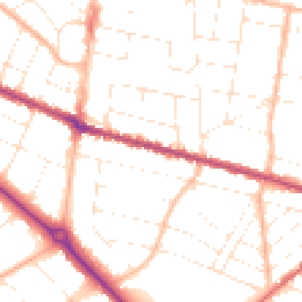
Daytime· 07:00 – 23:00
50.5dB

Night-time· 23:00 – 07:00
40.3dB