59a, Alma Road, Bournemouth, BH9 1AB
About 59a
59a is a one-bedroom detached house in Bournemouth (BH9 1AB). It has a recorded floor area of 43 m² (around 463 sq ft), construction records dating it to 1950-1966 and council tax band A. At 43 m² this is the 13th smallest of 42 units on EPC record in the building, where floor areas span 31–128 m². The building's EPC ratings span F to B across 42 units on file. The latest certificate (September 2018) shows a C (score 72).
Last sale on file: £140,000 in June 2019. Across the public record there are 4 sales, relatively high churn for a single property. Across 1998–2019, sale prices on this property compounded at 6.5% per year. Today's modelled estimate of £169,000 is 20.7% above the 2019 sale price. On a £-per-square-foot basis, the last sale (£302/sq ft) was about 46% above the typical sold price in the postcode. At 43 m² it's 24.6% smaller than the typical home in the postcode (57 m² median across 41 EPCs). 1 bedrooms is on the smaller side for this postcode, where 3 is the typical count.
What this property has
Inside
- Bedrooms1
- Bathrooms1
Outside
- Private gardenYes
Building
- Heating systemGas
- RefurbishedYes
Everything you need to know about 59a
The true value, the hidden risks and the full sale history, in one report.
Pick your report · every report is £14.99
One time fee only - money back guarantee

The data behind every report


Energy performance
EPC Rating
Get a survey for this property
Level 2 HomeBuyer Report
We've checked 10 risk factors against the available data for this property and believe a Level 2 HomeBuyer Report could be a suitable option for you.
From £495 · Includes VAT
Planning history
59a has no planning applications on record.
But the area is active
78 notable applications nearby — larger schemes and conversions that could reshape the street. The report maps them all.
Sales history & valuation
59a has more than tripled in price since its earliest registered sale in 1998.
£169,000
Modelled from EPC, postcode comparables and a sale-price growth of 6.5% per year over 21 years.
£140,000
Growth on file: 6.5% per year over 21 years.
Sales timeline
6 June 2019Most recent
£140,000
+19.7%over 11 years14 June 2007
£117,000
+50.0%over 3 years24 November 2003
£78,000
+105.3%over 5 years29 September 1998
£38,000
Median price across the last 5 sales in BH9 1AB: £235,000 (2022–2015).
Nearby sales in BH9 1AB
Versus other Alma Road homes
Price per m² for 59a runs comfortably ahead of the street norm.
Price per m²
£3,256
Street avg £2,433
Floor Area
43 m²
Street avg 51 m²
Habitable Rooms
3 rooms
Street avg 2 rooms
CO₂ Emissions
1.6 t/year
Street avg 2.4 t/year
Everything you need to know about 59a
The true value, the hidden risks and the full sale history, in one report.
Pick your report · every report is £14.99
One time fee only - money back guarantee
The data behind every report
Similar properties nearby
The neighbourhood at a glance
Crime
4/mo
Steady year-on-year across the wider district.
Nearest stop
0.1 km
Winton Banks — bus stop.
Closest school
0.5 km
St Luke's Church of England Primary School. 26 schools nearby.
Go deeper on the local area
A Local Area report breaks down crime, transport links, schools and air quality in depth.
Road noise across the postcode
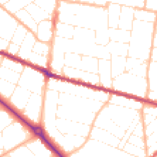
Daytime· 07:00 – 23:00
50.5dB

Night-time· 23:00 – 07:00
40.1dB