21 Lancaster Gardens, Wolverhampton, WV4 4DN
About 21 Lancaster Gardens
21 Lancaster Gardens is a five-bedroom detached house in Wolverhampton (WV4 4DN). It has a recorded floor area of 125 m² (around 1345 sq ft), construction records dating it to 1967-1975 and council tax band E. The latest certificate (August 2024) shows a D (score 62), on the cusp of jumping into the C band. The recommended improvements would push it to C (score 80). Records show the property has been extended at some point in its history.
At 125 m² the property is well over the postcode median (70 m² across 25 EPCs), placing it in the larger end of the local stock. 5 bedrooms is on the larger side for this postcode, where 4 is the typical count. A recent sale: £426,500 in August 2025. Today's modelled estimate of £476,000 is 11.6% above the 2025 sale price. On a £-per-square-foot basis, the last sale (£317/sq ft) was about 34% above the typical sold price in the postcode.
What this property has
Inside
- Bedrooms5
- Bathrooms3
- Dining roomYes
- EnsuiteYes
Outside
- Private gardenRear
Building
- Previously extendedYes
- RefurbishedYes
Everything you need to know about 21 Lancaster Gardens
The true value, the hidden risks and the full sale history, in one report.
Pick your report · every report is £14.99
One time fee only - money back guarantee

The data behind every report


Energy performance
EPC Rating
Get a survey for this property
Level 3 Building Survey
Because the property has been extended more than once, we believe a Level 3 building survey should be considered.
From £1,020 · Includes VAT
Planning history
21 Lancaster Gardens has no planning applications on record.
But the area is active
3 notable applications nearby — larger schemes and conversions that could reshape the street. The report maps them all.
Sales history & valuation
Latest sale on 21 Lancaster Gardens was the highest on Land Registry record across the postcode.
£476,000
Modelled from EPC, postcode comparables.
£426,500
Recorded with HM Land Registry.
Sales timeline
14 August 2025Most recent
£426,500
Median price across the last 5 sales in WV4 4DN: £247,500 (2025–2023).
Nearby sales in WV4 4DN
24 Lancaster Gardens, Wolverhampton, WV4 4DN
Sold Oct 2025
£425,00054 Lancaster Gardens, Wolverhampton, WV4 4DN
Sold Jun 2025
£245,00055 Lancaster Gardens, Wolverhampton, WV4 4DN
Sold Jan 2024
£247,5008 Lancaster Gardens, Wolverhampton, WV4 4DN
Sold Nov 2023
£225,00039 Lancaster Gardens, Wolverhampton, WV4 4DN
Sold Jun 2023
£252,000
Versus other Lancaster Gardens homes
21 Lancaster Gardens is notably below the street on years held.
Price per m²
£3,412
Street avg £3,046
Floor Area
125 m²
Street avg 81 m²
Habitable Rooms
6 rooms
Street avg 4 rooms
CO₂ Emissions
5.7 t/year
Street avg 4.1 t/year
Everything you need to know about 21 Lancaster Gardens
The true value, the hidden risks and the full sale history, in one report.
Pick your report · every report is £14.99
One time fee only - money back guarantee
The data behind every report
Similar properties nearby
1 Dimmingsdale Road
WV4 4XF
1 Hanbury Crescent
WV4 4BW
1 Buckley Road
WV4 4LJ
1 Hamble Road
WV4 4QF
1 Ashley Road
WV4 4DP
1 Fairview Road, Penn
WV4 4TD
1 Fancourt Avenue
WV4 4HY
1 Arley Grove
WV4 4QX
The neighbourhood at a glance
Daytime road noise here sits well below conversation level — a quiet pocket of the postcode.
Crime
6/mo
Steady year-on-year across the wider district.
Nearest stop
1.7 km
Miller and Carter PH — bus stop.
Closest school
0.8 km
Woodfield Primary School. 27 schools nearby.
Go deeper on the local area
A Local Area report breaks down crime, transport links, schools and air quality in depth.
Road noise across the postcode
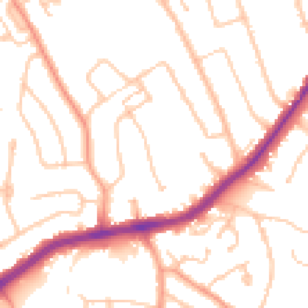
Daytime· 07:00 – 23:00
49.9dB

Night-time· 23:00 – 07:00
40.8dB