Waterford, Ball Lane, Coven Heath, Wolverhampton, WV10 7HB
About Waterford
Waterford is a property in Coven Heath, Wolverhampton, Wolverhampton (WV10 7HB).
On the market in March 2016 and unlisted since — roughly 10 years.
Everything you need to know about Waterford
The true value, the hidden risks and the full sale history, in one report.
Pick your report · every report is £14.99
One time fee only - money back guarantee

The data behind every report


Energy performance
No EPC on record
This property doesn't have an Energy Performance Certificate yet. An EPC is required to sell or let — and unlocks our automated valuation.
Get a survey for this property
Level 2 HomeBuyer Report
We've checked 10 risk factors against the available data for this property and believe a Level 2 HomeBuyer Report could be a suitable option for you.
Planning history
Waterford has no planning applications on record.
But the area is active
4 notable applications nearby — larger schemes and conversions that could reshape the street. The report maps them all.
Sales history & valuation
£270,000
Recorded with HM Land Registry.
Sales timeline
29 March 2016Most recent
£270,000
Median price across the last 5 sales in WV10 7HB: £310,000 (2024–2015).
Nearby sales in WV10 7HB
The Church On The Common, Ball Lane, Coven Heath, Wolverhampton, WV10 7HB
Sold Jun 2024
£385,000Red Roof Cottage, Ball Lane, Coven Heath, Wolverhampton, WV10 7HB
Sold Jul 2021
£357,0002 Hordern Cottages, Ball Lane, Coven Heath, Wolverhampton, WV10 7HB
Sold Aug 2017
£310,0001 Hordern Cottages, Ball Lane, Coven Heath, Wolverhampton, WV10 7HB
Sold May 2015
£285,000Little Orchard, Ball Lane, Coven Heath, Wolverhampton, WV10 7HB
Sold Apr 2002
£162,000
Everything you need to know about Waterford
The true value, the hidden risks and the full sale history, in one report.
Pick your report · every report is £14.99
One time fee only - money back guarantee
The data behind every report
Similar properties nearby
1 Cranesbill Close, Featherstone
WV10 7TY
1 Bridge Cottages, Straight Mile, Calf Heath
WV10 7DP
1 Brooklime Gardens, Featherstone
WV10 7TW
1 Bellflower Close, Featherstone
WV10 7SU
1 Brewood Road, Cross Green
WV10 7PW
1 College Way, Brinsford
WV10 7FJ
1 Ball Lane, Coven Heath
WV10 7EY
1 Featherstone Hall Barn, New Road, Featherstone
WV10 7NW
The neighbourhood at a glance
Crime
6/mo
Steady year-on-year across the wider district.
Nearest stop
0.2 km
Ball Lane — bus stop.
Closest school
1.6 km
St Anthony's Catholic Primary Academy. 9 schools nearby.
Go deeper on the local area
A Local Area report breaks down crime, transport links, schools and air quality in depth.
Road noise across the postcode
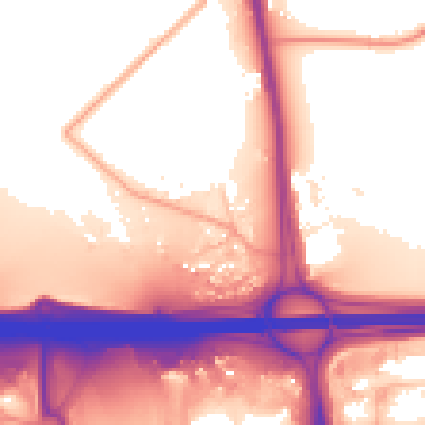
Daytime· 07:00 – 23:00
58.8dB
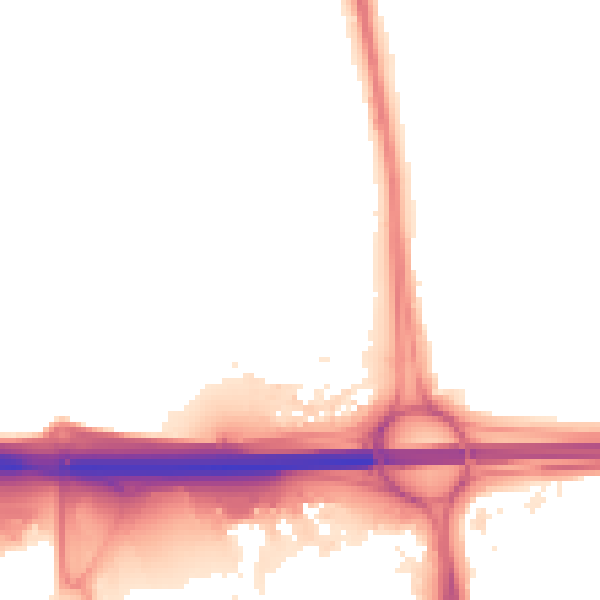
Night-time· 23:00 – 07:00
52.5dB