353 Walsall Road, Great Wyrley, Walsall, WS6 6DP
About 353 Walsall Road
353 Walsall Road is a four-bedroom detached house in Great Wyrley, Walsall, Walsall (WS6 6DP). It has a recorded floor area of 124 m² (around 1335 sq ft), construction records dating it to 1967-1975 and council tax band C. The latest certificate (July 2021) shows a D (score 67), on the cusp of jumping into the C band. The rating has held steady at D across 2 certificates since March 2011. Between certificates, window efficiency dropped from Good to Average. The recommended improvements would lift it to B (score 81), a 2-band jump. Records show the property has been extended at some point in its history.
At 124 m² the property is well over the postcode median (84 m² across 18 EPCs), placing it in the larger end of the local stock. One planning record on file: an extension approved in 2004. Past consents include an extension, a porch and a conservatory, meaningful when judging how the property has evolved. Across 1998–2021, sale prices on this property compounded at 6.2% per year. Today's modelled estimate of £340,000 is 19.3% above the 2021 sale price. On a £-per-square-foot basis, the last sale (£214/sq ft) was about 88.2% above the typical sold price in the postcode. Most recent transfer: September 2021 at £285,000. That sale was during the post-pandemic price surge, when transactions cleared materially above pre-2020 trend.
What this property has
Inside
- Bedrooms4
- Bathrooms1
- Dining roomYes
Outside
- GarageYes
Building
- Previously extendedYes
Everything you need to know about 353 Walsall Road
The true value, the hidden risks and the full sale history, in one report.
Pick your report · every report is £14.99
One time fee only - money back guarantee

The data behind every report


Energy performance
Recommended upgrades on file would lift this property by multiple EPC bands.
EPC Rating
Property Improvements
Changes detected from historical EPC data
Heating controls upgraded for better temperature management
Get a survey for this property
Level 2 HomeBuyer Report
We've checked 10 risk factors against the available data for this property and believe a Level 2 HomeBuyer Report could be a suitable option for you.
From £595 · Includes VAT
Planning history
1 application on record at 353 Walsall Road, Great Wyrley, Walsall, WS6 6DP
- Oct 2004PorchFullOutcome in report
Extension: Single storey · Front of property
First floor extension including porch, convervatory, (canopy bay window and porch)
ExtensionConservatory- Reference
- 04/01069/FUL
Unlock 353 Walsall Road, Great Wyrley, Walsall, WS6 6DP's full planning history
You're seeing the shape of it. The report has the substance.
- Every decision — granted, refused or withdrawn (1 on record)
- All 1 application on this property in full, plus 2 notable nearby
- What the pattern means for extending or converting here
One time fee only - money back guarantee
Sales history & valuation
Price for 353 Walsall Road has grown more than fourfold since the 1998 starting point.
£340,000
Modelled from EPC, postcode comparables and a sale-price growth of 6.2% per year over 23 years.
£285,000
Growth on file: 6.2% per year over 23 years.
Sales timeline
15 September 2021Most recent
£285,000
+307.4%over 23 years29 April 1998
£69,950
Median price across the last 5 sales in WS6 6DP: £260,550 (2024–2022).
Nearby sales in WS6 6DP
361 Walsall Road, Great Wyrley, Walsall, WS6 6DP
Sold Apr 2024
£292,500379 Walsall Road, Great Wyrley, Walsall, WS6 6DP
Sold Apr 2024
£105,000375 Walsall Road, Great Wyrley, Walsall, WS6 6DP
Sold Jun 2022
£110,000367 Walsall Road, Great Wyrley, Walsall, WS6 6DP
Sold Mar 2022
£350,000377 Walsall Road, Great Wyrley, Walsall, WS6 6DP
Sold Jan 2022
£95,000
Versus other Walsall Road homes
Habitable Rooms for 353 Walsall Road runs comfortably ahead of the street norm.
Price per m²
£2,298
Street avg £1,764
Floor Area
124 m²
Street avg 97 m²
Habitable Rooms
11 rooms
Street avg 5 rooms
CO₂ Emissions
4.9 t/year
Street avg 5.9 t/year
Everything you need to know about 353 Walsall Road
The true value, the hidden risks and the full sale history, in one report.
Pick your report · every report is £14.99
One time fee only - money back guarantee
The data behind every report
Similar properties nearby
1 Appledore Close, Great Wyrley
WS6 6DQ
1 Estridge Lane
WS6 6EL
1 Bentons Lane
WS6 6EF
1 Anson Road, Great Wyrley
WS6 6JE
1 Achilles Close
WS6 6JW
1 Brooklands Avenue
WS6 6LF
1 Bobbin Close, Great Wyrley
WS6 6GF
1 Brook Lane, Great Wyrley
WS6 6BQ
The neighbourhood at a glance
Rail-style transport is unusually close for this postcode.
Crime
3/mo
Steady year-on-year across the wider district.
Nearest stop
0.0 km
Shaws Lane — bus stop.
Closest school
0.9 km
Moat Hall Primary Academy. 9 schools nearby.
Go deeper on the local area
A Local Area report breaks down crime, transport links, schools and air quality in depth.
Road noise across the postcode
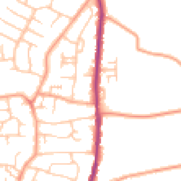
Daytime· 07:00 – 23:00
49.8dB

Night-time· 23:00 – 07:00
39.5dB