19 Fairfield Street, Pemberton, Wigan, WN5 8DL
About 19 Fairfield Street
19 Fairfield Street is a three-bedroom semi-detached house in Pemberton, Wigan, Wigan (WN5 8DL). It has a recorded floor area of 97 m² (around 1044 sq ft), construction records dating it to 1950-1966 and council tax band B. The latest certificate (February 2025) shows a C (score 69), just inside the C band. When first surveyed in December 2011 the rating was E, the property has climbed 2 bands since. Between certificates, wall efficiency went from Poor to Average, window efficiency went from Average to Good and hot-water efficiency went from Average to Good; while roof efficiency dropped from Average to Very Poor. Other recorded features include a conservatory, outbuildings and a loft. Period features are noted in the property record. Records show the property has been extended at some point in its history.
Today's modelled estimate of £239,000 sits 231.9% above the 2012 sale of £72,000. On a £-per-square-foot basis, the last sale (£69/sq ft) was about 43.6% below the postcode norm. One planning record on file: an extension approved in 2015. Past consents include an extension and a porch, meaningful when judging how the property has evolved. At 97 m² it's 24.4% larger than the typical home in the postcode (78 m² median across 7 EPCs). Its energy rating outperforms most of the postcode (better than 86% of similar EPCs). Last changed hands 14 years ago, in May 2012.
What this property has
Inside
- Bedrooms3
- Bathrooms2
- EnsuiteYes
- LoftYes
- ConservatoryYes
Outside
- Private gardenYes
- GarageDouble
- OutbuildingsYes
Building
- Period featuresYes
- Previously extendedYes
Everything you need to know about 19 Fairfield Street
The true value, the hidden risks and the full sale history, in one report.
30-day money-back guarantee

The data behind every report


Energy performance
EPC Rating
Property Improvements
Changes detected from historical EPC data
Heating controls upgraded for better temperature management
Hot water efficiency improved
Windows upgraded, improving insulation
Cavity wall insulation installed
More low energy lighting installed
Get a survey for this property
Level 3 Building Survey
Because the property has permanent outbuildings, we believe a Level 3 building survey should be considered.
From £885 · Includes VAT
Planning history
- Apr 2015PorchFullIn report
Extension: Single storey · Side of property
To extend dwellinghouse - single storey to side, porch at front.
Extension- Documents
- 7 docs on file
- Reference
- A/15/80550/HH
We flagged 2 things worth checking at 19 Fairfield Street
Independent checks surfaced things a buyer would want to understand before offering. The report explains each one in full, with the underlying data and what to ask.
- Signs of HMO activity in the area
- Larger development activity nearby
30-day money-back guarantee
Sales history & valuation
19 Fairfield Street's estimated value is more than triple its earliest registered sale price (2012).
£239,000
Modelled from EPC, postcode comparables.
£72,000
Recorded with HM Land Registry.
Sales timeline
3 May 2012Most recent
£72,000
Median price across the last 5 sales in WN5 8DL: £119,950 (2020–2005).
Nearby sales in WN5 8DL
5 Fairfield Street, Pemberton, Wigan, WN5 8DL
Sold Oct 2020
£96,00023 Fairfield Street, Pemberton, Wigan, WN5 8DL
Sold Oct 2015
£137,50013 Fairfield Street, Pemberton, Wigan, WN5 8DL
Sold Aug 2005
£79,0007 Fairfield Street, Pemberton, Wigan, WN5 8DL
Sold Apr 2005
£78,0008 Fairfield Street, Pemberton, Wigan, WN5 8DL
Sold Apr 2004
£94,950
Versus other Fairfield Street homes
19 Fairfield Street is notably below the street on price per m².
Price per m²
£742
Street avg £1,305
Floor Area
97 m²
Street avg 80 m²
Habitable Rooms
5 rooms
Street avg 5 rooms
CO₂ Emissions
3.7 t/year
Street avg 3.8 t/year
Everything you need to know about 19 Fairfield Street
The true value, the hidden risks and the full sale history, in one report.
30-day money-back guarantee
The data behind every report
Similar properties nearby
1 Brindley Street
WN5 8ET
1 Croft Avenue, Orrell
WN5 8TW
1 Crantock Road
WN5 8AR
1 Coniston Avenue, Orrell
WN5 8PR
1 Cotswold Avenue
WN5 8JZ
1 Beechwood Crescent, Orrell
WN5 8NL
1 Cosgate Close, Orrell
WN5 8SG
1 Cambridge Road, Orrell
WN5 8PL
The neighbourhood at a glance
Rail-style transport is unusually close for this postcode.
Crime
2/mo
Steady year-on-year across the wider district.
Nearest stop
0.2 km
Pemberton Rail Station — bus stop.
Closest school
0.2 km
Highfield St Matthew's Church of England Primary School. 24 schools nearby.
Go deeper on the local area
The full report breaks down crime, transport links, schools and air quality in depth.
Road noise across the postcode
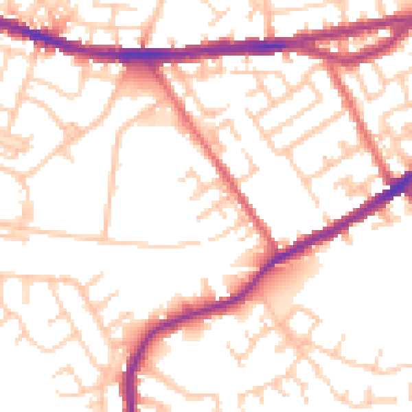
Daytime· 07:00 – 23:00
53.5dB

Night-time· 23:00 – 07:00
43.3dB