41 Neston Road, Watford, WD24 7BN
About 41 Neston Road
41 Neston Road is a two-bedroom mid-terrace house in Watford (WD24 7BN). It has a recorded floor area of 74 m² (around 797 sq ft), construction records dating it to 1900-1929 and council tax band C. The latest certificate (June 2016) shows a D (score 59), a step below the typical UK home. The recommended improvements would push it to C (score 78). Period features are noted in the property record.
Across 1996–2016, sale prices on this property compounded at 9.5% per year. Today's modelled estimate of £408,000 is 10.3% above the 2016 sale price. On a £-per-square-foot basis, the last sale (£465/sq ft) was about 115.6% above the typical sold price in the postcode. On the market in October 2016 and unlisted since — roughly 10 years.
What this property has
Inside
- Bedrooms2
- Bathrooms1
Outside
- Private gardenRear
Building
- Central heatingYes
- Period featuresYes
Everything you need to know about 41 Neston Road
The true value, the hidden risks and the full sale history, in one report.
30-day money-back guarantee

The data behind every report


Energy performance
EPC Expired
This certificate is over 10 years old and is no longer valid.Expired 20 Jun 2026
EPC Rating
Planning history
41 Neston Road has no planning applications on record.
Notable planning nearby
3applications of note in the surrounding area
We flagged 1 thing worth checking at 41 Neston Road
Independent checks surfaced things a buyer would want to understand before offering. The report explains each one in full, with the underlying data and what to ask.
- Larger development activity nearby
30-day money-back guarantee
Sales history & valuation
41 Neston Road has more than quadrupled in price since its earliest registered sale in 1996.
£408,000
Modelled from EPC, postcode comparables and a sale-price growth of 9.5% per year over 21 years.
£370,000
Growth on file: 9.5% per year over 21 years.
Sales timeline
3 October 2016Most recent
£370,000
+549.1%over 20 years31 January 1996
£57,000
Median price across the last 5 sales in WD24 7BN: £340,000 (2024–2022).
Versus other Neston Road homes
41 Neston Road outperforms the street on price per m² by a wide margin.
Price per m²
£5,000
Street avg £3,263
Floor Area
74 m²
Street avg 83 m²
Habitable Rooms
3 rooms
Street avg 4 rooms
CO₂ Emissions
4.0 t/year
Street avg 4.0 t/year
Everything you need to know about 41 Neston Road
The true value, the hidden risks and the full sale history, in one report.
30-day money-back guarantee
The data behind every report
Similar properties nearby
1 Southwold Road
WD24 7DP
10 Hillrise Avenue
WD24 7NR
1 Parkgate Road
WD24 7BS
1 Norfolk Avenue
WD24 7DZ
10 Neston Road
WD24 7BW
1 Woodmere Avenue
WD24 7LR
1 Northfield Gardens
WD24 7RF
1 Munden Grove
WD24 7EF
The neighbourhood at a glance
Rail-style transport is unusually close for this postcode.
Crime
4/mo
Rising year-on-year across the wider district.
Nearest stop
0.1 km
Parkgate Road — bus stop.
Closest school
0.2 km
Parkgate Junior School. 32 schools nearby.
Go deeper on the local area
The full report breaks down crime, transport links, schools and air quality in depth.
Road noise across the postcode
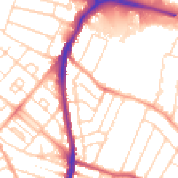
Daytime· 07:00 – 23:00
52.9dB

Night-time· 23:00 – 07:00
42.4dB