1 The Thrums, Watford, WD24 6DJ
About 1 The Thrums
1 The Thrums is a semi-detached house in Watford (WD24 6DJ). It has a recorded floor area of 88 m² (around 947 sq ft), construction records dating it to 1930-1949 and council tax band D. The latest certificate (June 2021) shows a C (score 73). When first surveyed in April 2013 the rating was E, the property has climbed 2 bands since. Between certificates, wall efficiency went from Very Poor to Good and hot-water efficiency went from Average to Good; while roof efficiency dropped from Good to Average. The recommended improvements would push it to B (score 87).
One historical planning record sits against the property in 2015.
Everything you need to know about 1 The Thrums
The true value, the hidden risks and the full sale history, in one report.
30-day money-back guarantee

The data behind every report


Energy performance
EPC Rating
Property Improvements
Changes detected from historical EPC data
Heating controls upgraded for better temperature management
Hot water efficiency improved
Wall insulation improved
Planning history
- Feb 2015RenovationFullIn report
Installation of carbon reduction and energy efficiency External Wall Insulation including all necessary enabling and finishing works
- Documents
- 14 docs on file
- Reference
- 15/00010/FUL
We flagged 1 thing worth checking at 1 The Thrums
Independent checks surfaced things a buyer would want to understand before offering. The report explains each one in full, with the underlying data and what to ask.
- Signs of HMO activity in the area
30-day money-back guarantee
Sales history & valuation
1 The Thrums has no Land Registry sales on file, suggesting it has stayed in the same hands since registration began.
£482,000
Modelled from EPC, postcode comparables.
No sales recorded with HM Land Registry
That can mean the property has never traded since the registry began publishing in 1995, was a new build that hasn't been registered yet, or is held in the same hands long-term.
Median price across the last 5 sales in WD24 6DJ: £375,000 (2025–2015).
Versus other The Thrums homes
EPC Rating for 1 The Thrums runs comfortably ahead of the street norm.
EPC Rating
73 (C)
Street avg 65 (D)
Floor Area
88 m²
Street avg 98 m²
CO₂ Emissions
2.7 t/year
Street avg 4.1 t/year
Habitable Rooms
5 rooms
Street avg 5 rooms
Everything you need to know about 1 The Thrums
The true value, the hidden risks and the full sale history, in one report.
30-day money-back guarantee
The data behind every report
Similar properties nearby
The neighbourhood at a glance
Rail-style transport is unusually close for this postcode.
Crime
4/mo
Rising year-on-year across the wider district.
Nearest stop
0.2 km
Church of St Helen's — bus stop.
Closest school
0.5 km
Beechfield School. 31 schools nearby.
Go deeper on the local area
The full report breaks down crime, transport links, schools and air quality in depth.
Road noise across the postcode
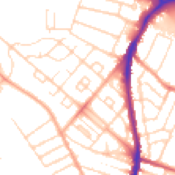
Daytime· 07:00 – 23:00
51.4dB

Night-time· 23:00 – 07:00
40.7dB