37 Leavesden Road, Watford, WD24 5EB
About 37 Leavesden Road
37 Leavesden Road is a three-bedroom mid-terrace house in Watford (WD24 5EB). It has a recorded floor area of 68 m² (around 732 sq ft), construction records dating it to 1900-1929 and council tax band C. The latest certificate (November 2025) shows a D (score 68), on the cusp of jumping into the C band. The rating has held steady at D across 2 certificates since November 2015. Between certificates, window efficiency dropped from Good to Average and lighting dropped from Very Good to Good. The recommended improvements would push it to C (score 78).
Untraded for 27 years, with the last transfer in December 1998. Across 1996–1998, sale prices on this property compounded at 14.3% per year. Today's modelled estimate of £390,000 sits 423.5% above the 1998 sale of £74,500. On a £-per-square-foot basis, the last sale (£102/sq ft) was about 57.7% below the postcode norm.
What this property has
Inside
- Bedrooms3
- Bathrooms1
- CloakroomYes
Outside
- Private gardenRear
- ParkingYes
Everything you need to know about 37 Leavesden Road
The true value, the hidden risks and the full sale history, in one report.
30-day money-back guarantee

The data behind every report


Energy performance
EPC Rating
Planning history
37 Leavesden Road has no planning applications on record.
Notable planning nearby
3applications of note in the surrounding area
Sales history & valuation
37 Leavesden Road's modelled value sits at over four times its earliest registered sale price (1996).
£390,000
Modelled from EPC, postcode comparables and a sale-price growth of 14.3% per year over 2 years.
£74,500
Growth on file: 14.3% per year over 2 years.
Sales timeline
18 December 1998Most recent
£74,500
+33.0%over 2 years31 October 1996
£56,000
Median price across the last 5 sales in WD24 5EB: £380,000 (2025–2021).
Nearby sales in WD24 5EB
Versus other Leavesden Road homes
On price per m², 37 Leavesden Road runs well behind the street norm.
Price per m²
£1,096
Street avg £3,692
Floor Area
68 m²
Street avg 71 m²
Habitable Rooms
4 rooms
Street avg 4 rooms
CO₂ Emissions
2.6 t/year
Street avg 3.1 t/year
Everything you need to know about 37 Leavesden Road
The true value, the hidden risks and the full sale history, in one report.
30-day money-back guarantee
The data behind every report
Similar properties nearby
The neighbourhood at a glance
Rail-style transport is unusually close for this postcode.
Crime
4/mo
Rising year-on-year across the wider district.
Nearest stop
0.1 km
Brixton Road — bus stop.
Closest school
0.7 km
Nascot Wood Infant and Nursery School. 34 schools nearby.
Go deeper on the local area
The full report breaks down crime, transport links, schools and air quality in depth.
Road noise across the postcode
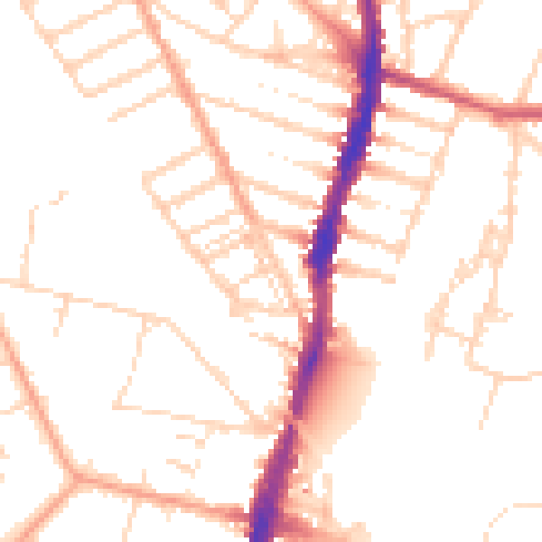
Daytime· 07:00 – 23:00
50.4dB

Night-time· 23:00 – 07:00
40.7dB