56 Yarmouth Road, Watford, WD24 4DW
About 56 Yarmouth Road
56 Yarmouth Road is a mid-terrace house in Watford (WD24 4DW). It has a recorded floor area of 110 m² (around 1184 sq ft), construction records dating it to 1900-1929 and council tax band D. The latest certificate (May 2024) shows a C (score 73). When first surveyed in August 2010 the rating was D, the property has climbed 1 band since. Between certificates, wall efficiency went from Very Poor to Poor, roof efficiency went from Very Poor to Good and lighting went from Very Poor to Very Good; while window efficiency dropped from Good to Average and hot-water efficiency dropped from Very Good to Good. The recommended improvements would push it to B (score 86).
A recent sale: £500,000 in March 2025. Across the public record there are 4 sales, relatively high churn for a single property. 4 planning records sit against the property, 1 approved, 3 refused. Past consents include an extension, meaningful when judging how the property has evolved. At 110 m² it's 29.7% larger than the typical home in the postcode (85 m² median across 22 EPCs). Its energy rating outperforms most of the postcode (better than 77% of similar EPCs). Across 2008–2025, sale prices on this property compounded at 5.3% per year. On a £-per-square-foot basis, the last sale (£422/sq ft) was about 102% above the typical sold price in the postcode.
Everything you need to know about 56 Yarmouth Road
The true value, the hidden risks and the full sale history, in one report.
30-day money-back guarantee

The data behind every report


Energy performance
EPC Rating
Property Improvements
Changes detected from historical EPC data
Hot water efficiency decreased
Wall insulation improved
Loft insulation installed or upgraded to 250mm+
More low energy lighting installed
Planning history
Council records show a subdivision application — the property's legal arrangement has been altered.
- Jul 2019ExtensionFullIn report
Extension: Single storey · Side and rear of property
Erection of a single storey side and rear extensions
- Documents
- 6 docs on file
- Reference
- 19/00579/FULH
- Apr 2019ExtensionOutlineIn report
Extension: Single storey · Rear of property
The erection of a single storey rear extension which would extend beyond the rear wall of the original house by 3.5m for which the maximum height would be 3.0m and for which the height of the eaves would be 2.9m
- Documents
- 9 docs on file
- Reference
- 19/00287/HPD
We flagged 1 thing worth checking at 56 Yarmouth Road
Independent checks surfaced things a buyer would want to understand before offering. The report explains each one in full, with the underlying data and what to ask.
- Larger development activity nearby
30-day money-back guarantee
Sales history & valuation
Latest sale on 56 Yarmouth Road was the highest on Land Registry record across the postcode.
£529,000
Modelled from EPC, postcode comparables and a sale-price growth of 5.3% per year over 17 years.
£500,000
Growth on file: 5.3% per year over 17 years.
Sales timeline
17 March 2025Most recent
£500,000
+92.3%over 7 years3 September 2017
£260,000
+4.8%over 6 years2 March 2011
£248,000
+19.8%over 2 years28 March 2008
£207,000
Median price across the last 5 sales in WD24 4DW: £417,000 (2025–2023).
Nearby sales in WD24 4DW
Versus other Yarmouth Road homes
Years Held for 56 Yarmouth Road lags the street by a wide margin.
Price per m²
£4,545
Street avg £3,463
Floor Area
110 m²
Street avg 91 m²
Habitable Rooms
5 rooms
Street avg 5 rooms
CO₂ Emissions
3.2 t/year
Street avg 4.2 t/year
Everything you need to know about 56 Yarmouth Road
The true value, the hidden risks and the full sale history, in one report.
30-day money-back guarantee
The data behind every report
Similar properties nearby
The neighbourhood at a glance
Rail-style transport is unusually close for this postcode.
Crime
4/mo
Rising year-on-year across the wider district.
Nearest stop
0.2 km
Regent Street — bus stop.
Closest school
0.5 km
Parkgate Junior School. 34 schools nearby.
Go deeper on the local area
The full report breaks down crime, transport links, schools and air quality in depth.
Road noise across the postcode
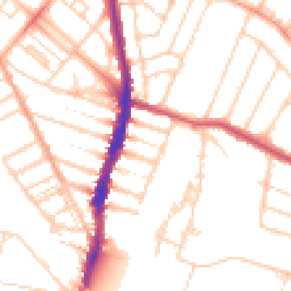
Daytime· 07:00 – 23:00
51.3dB

Night-time· 23:00 – 07:00
41.0dB