20 St Johns Road, Watford, WD17 1QA
About 20 St Johns Road
20 St Johns Road is a one-bedroom end-of-terrace house in Watford (WD17 1QA). It has a recorded floor area of 149 m² (around 1604 sq ft), construction records dating it to 1930-1949 and council tax band E. The latest certificate (October 2025) shows a D (score 57), a step below the typical UK home. The recommended improvements would push it to C (score 80).
It hasn't traded since June 1995, a hold of 31 years that's notably long for the area. Only one transfer is on record with HM Land Registry, suggesting it has stayed in the same hands for a long time. At 149 m² the property is well over the postcode median (105 m² across 6 EPCs), placing it in the larger end of the local stock. Today's modelled estimate of £666,000 sits 753.8% above the 1995 sale of £78,000. On a £-per-square-foot basis, the last sale (£49/sq ft) was about 82.3% below the postcode norm.
What this property has
Inside
- Bedrooms1
- Bathrooms6
Everything you need to know about 20 St Johns Road
The true value, the hidden risks and the full sale history, in one report.
30-day money-back guarantee

The data behind every report


Energy performance
20 St Johns Road's carbon output runs well above what efficient homes in the postcode produce.
EPC Rating
Planning history
20 St Johns Road has no planning applications on record.
Notable planning nearby
7applications of note in the surrounding area
We flagged 2 things worth checking at 20 St Johns Road
Independent checks surfaced things a buyer would want to understand before offering. The report explains each one in full, with the underlying data and what to ask.
- Signs of HMO activity in the area
- Larger development activity nearby
30-day money-back guarantee
Sales history & valuation
Latest sale on 20 St Johns Road was the lowest on Land Registry record across the postcode.
£666,000
Modelled from EPC, postcode comparables.
£78,000
Recorded with HM Land Registry.
Sales timeline
29 June 1995Most recent
£78,000
Median price across the last 5 sales in WD17 1QA: £590,000 (2022–2015).
Nearby sales in WD17 1QA
Versus other St Johns Road homes
Price per m² for 20 St Johns Road lags the street by a wide margin.
Price per m²
£523
Street avg £4,100
Floor Area
149 m²
Street avg 130 m²
Habitable Rooms
6 rooms
Street avg 6 rooms
CO₂ Emissions
6.9 t/year
Street avg 7.7 t/year
Everything you need to know about 20 St Johns Road
The true value, the hidden risks and the full sale history, in one report.
30-day money-back guarantee
The data behind every report
Similar properties nearby
1 Elm Court, Albert Road South
WD17 1QQ
10 Caledonian Court, West Street
WD17 1RY
10 Woodford Road
WD17 1PA
1 Franklin Road
WD17 1QD
10a, Clarendon Road
WD17 1DY
10 Franklin Road
WD17 1QD
10 Terrace Gardens
WD17 1RB
1 Orphanage Road
WD17 1PG
The neighbourhood at a glance
Rail-style transport is unusually close for this postcode.
Crime
10/mo
Steady year-on-year across the wider district.
Nearest stop
0.2 km
West Street — bus stop.
Closest school
0.4 km
Watford St John's Church of England Primary School. 36 schools nearby.
Go deeper on the local area
The full report breaks down crime, transport links, schools and air quality in depth.
Road noise across the postcode
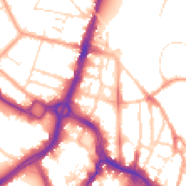
Daytime· 07:00 – 23:00
54.3dB

Night-time· 23:00 – 07:00
44.8dB