19 Cotswold Avenue, Lowton, Warrington, WA3 1HW
About 19 Cotswold Avenue
19 Cotswold Avenue is a four-bedroom semi-detached house in Lowton, Warrington, Warrington (WA3 1HW). It has a recorded floor area of 149 m² (around 1604 sq ft), construction records dating it to 1967-1975 and council tax band C. The latest certificate (April 2019) shows an F (score 35), near the bottom of the EPC scale. The recommended improvements would lift it to D (score 63), a 2-band jump.
At 149 m² the property is well over the postcode median (101 m² across 15 EPCs), placing it in the larger end of the local stock. On energy efficiency it sits in the bottom 10% of properties in this postcode — significant headroom for improvement. Today's modelled estimate of £341,000 is 13.7% above the 2022 sale price. Last sale on file: £299,995 in November 2022. That sale was during the post-pandemic price surge, when transactions cleared materially above pre-2020 trend.
What this property has
Inside
- Bedrooms4
- Bathrooms2
Outside
- GarageDouble, Detached
Everything you need to know about 19 Cotswold Avenue
The true value, the hidden risks and the full sale history, in one report.
Pick your report · every report is £14.99
One time fee only - money back guarantee

The data behind every report


Energy performance
19 Cotswold Avenue sits at the bottom of the postcode for energy efficiency — meaningful headroom to improve.
EPC Rating
Get a survey for this property
Level 2 HomeBuyer Report
We've checked 10 risk factors against the available data for this property and believe a Level 2 HomeBuyer Report could be a suitable option for you.
From £595 · Includes VAT
Planning history
19 Cotswold Avenue has no planning applications on record.
A planning report still maps activity across the surrounding area and reads this property's extension & conversion potential.
Sales history & valuation
The latest sale landed in the post-pandemic price surge — useful context when reading the figure.
£341,000
Modelled from EPC, postcode comparables.
£299,995
Recorded with HM Land Registry.
Sales timeline
10 November 2022Most recent
£299,995
Median price across the last 5 sales in WA3 1HW: £365,000 (2024–2021).
Nearby sales in WA3 1HW
38 Cotswold Avenue, Lowton, Warrington, WA3 1HW
Sold Dec 2024
£380,00016 Cotswold Avenue, Lowton, Warrington, WA3 1HW
Sold Nov 2022
£375,00018 Cotswold Avenue, Lowton, Warrington, WA3 1HW
Sold Oct 2022
£291,0001 Cotswold Avenue, Lowton, Warrington, WA3 1HW
Sold Jun 2021
£2203 Cotswold Avenue, Lowton, Warrington, WA3 1HW
Sold May 2021
£365,000
Versus other Cotswold Avenue homes
19 Cotswold Avenue is notably below the street on epc rating.
Price per m²
£2,013
Street avg £2,316
Floor Area
149 m²
Street avg 113 m²
Habitable Rooms
7 rooms
Street avg 5 rooms
CO₂ Emissions
7.0 t/year
Street avg 4.5 t/year
Everything you need to know about 19 Cotswold Avenue
The true value, the hidden risks and the full sale history, in one report.
Pick your report · every report is £14.99
One time fee only - money back guarantee
The data behind every report
Similar properties nearby
1 Cotswold Gardens, Lowton
WA3 1FT
1 Barford Drive, Lowton
WA3 1DD
1 Heath Lane, Lowton
WA3 1JB
1 Crompton Way, Lowton
WA3 1FS
1 Glastonbury Avenue, Lowton
WA3 1ET
1 Kirkham Avenue, Lowton
WA3 1LL
1 Adwell Close, Lowton
WA3 1DE
1 Clayhill Grove, Lowton
WA3 1FZ
The neighbourhood at a glance
Crime
1/mo
Steady year-on-year across the wider district.
Nearest stop
0.2 km
Fulwood Road — bus stop.
Closest school
0.5 km
St Luke's CofE Primary School. 11 schools nearby.
Go deeper on the local area
A Local Area report breaks down crime, transport links, schools and air quality in depth.
Road noise across the postcode
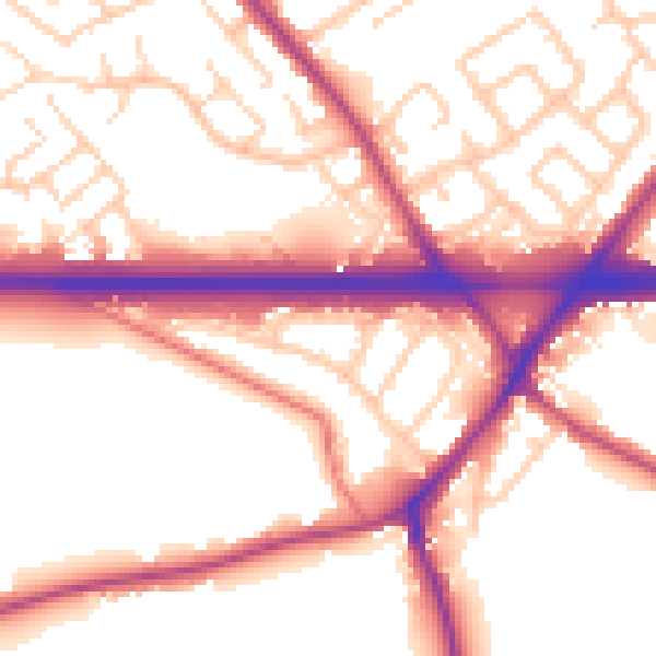
Daytime· 07:00 – 23:00
55.4dB

Night-time· 23:00 – 07:00
48.3dB