4 Crompton Way, Lowton, Warrington, WA3 1FS
About 4 Crompton Way
4 Crompton Way is a three-bedroom mid-terrace house in Lowton, Warrington, Warrington (WA3 1FS). It has a recorded floor area of 98 m² (around 1055 sq ft), construction records dating it to 2003-2006 and council tax band C. The latest certificate (January 2025) shows a C (score 73). The rating has held steady at C across 3 certificates since December 2008. Between certificates, lighting went from Poor to Very Good; while hot-water efficiency dropped from Very Good to Good and main heating dropped from Very Good to Good. The recommended improvements would push it to B (score 87).
Held since December 2005 — that's 20 years off the open market, well above the local norm. Today's modelled estimate of £272,000 sits 51.2% above the 2005 sale of £179,950. On a £-per-square-foot basis, the last sale (£171/sq ft) was about 23.2% below the postcode norm. It lags the bulk of the postcode on energy efficiency (less efficient than 83% of similar EPCs).
What this property has
Inside
- Bedrooms3
Everything you need to know about 4 Crompton Way
The true value, the hidden risks and the full sale history, in one report.
Pick your report · every report is £14.99
One time fee only - money back guarantee

The data behind every report


Energy performance
EPC Rating
Property Improvements
Changes detected from historical EPC data
Hot water efficiency decreased
More low energy lighting installed
More low energy lighting installed
Get a survey for this property
Level 2 HomeBuyer Report
We've checked 10 risk factors against the available data for this property and believe a Level 2 HomeBuyer Report could be a suitable option for you.
From £545 · Includes VAT
Planning history
4 Crompton Way has no planning applications on record.
A planning report still maps activity across the surrounding area and reads this property's extension & conversion potential.
Sales history & valuation
£272,000
Modelled from EPC, postcode comparables.
£179,950
Recorded with HM Land Registry.
Sales timeline
21 December 2005Most recent
£179,950
Median price across the last 5 sales in WA3 1FS: £200,000 (2025–2024).
Nearby sales in WA3 1FS
95 Crompton Way, Lowton, Warrington, WA3 1FS
Sold Jun 2025
£200,00075 Crompton Way, Lowton, Warrington, WA3 1FS
Sold Mar 2025
£340,00023 Crompton Way, Lowton, Warrington, WA3 1FS
Sold Nov 2024
£200,00028 Crompton Way, Lowton, Warrington, WA3 1FS
Sold Sept 2024
£239,95074 Crompton Way, Lowton, Warrington, WA3 1FS
Sold Jul 2024
£242,000
Versus other Crompton Way homes
Years Held for 4 Crompton Way runs comfortably ahead of the street norm.
Price per m²
£1,836
Street avg £2,694
Floor Area
98 m²
Street avg 86 m²
Habitable Rooms
3 rooms
Street avg 6 rooms
CO₂ Emissions
2.9 t/year
Street avg 1.5 t/year
Everything you need to know about 4 Crompton Way
The true value, the hidden risks and the full sale history, in one report.
Pick your report · every report is £14.99
One time fee only - money back guarantee
The data behind every report
Similar properties nearby
1 Kirkham Avenue, Lowton
WA3 1LL
1 Glastonbury Avenue, Lowton
WA3 1ET
1 Adwell Close, Lowton
WA3 1DE
1 Clayhill Grove, Lowton
WA3 1FZ
1 Heathmoor Avenue, Lowton
WA3 1HP
1 Crompton Way, Lowton
WA3 1FS
1 Bodden Street, Lowton
WA3 1DX
1 Cotswold Gardens, Lowton
WA3 1FT
The neighbourhood at a glance
Crime
1/mo
Steady year-on-year across the wider district.
Nearest stop
0.2 km
Sandy Lane — bus stop.
Closest school
0.2 km
Lowton Church of England High School. 12 schools nearby.
Go deeper on the local area
A Local Area report breaks down crime, transport links, schools and air quality in depth.
Road noise across the postcode
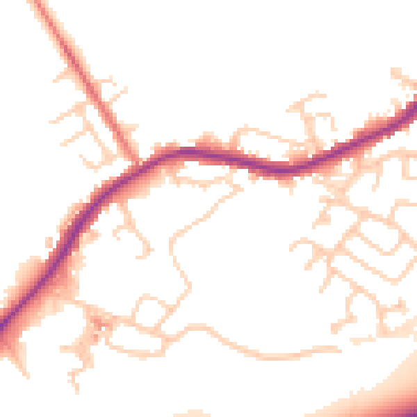
Daytime· 07:00 – 23:00
50.8dB

Night-time· 23:00 – 07:00
44.1dB