19 Crompton Way, Lowton, Warrington, WA3 1FS
About 19 Crompton Way
19 Crompton Way is a four-bedroom end-of-terrace house in Lowton, Warrington, Warrington (WA3 1FS). It has a recorded floor area of 115 m² (around 1238 sq ft), construction records dating it to 2003-2006 and council tax band C. The latest certificate (May 2012) shows a C (score 75), near the top of the C band. The recommended improvements would push it to B (score 86). The latest certificate is from May 2012, so improvements made since then won't be reflected. The home occupies a corner plot.
At 115 m² the property is well over the postcode median (86 m² across 75 EPCs), placing it in the larger end of the local stock. It lags the bulk of the postcode on energy efficiency (less efficient than 83% of similar EPCs). Across 2006–2019, sale prices on this property compounded at -1.6% per year. Today's modelled estimate of £280,000 sits 60% above the 2019 sale of £175,000. On a £-per-square-foot basis, the last sale (£141/sq ft) was about 36.4% below the postcode norm. Sold September 2019 for £175,000.
What this property has
Inside
- Bedrooms4
- Bathrooms3
Outside
- Corner plotYes
Building
- Central heatingYes
Everything you need to know about 19 Crompton Way
The true value, the hidden risks and the full sale history, in one report.
Pick your report · every report is £14.99
One time fee only - money back guarantee

The data behind every report


Energy performance
19 Crompton Way's EPC is over a decade old — improvements since won't be reflected.
EPC Expired
This certificate is over 10 years old and is no longer valid.Expired 16 May 2022
EPC Rating
Get a survey for this property
Level 2 HomeBuyer Report
We've checked 10 risk factors against the available data for this property and believe a Level 2 HomeBuyer Report could be a suitable option for you.
From £545 · Includes VAT
Planning history
19 Crompton Way has no planning applications on record.
A planning report still maps activity across the surrounding area and reads this property's extension & conversion potential.
Sales history & valuation
19 Crompton Way changed hands twice within eighteen months — unusual for the area.
£280,000
Modelled from EPC, postcode comparables and a sale-price growth of -1.6% per year over 13 years.
£175,000
Growth on file: -1.6% per year over 13 years.
Sales timeline
10 September 2019Most recent
£175,000
+9.4%over 9 months14 December 2018
£160,000
-26.6%over 12 years29 June 2006
£217,950
Median price across the last 5 sales in WA3 1FS: £200,000 (2025–2024).
Nearby sales in WA3 1FS
95 Crompton Way, Lowton, Warrington, WA3 1FS
Sold Jun 2025
£200,00075 Crompton Way, Lowton, Warrington, WA3 1FS
Sold Mar 2025
£340,00023 Crompton Way, Lowton, Warrington, WA3 1FS
Sold Nov 2024
£200,00028 Crompton Way, Lowton, Warrington, WA3 1FS
Sold Sept 2024
£239,95074 Crompton Way, Lowton, Warrington, WA3 1FS
Sold Jul 2024
£242,000
Versus other Crompton Way homes
On floor area, 19 Crompton Way stands well clear of the street.
Price per m²
£1,522
Street avg £2,698
Floor Area
115 m²
Street avg 86 m²
Habitable Rooms
6 rooms
Street avg 5 rooms
CO₂ Emissions
2.9 t/year
Street avg 1.5 t/year
Everything you need to know about 19 Crompton Way
The true value, the hidden risks and the full sale history, in one report.
Pick your report · every report is £14.99
One time fee only - money back guarantee
The data behind every report
Similar properties nearby
1 Cotswold Gardens, Lowton
WA3 1FT
1 Barford Drive, Lowton
WA3 1DD
1 Kirkham Avenue, Lowton
WA3 1LL
1 Glastonbury Avenue, Lowton
WA3 1ET
1 Heath Lane, Lowton
WA3 1JB
1 Adwell Close, Lowton
WA3 1DE
1 Crompton Way, Lowton
WA3 1FS
1 Clayhill Grove, Lowton
WA3 1FZ
The neighbourhood at a glance
Crime
1/mo
Steady year-on-year across the wider district.
Nearest stop
0.2 km
Sandy Lane — bus stop.
Closest school
0.2 km
Lowton Church of England High School. 12 schools nearby.
Go deeper on the local area
A Local Area report breaks down crime, transport links, schools and air quality in depth.
Road noise across the postcode
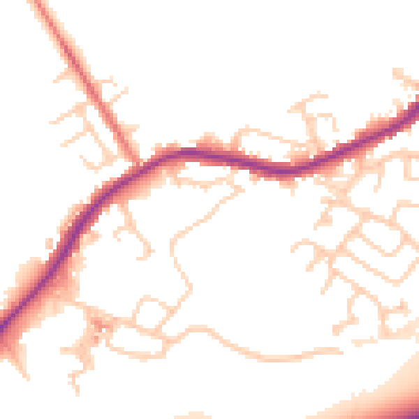
Daytime· 07:00 – 23:00
50.8dB

Night-time· 23:00 – 07:00
44.1dB