Are you a property professional?Get qualified leads from motivated homeowners.
Get started9 Vaughan Avenue, Hounslow, London, W6 0XS
5 planning records
About 9 Vaughan Avenue
A plain-English summary derived from public records, EPC certificates, sold prices and local data.
9 Vaughan Avenue is a five-bedroom semi-detached house in Hounslow, London, London (W6 0XS). It has a recorded floor area of 148 m² (around 1593 sq ft), construction records dating it to 1900-1929 and council tax band G. The latest certificate (October 2015) shows an E (score 46), well below the UK norm with real room to improve. The recommended improvements would lift it to C (score 74), a 2-band jump. The latest certificate is from October 2015, so improvements made since then won't be reflected.
Sale prices here have outpaced London HPI: 6.1% per year against 0% for the wider region. On a £-per-square-foot basis, the last sale (£1,208/sq ft) was about 104.9% above the typical sold price in the postcode. 5 planning records sit against the property, 5 approved, 0 refused. Past consents include tree works, an extension and a loft conversion, meaningful when judging how the property has evolved. The record references conservation-area consent, which constrain future alterations. At 148 m² it's 16.5% larger than the typical home in the postcode (127 m² median across 13 EPCs). 5 bedrooms is on the larger side for this postcode, where 2 is the typical count. Most recent transfer: September 2020 at £1,925,000.
What this property has
Pulled from EPC certificates, claim submissions and our property model. Empty categories are hidden — we only show what's known.
Inside
- Bedrooms5
- Bathrooms3
- Dining roomYes
- CloakroomYes
Energy performance
Every EPC certificate filed against this property — current rating, recorded improvements, and where there's headroom to reach a higher band.
9 Vaughan Avenue's carbon output runs well above what efficient homes in the postcode produce.
EPC Expired
This certificate is over 10 years old and is no longer valid.Expired 25 Oct 2025
Planning history
Applications and permits filed against 9 Vaughan Avenue, Hounslow, London, W6 0XS, sourced from the PlanIt planning register.
9 Vaughan Avenue has been through 5 approved planning applications — a well-evolved property.
- Mar 2021Tree WorksTreesGranted
Reduce crown to Sycamore tree in rear garden by three meters.
Sales history & valuation
Recorded transactions, our model's current estimate, and a quick read on what neighbouring properties have sold for.
The latest sale landed in the post-pandemic price surge — useful context when reading the figure.
Current estimate
See how we calculated this£1,991,000
Modelled from EPC, postcode comparables and a sale-price growth of 6.1% per year over 4 years.
Last sold (2020)
£1,925,000
Growth on file: 6.1% per year over 4 years.
Sales timeline
Versus other Vaughan Avenue homes
Four headline reads against 5 similar houses on this street, drawn from the latest EPC and Land Registry data.
9 Vaughan Avenue is notably below the street on floor area.
EPC Rating
46 (E)
Street avg 54 (E)
Floor Area
148 m²
Street avg 202 m²
CO₂ Emissions
8.3 t/year
Street avg 9.4 t/year
Similar properties nearby
A handful of close matches in the same postcode area, ranked by likeness on bedrooms, type and floor area.
The neighbourhood at a glance
A condensed read of the local area. Each tile links through to the full breakdown on the London district page.
Rail-style transport is unusually close for this postcode.
Crime
19/mo
Falling year-on-year across the wider district.
Nearest stop
0.0 km
Stamford Brook Underground Station — subway entrance.
Road noise across the postcode
Modelled day and night-time noise levels around W6 0XS from Defra's strategic mapping. The pin marks this postcode's centroid.
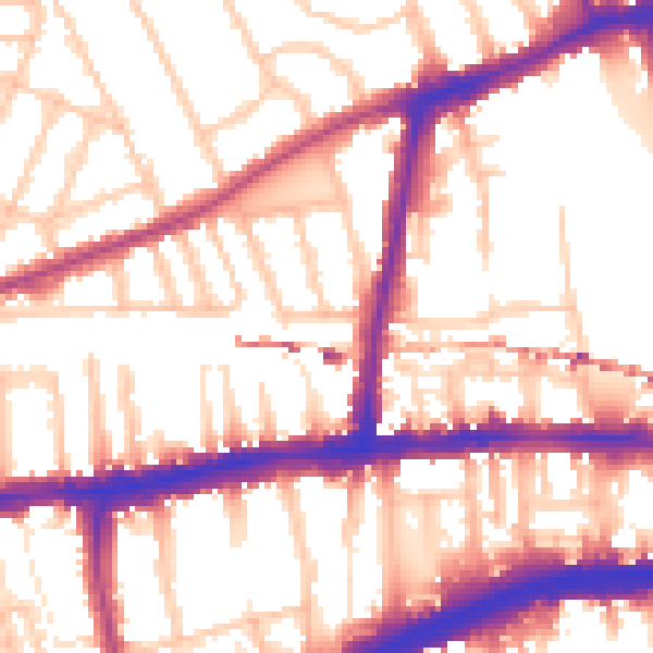
Daytime· 07:00 – 23:00
55.6dB

Everything within walking distance
Schools, transport stops and scenic spots near this property — 92 points of interest in total.
Beautiful places to visit nearby
Curated scenic spots within reach of this postcode, served by Beautifulplaces.ai. Photography and tagging come from their open dataset.
Common questions
The questions buyers, sellers and homeowners most often ask about 9 Vaughan Avenue, Hounslow, London, W6 0XS. Each answer is also embedded as structured data for search engines.