17 Beaconsfield Road, Ealing, London, W5 5JE
About 17 Beaconsfield Road
17 Beaconsfield Road is a four-bedroom mid-terrace house in Ealing, London, London (W5 5JE). It has a recorded floor area of 125 m² (around 1345 sq ft), construction records dating it to 1900-1929 and council tax band G. The latest certificate (November 2013) shows a D (score 61), on the cusp of jumping into the C band. The recommended improvements would push it to C (score 75). The latest certificate is from November 2013, so improvements made since then won't be reflected. Records show the property has been extended at some point in its history.
3 planning records sit against the property, 3 approved, 0 refused. Past consents include an extension, meaningful when judging how the property has evolved. Across 2001–2014, sale prices on this property compounded at 9.2% per year. Today's modelled estimate of £1,195,000 is 29.2% above the 2014 sale price. On a £-per-square-foot basis, the last sale (£687/sq ft) was about 21.9% above the typical sold price in the postcode. 12 years since the last transfer (February 2014).
Know exactly what you're buying at 17 Beaconsfield Road
Before you offer, see what the listing won't tell you, the true value, the red flags and the full history.
Already flagged here
Valuation
against the asking price
Risks
planning & flood
Sold prices
similar homes nearby
Trends
the local market
What this property has
Inside
- Bedrooms4
- Bathrooms2
- Dining roomYes
Outside
- GarageYes
Building
- Previously extendedYes
Energy performance
17 Beaconsfield Road's EPC is over a decade old — improvements since won't be reflected.
EPC Expired
This certificate is over 10 years old and is no longer valid.Expired 26 Nov 2023
EPC Rating
Planning history
17 Beaconsfield Road has 2 separate extension applications on the council record.
- Feb 2004ExtensionFullIn report
Extension: Single storey · Rear of property
Ground floor rear extension
- Agent
- CSM Architectural Design Ltd
- Reference
- P/2003/5026
- Jan 2004OutlineIn report
Proposed prior demolition of conservatory, rear loft extension and installation of roof lights in front roof slope (Lawful Development Certificate)
- Agent
- CSM Architectural Design Ltd
- Reference
- P/2003/5017
We flagged 1 thing worth checking at 17 Beaconsfield Road
Independent checks surfaced things a buyer would want to understand before offering. The report explains each one in full, with the underlying data and what to ask.
- Larger development activity nearby
30-day money-back guarantee
Sales history & valuation
Sale price has at least doubled since 2001.
£1,195,000
Modelled from EPC, postcode comparables and a sale-price growth of 9.2% per year over 12 years.
£925,000
Growth on file: 9.2% per year over 12 years.
Sales timeline
18 February 2014Most recent
£925,000
+191.3%over 12 years21 December 2001
£317,500
Median price across the last 5 sales in W5 5JE: £1,068,750 (2024–2019).
Nearby sales in W5 5JE
7 Beaconsfield Road, Ealing, London, W5 5JE
Sold Aug 2024
£1,231,50024 Beaconsfield Road, Ealing, London, W5 5JE
Sold Aug 2024
£1,017,50044 Beaconsfield Road, Ealing, London, W5 5JE
Sold Aug 2020
£1,068,7503 Beaconsfield Road, Ealing, London, W5 5JE
Sold Oct 2019
£1,085,00014 Beaconsfield Road, Ealing, London, W5 5JE
Sold Oct 2019
£930,000
Everything we know about 17 Beaconsfield Road, in one report
What it's really worth, what could be wrong, and the planning, sales and area data in full.
What we flagged
- Larger development activity nearby

Versus other Beaconsfield Road homes
Price per m²
£7,400
Street avg £7,152
Floor Area
125 m²
Street avg 127 m²
Habitable Rooms
6 rooms
Street avg 5 rooms
CO₂ Emissions
5.2 t/year
Street avg 5.5 t/year
Similar properties nearby
1 Holinser Terrace, Ealing
W5 5BD
1 Gideon Mews, Ealing
W5 5EL
1 Keswick Mews, Ealing
W5 5PG
1 Disraeli Road, Ealing
W5 5HS
1 Church Lane, Ealing
W5 5HD
1 Lammas Park Gardens, Ealing
W5 5HZ
1 Blandford Road, Ealing
W5 5RL
1 Clovelly Road, Ealing
W5 5HF
The neighbourhood at a glance
Rail-style transport is unusually close for this postcode.
Crime
14/mo
Rising year-on-year across the wider district.
Nearest stop
0.1 km
St Mary's Church (W5) — bus stop.
Closest school
0.2 km
Grange Primary School. 40 schools nearby.
Go deeper on the local area
The full report breaks down crime, transport links, schools and air quality in depth.
Road noise across the postcode
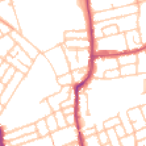
Daytime· 07:00 – 23:00
50.5dB

Night-time· 23:00 – 07:00
40.6dB