22 Clarendon Road, Ealing, London, W5 1AB
About 22 Clarendon Road
22 Clarendon Road is a semi-detached house in Ealing, London, London (W5 1AB). It has a recorded floor area of 122 m² (around 1313 sq ft), construction records dating it to before 1900 and council tax band F. The latest certificate (December 2023) shows a D (score 55), a step below the typical UK home. The recommended improvements would lift it to B (score 85), a 2-band jump.
2 planning records sit against the property, 1 approved, 0 refused, 1 pending. Past consents include an extension and a garage conversion, meaningful when judging how the property has evolved. An active application for an extension is awaiting a decision. A recent sale: £925,000 in March 2025. On a £-per-square-foot basis, the last sale (£704/sq ft) was about 47.1% above the typical sold price in the postcode.
Know exactly what you're buying at 22 Clarendon Road
Before you offer, see what the listing won't tell you, the true value, the red flags and the full history.
Already flagged here
Valuation
against the asking price
Risks
planning & flood
Sold prices
similar homes nearby
Trends
the local market
Energy performance
22 Clarendon Road's carbon output runs well above what efficient homes in the postcode produce.
EPC Rating
Planning history
An application for solar panel installation is currently awaiting a decision.
- Feb 2026Solar PanelsFullIn report
Extension: Rear of property
Alteration of roof from hip to gable end; rear roof extension, installation of two rooflights to front roof slope; installation of one window to side gable; alterations to side fenestrations and solar panels to the rear dormer flat roof (Joint Application)
Extension- Documents
- 20 docs on file
- Reference
- 260537HH
- Jul 2025Garage ConversionFullIn report
Extension: Single storey · Rear of property
Single storey rear extension; Conversion of the garage to a utility room/ pantry, and a boot room, replacement of windows and doors of the rear elevation and garage; construction of enclosed walkway between main house and garage
Extension- Documents
- 14 docs on file
- Reference
- 251711HH
We flagged 2 things worth checking at 22 Clarendon Road
Independent checks surfaced things a buyer would want to understand before offering. The report explains each one in full, with the underlying data and what to ask.
- Signs of HMO activity in the area
- Larger development activity nearby
30-day money-back guarantee
Sales history & valuation
22 Clarendon Road valuation sits well clear of the typical sold price in this postcode.
£950,000
Modelled from EPC, postcode comparables.
£925,000
Recorded with HM Land Registry.
Sales timeline
20 March 2025Most recent
£925,000
Median price across the last 5 sales in W5 1AB: £906,000 (2025–2012).
Nearby sales in W5 1AB
16 Clarendon Road, Ealing, London, W5 1AB
Sold Mar 2025
£930,00036 Clarendon Road, Ealing, London, W5 1AB
Sold Jul 2018
£955,00028 Clarendon Road, Ealing, London, W5 1AB
Sold Feb 2018
£906,00014 Clarendon Road, Ealing, London, W5 1AB
Sold Feb 2016
£862,00040 Clarendon Road, Ealing, London, W5 1AB
Sold May 2012
£885,000
Everything we know about 22 Clarendon Road, in one report
What it's really worth, what could be wrong, and the planning, sales and area data in full.
What we flagged
- Signs of HMO activity in the area
- Larger development activity nearby

Versus other Clarendon Road homes
On years held, 22 Clarendon Road runs well behind the street norm.
Price per m²
£7,582
Street avg £6,121
Floor Area
122 m²
Street avg 134 m²
Habitable Rooms
5 rooms
Street avg 6 rooms
CO₂ Emissions
6.0 t/year
Street avg 6.8 t/year
Similar properties nearby
1 Barnfield Road, Ealing
W5 1QU
1 Brunswick Gardens, Ealing
W5 1AP
1 Curzon Road, Ealing
W5 1NE
1 Brunner Road, Ealing
W5 1BA
1 Holyoake Walk, Ealing
W5 1QN
1 Garth Mews, Ealing
W5 1HF
1 Brookfield Avenue, Ealing
W5 1LA
1 Harrow View Road, Ealing
W5 1NA
The neighbourhood at a glance
Rail-style transport is unusually close for this postcode.
Crime
14/mo
Rising year-on-year across the wider district.
Nearest stop
0.1 km
Brunswick Road / Clarendon Road — bus station.
Closest school
0.7 km
Montpelier Primary School. 35 schools nearby.
Go deeper on the local area
The full report breaks down crime, transport links, schools and air quality in depth.
Road noise across the postcode
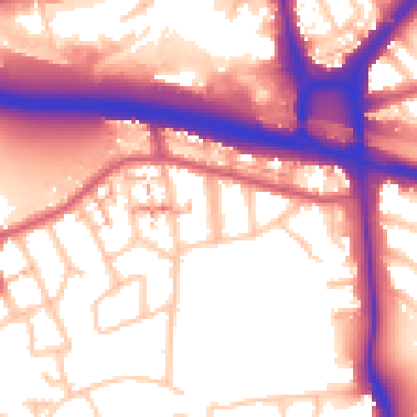
Daytime· 07:00 – 23:00
58.2dB

Night-time· 23:00 – 07:00
50.4dB